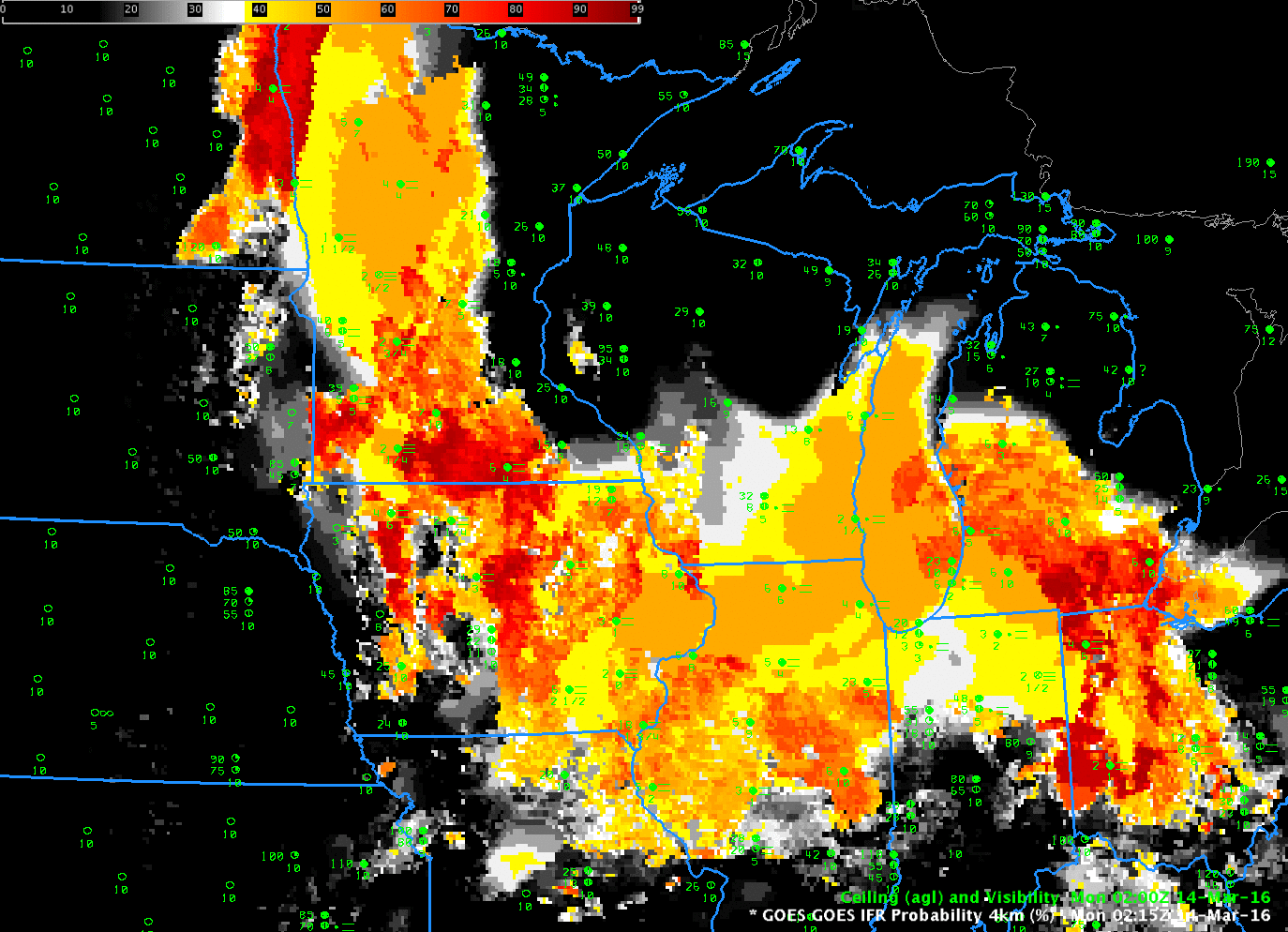
GOES-R IFR Probability Fields, hourly from 0215-1215, 14 March 2016 (Click to enlarge)
A rain-dampened boundary layer allowed fog to form over much of the upper midwest on early Monday March 14 2016 (as a baggy low pressure system moved eastward). GOES-R IFR Probability fields, above, captured the slow expansion of the region of IFR conditions. The character of the IFR Probability Field varies from smooth (over northern Illinois at 0215 UTC, for example (link)) to pixelated (over southern Minnesota at the same time). This is related to whether the model only is used as a predictor (over northern Illinois) because of high clouds that prevent the satellite from viewing low clouds or whether model and satellite data are both used as predictors (over southern Minnesota). The toggle below, of IFR Probability Fields and Brightness Temperature Difference fields at 1000 UTC on 14 March, underscores this relationship between IFR Probability and Brightness Temperature Difference fields.
In the animation above, IFR conditions are in general observed where IFR Probability fields suggest their presence.
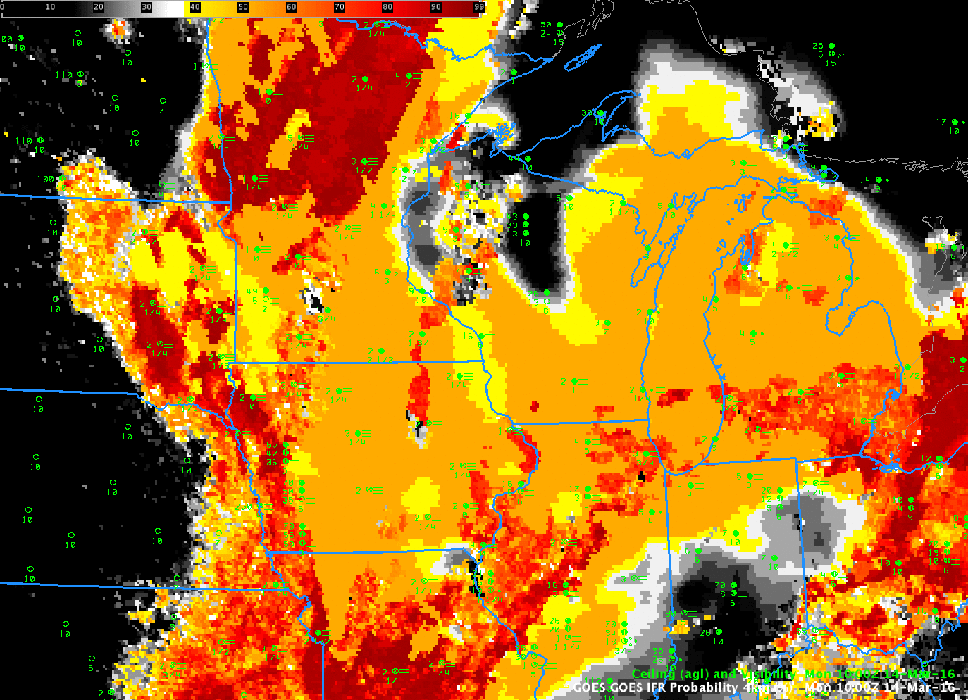
GOES-R IFR Probability and GOES-13 Brightness Temperature Difference Field, 1000 UTC on 14 March 2016 (Click to enlarge)