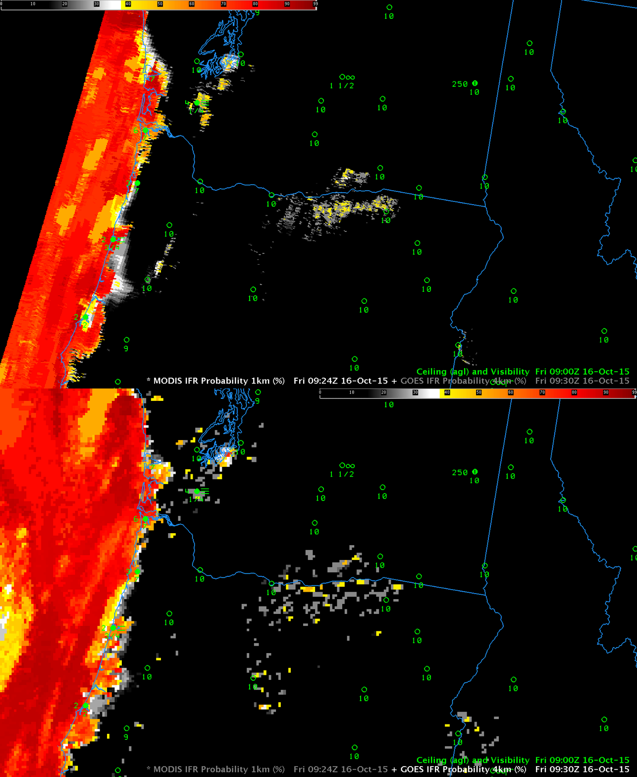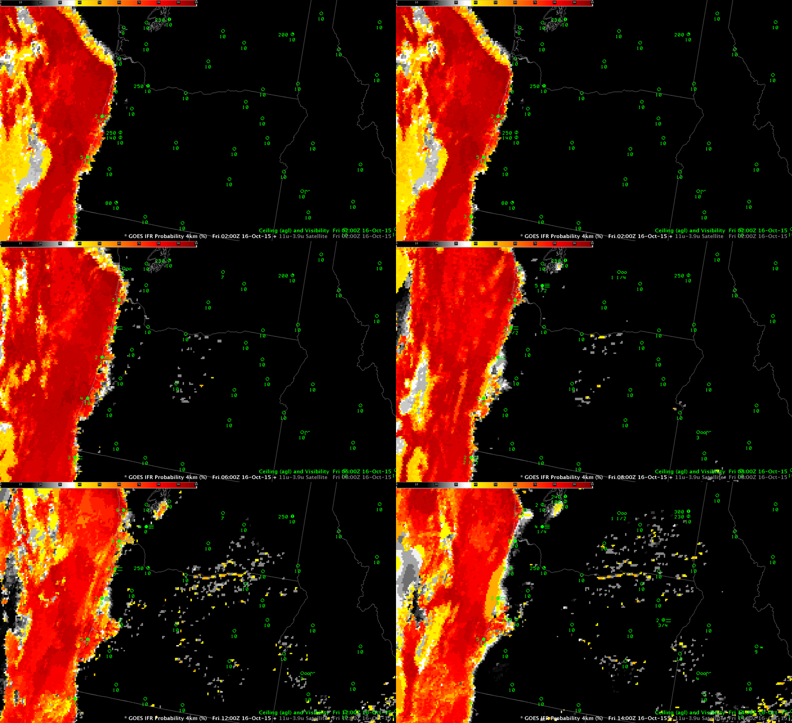
GOES-R IFR Probability fields, every 2 hours from 0200 through 1400 UTC on 16 October 2015 (Click to enlarge)
The GOES-R IFR Probability fields over Oregon and Washington on the morning of 16 October 2015 correctly diagnose low ceilings and reduced visibilities along the coast, even when high clouds intervene at the end of the animation above (especially evident at 1300 UTC, below). In addition to marine stratus that is reducing visibility/ceilings along the coast, surface observations suggest a valley fog is forming in/around Centralia/Chehalis Washington (KCLS). However, GOES-based IFR Probability fields do not become enhanced in that area. Why not?
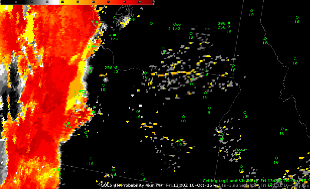
GOES-R IFR Probability computed from GOES-15, 1300 UTC on 16 October 2015. Note the Character of the field near Newport OR (KONP); the uniformity of the field is characteristic of regions where satellite signals cannot be used because of high clouds (Click to enlarge)
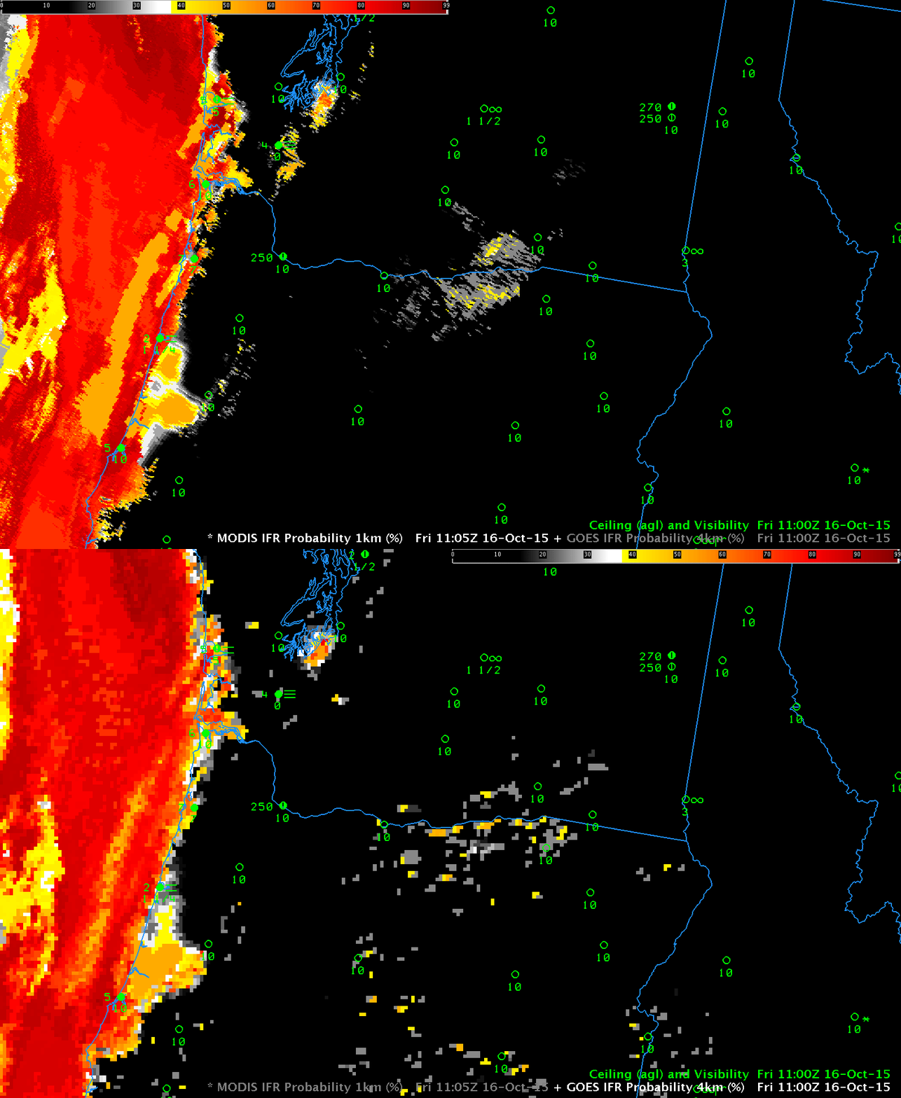
The valley of the Chehalis River, in which the fog is forming, is far too narrow to be resolved by GOES-15, which satellite has 4-km pixel sizes at the sub-satellite point. (Pixels are closer to 6 km in size over southern Washington). Higher-resolution MODIS data (with a 1-km pixel size) can be used to create GOES-R IFR Probabilities, and MODIS overpasses viewed Centralia/Chehalis at 0650, 0924 and 1105 UTC. The imagery below toggles between MODIS-based and GOES-based GOES-R IFR Probabilities at those times. Even as early as 0645 UTC, the MODIS-based IFR Probability fields are suggesting that a fog is starting to develop. At later times the MODIS-based IFR Probability values are much larger than the GOES-based values. MODIS data can give an early alert to the development of small-scale fog.
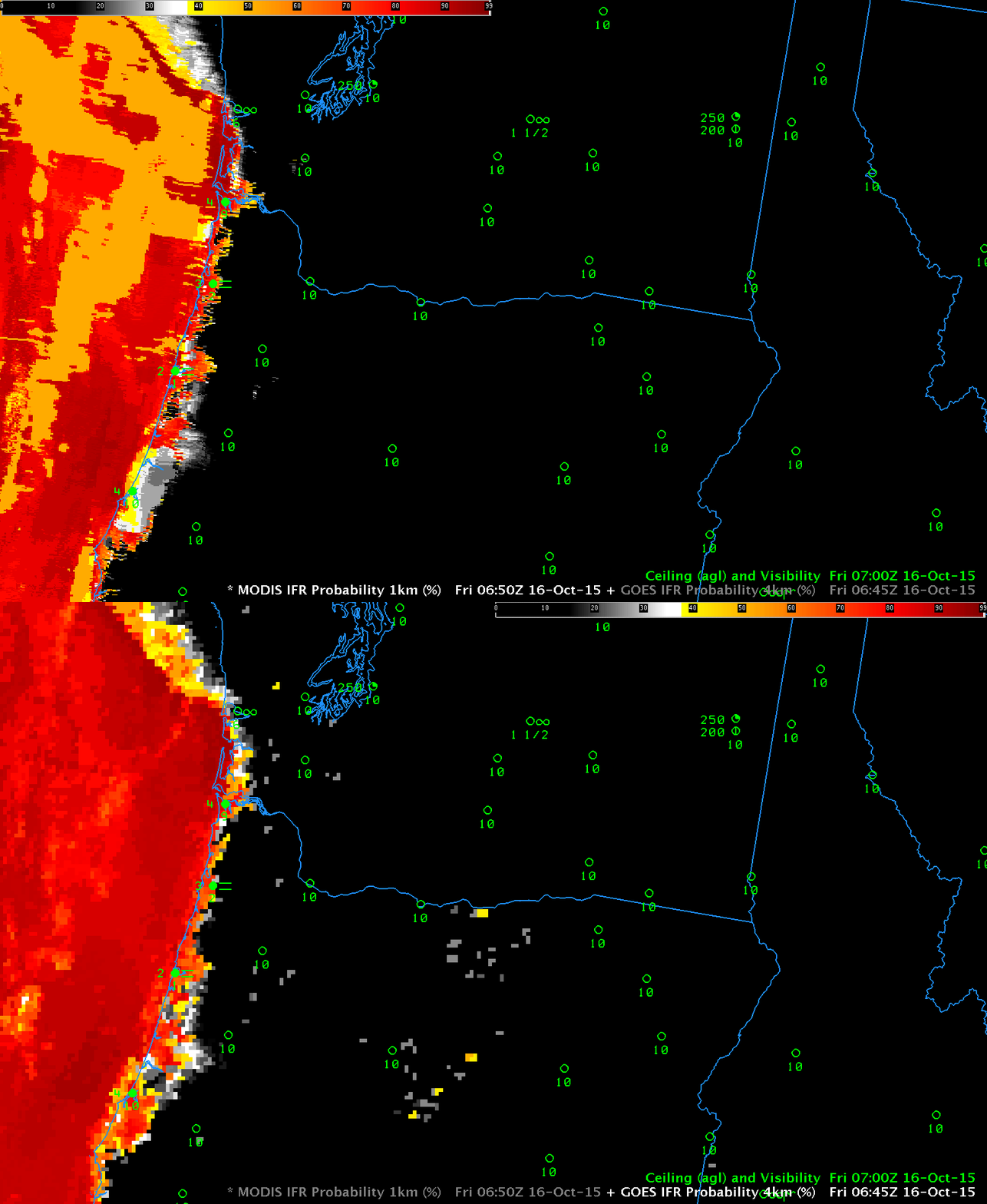
MODIS-based (0650 UTC) and GOES-15-based (0645 UTC) GOES-R IFR Probability fields (Click to enlarge)

