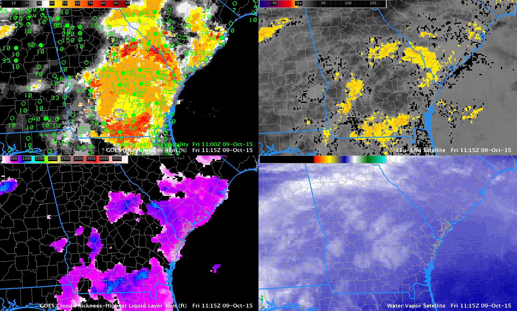
GOES-R IFR Probability fields (Upper left), GOES-13 Brightness Temperature Difference (10.7 µm – 3.9 µm) Fields (Upper Right), GOES-R Cloud Thickness (Lower Left), GOES-13 Infrared Water Vapor (6.5 µm) Imagery (Lower Right), all at 1115 UTC 9 October 2015
Dense fog formed over south Georgia early in the morning of 9 October 2015 (National Weather Service Homepage in Peachtree City). The imagery above, from 1115 UTC, demonstrates a strength of the GOES-R IFR Probability field: it maintains a signal where dense fog is ongoing even as high clouds overspread the region. At 0800 UTC on 9 October (below), high clouds had not yet overspread south Georgia, and the image below shows that both IFR Probabilities and Brightness Temperatuere Difference fields outline the region of developing fog. When high clouds appear (as in the image above), the Brightness Temperature Difference signal that can be used in clear skies loses its utility in fog detection.

As above, but at 0800 UTC 9 October 2015