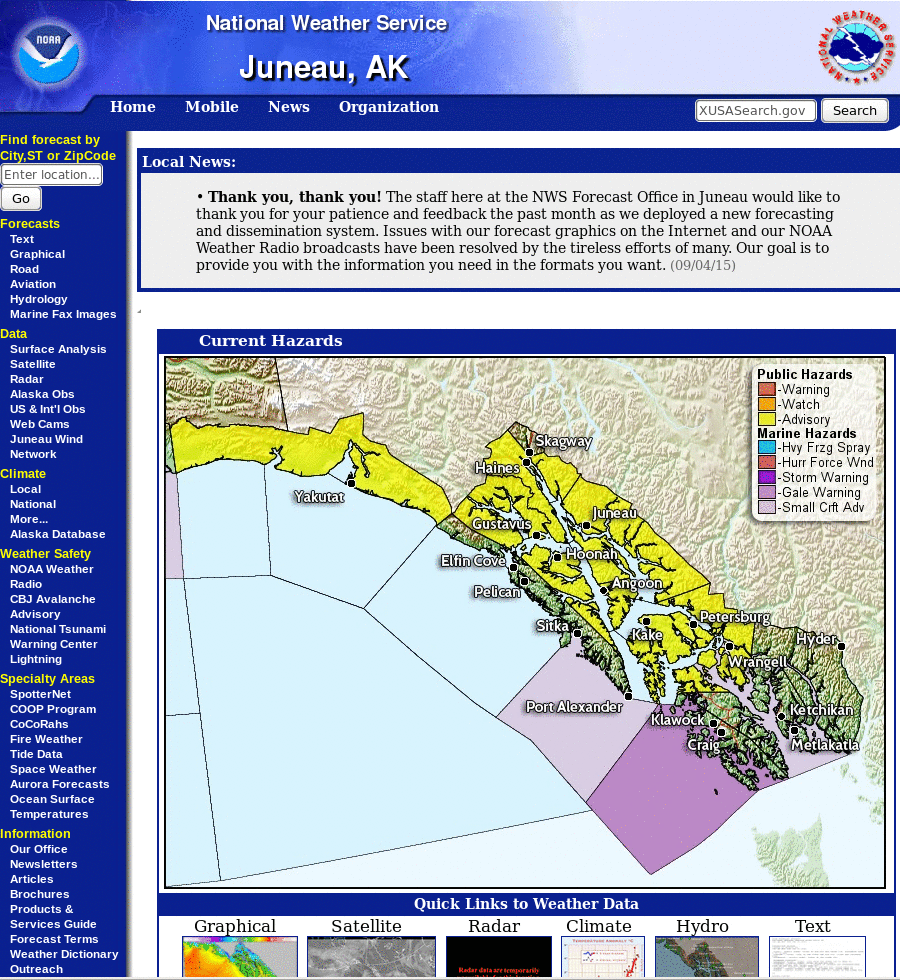
Screenshot from the Juneau, AK WFO on 8 September 2015. The yellow region has a Dense Fog Advisory (Click to enlarge)
A challenge in using GOES-R IFR Probabilities at high latitudes is that GOES pixels are larger, typically twice or three times the size of pixels over the lower 48. If Fog is starting out as a small-scale phenomenon, the early development of the feature can be missed. Dense fog developed over southeast Alaska on the morning of 8 September. The animation of GOES-15-based IFR Probabilities, below, shows the slow increase in areal extent to the IFR Probabilities in the six hours between 0445 and 1045 UTC; values also increased. This slow increase in concert with observations can increase confidence that wide-spread dense fog is possible.
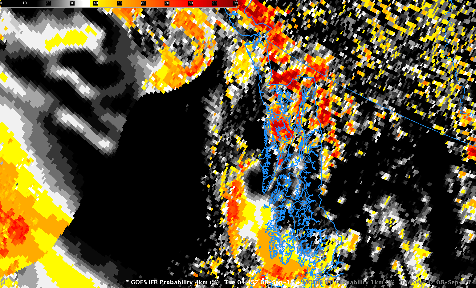
GOES-15 based GOES-R IFR Probabilities, 0445, 0715 and 1045 UTC on 8 September 2015 (Click to enlarge)
MODIS data from Terra and Aqua can also be used to compute IFR Probabilities, and the high resolution information from these two polar orbiting satellites can clarify where fog might be occurring. Additionally, MODIS fields are a bit more frequent over Alaska than they are over the lower 48. The 0600 and 0737 UTC passes, shown below, show how MODIS data can be used to refine the GOES-based information at times during the night. The temporal change between MODIS information at 0600 and 0737 UTC also confirms the trend observed in GOES data alone.
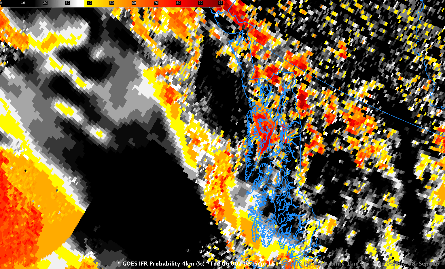
GOES-15 and MODIS-based GOES-R IFR Probabilities, 0600 UTC 8 September 2015 (Click to enlarge)
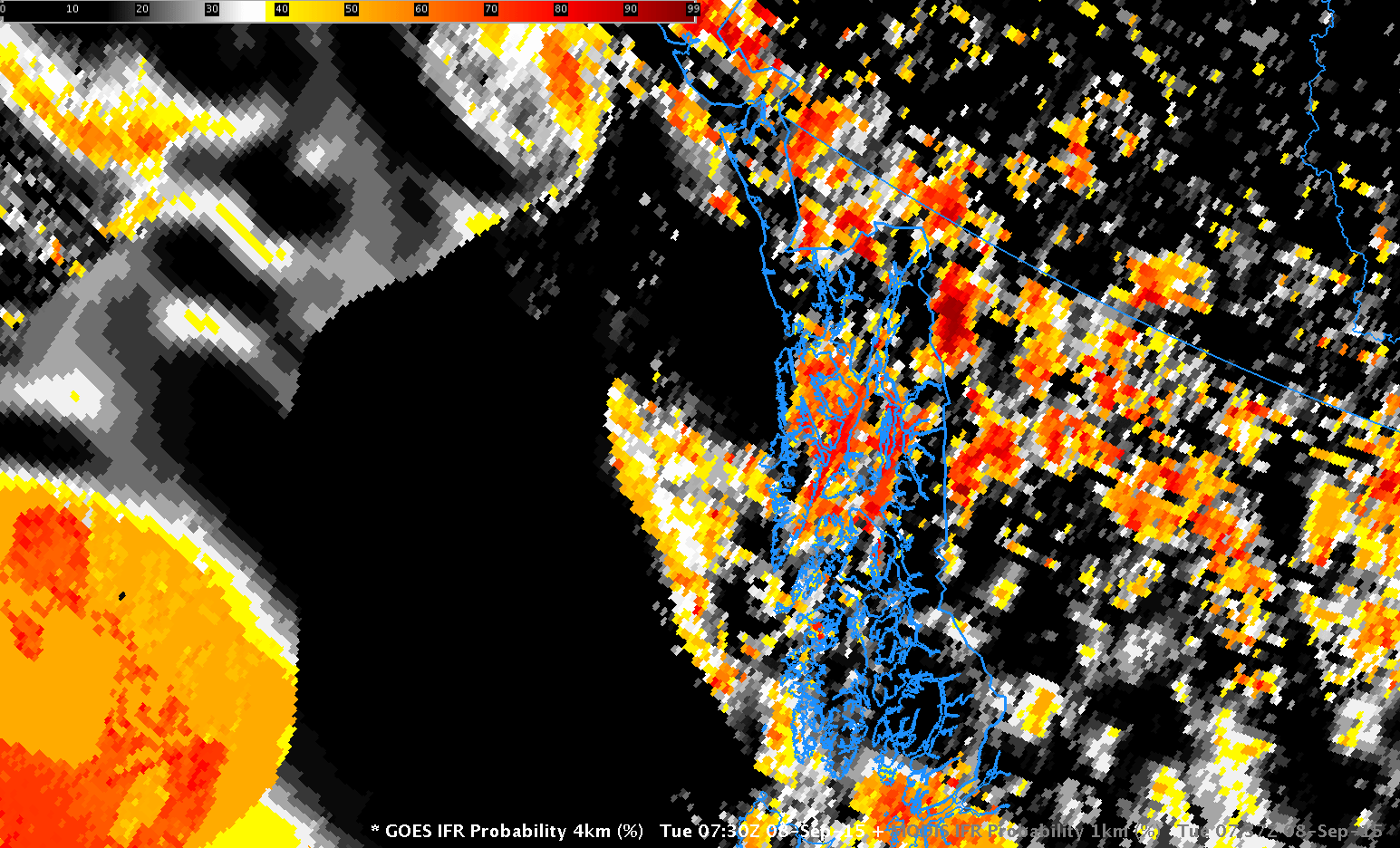
GOES-15 and MODIS-based GOES-R IFR Probabilities, ~0730 UTC 8 September 2015 (Click to enlarge)