Screenshot from Charleston WFO, 1230 UTC 4 August 2015
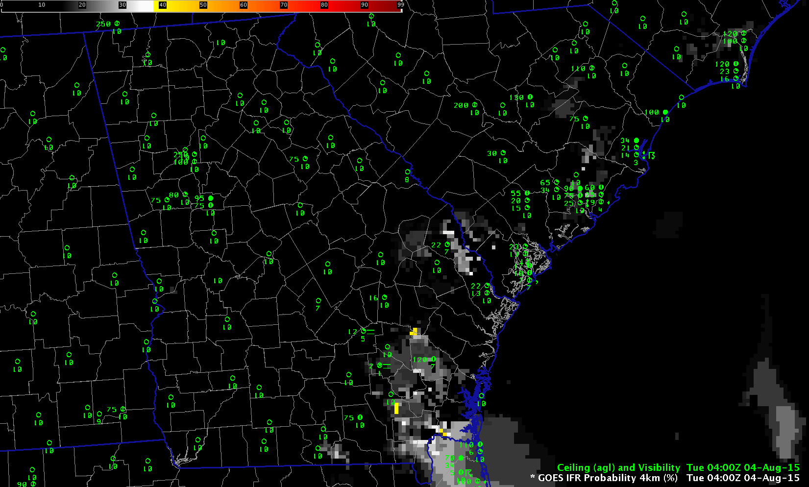
GOES-R IFR Probability fields computed from GOES-13 and Rapid Refresh Data, hourly from 0400 through 1215 UTC 4 August 2015 (Click to enlarge)
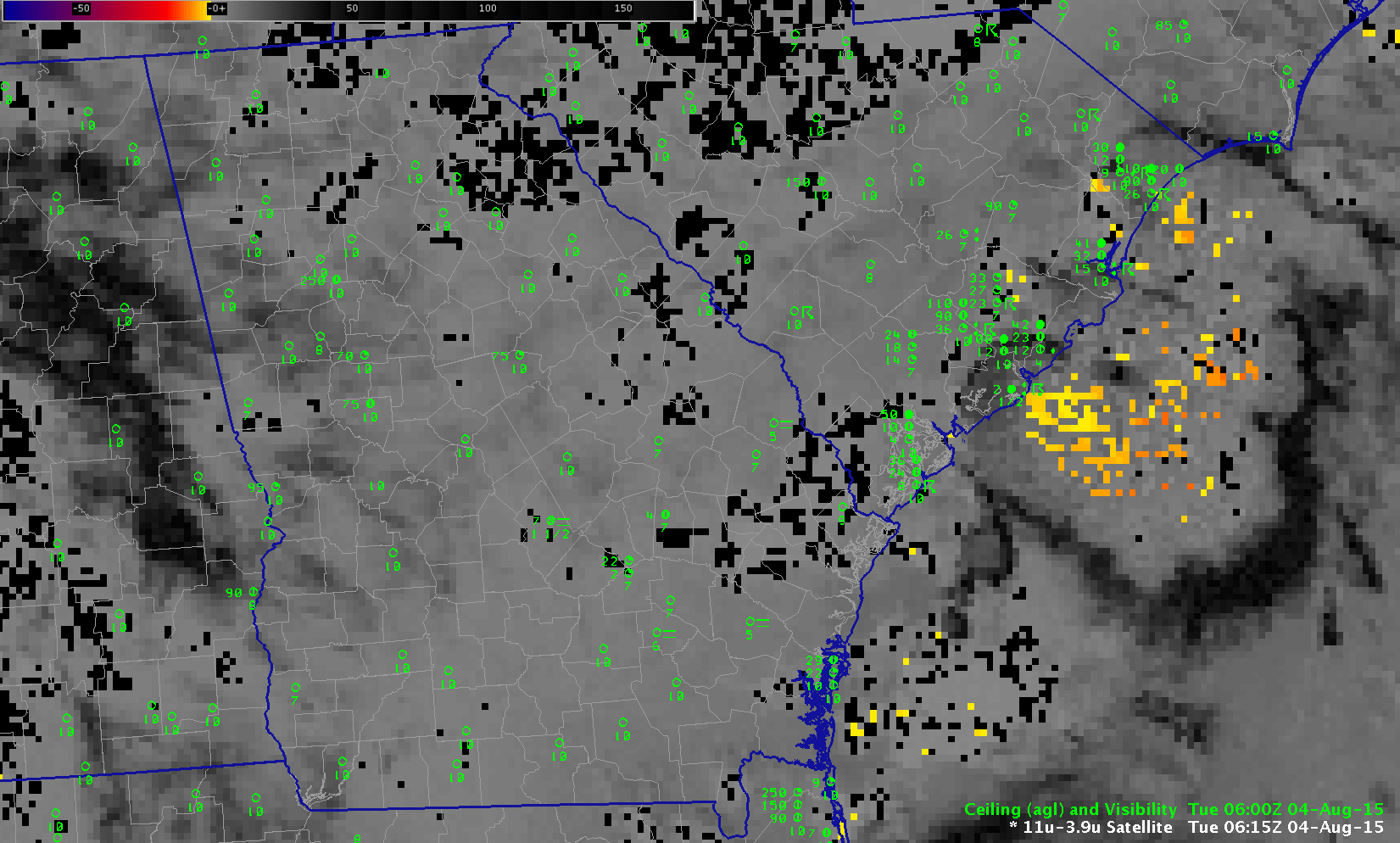
Dense fog developed over the piedmont of South Carolina/Georgia on 4 August 2015 in the wake of departing convection. The GOES-R IFR Probability fields, shown above hourly from 0400 to 1215, do parallel the development of the reduced ceilings and visibilities. Brightness Temperature Difference fields, below, from 0615 to 1215 UTC, do not show a strong fog signal until after 0800 UTC, yet IFR conditions at that time stretch from Walterboro SC (KRBW) southeastward to Eastman GA (KEZM) and Baxley GA (KBHC). GOES-R IFR Probabilities therefore give a better head’s up to a forecaster tasked with monitoring ceilings and visibilities.
Suomi NPP overflew the Southeast United States at ~0730 UTC on 4 August. Ample illumination from the waning three-quarter moon showed cloudiness over southeastern coastal South Carolina and adjacent parts of Georgia but the brightness temperature difference field does not suggest that these are all water-based clouds (such clouds generally fall in the yellow or orange part of the enhancement).
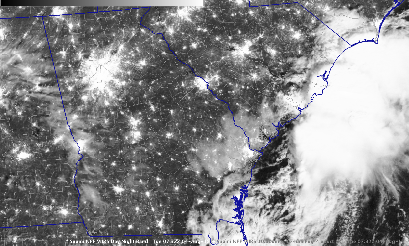
Suomi NPP Day Night Band visible (0.70 µm) image, 0732 UTC 04 August 2015 (click to enlarge)
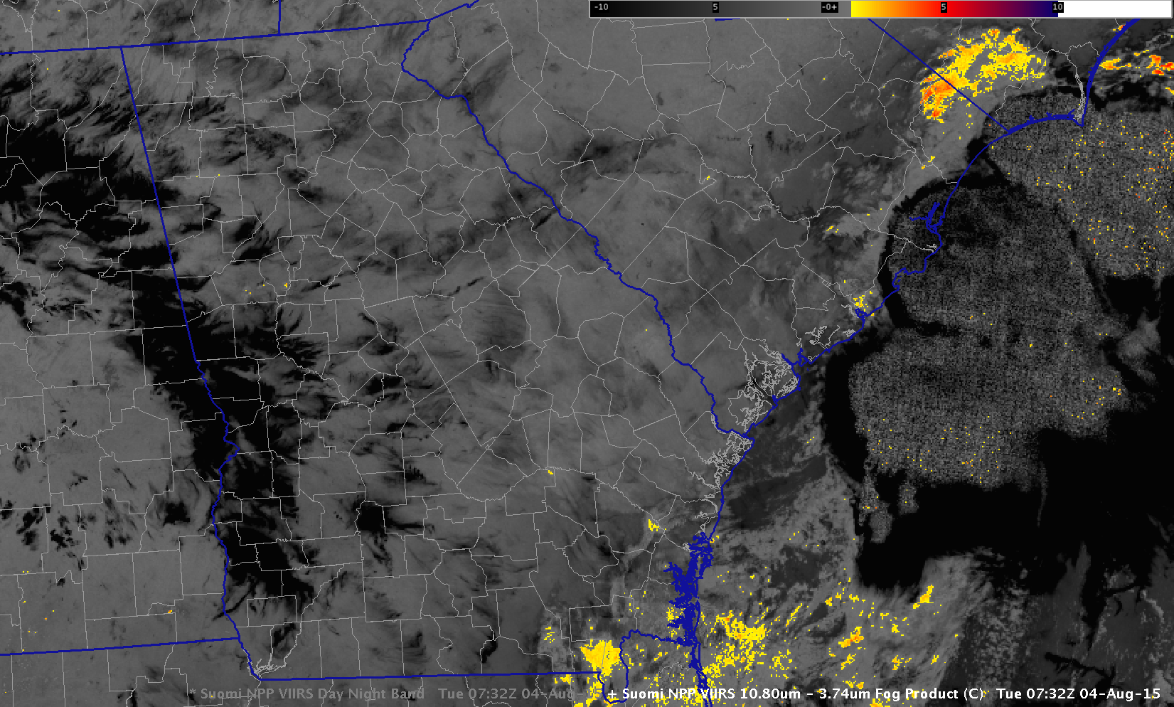
Suomi NPP Brightness temperature Difference field (11.45 µm – 3.74 µm), 0732 UTC on 4 August 2015 (click to enlarge)
MODIS data from Terra and Aqua satellites can also be used to compute GOES-R IFR Probability fields, and two MODIS swaths were produced over South Carolina/Georgia early on August 4. Toggles between the 0337 Terra-based GOES-R IFR Probability Field and the 0755 UTC Aqua-based GOES-R IFR Probability fields are below. The larger values from MODIS — especially at 0755 UTC — suggest the fog was initially at small-scale horizontally. The 1-km resolution pixels from MODIS better capture any small-scale features.
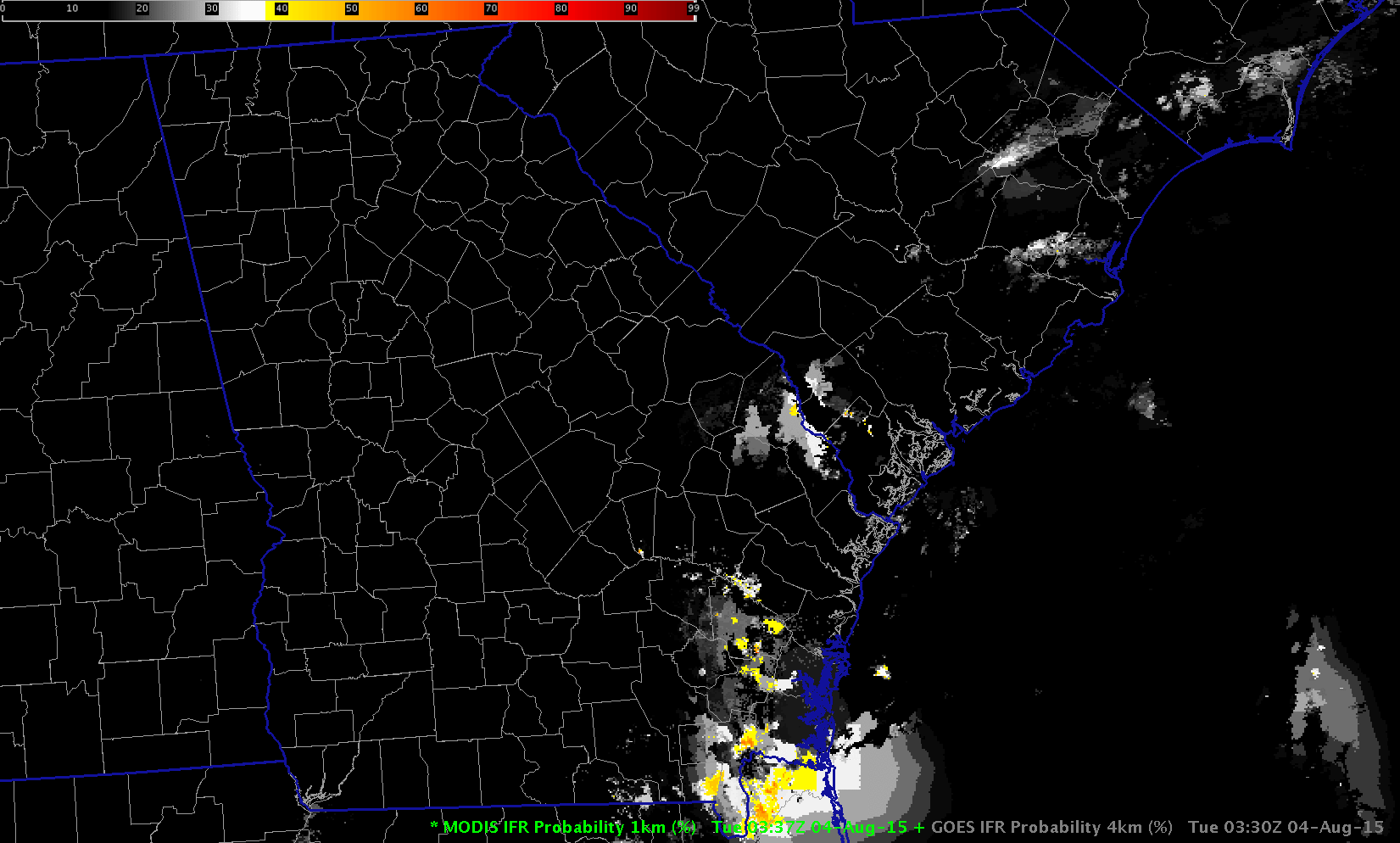
MODIS-based (Terra) and GOES-based (GOES-13) GOES-R IFR Probability fields at ~0340 UTC on 04 August 2015 (click to enlarge)
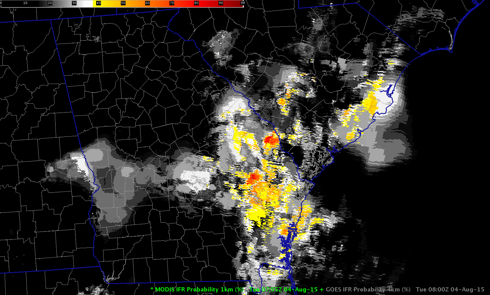
MODIS-based (Aqua) and GOES-based (GOES-13) GOES-R IFR Probability fields at ~0800 UTC on 04 August 2015 (click to enlarge)