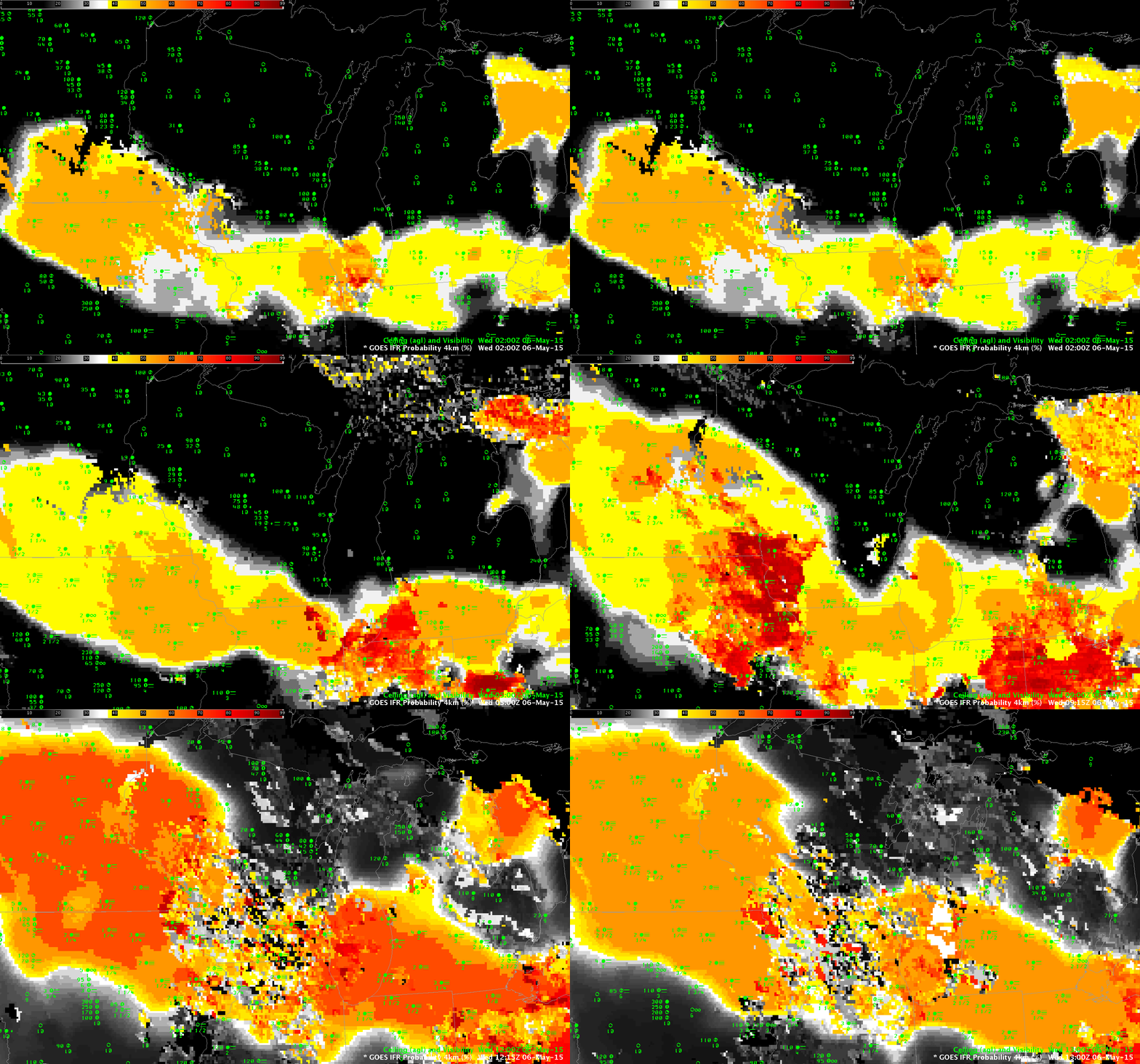
Fog and low clouds developed north of a stationary front draped across the midwest early in the morning on May 6th. Dense fog advisories were hoisted from Iowa to northwestern Ohio.
The animation above shows the increase in IFR Probabilities overnight as the dense fog developed. Note the difference in IFR Probability that arises when satellite data can be used as a predictor (that is, when the developing fog/low stratus is not overlain by higher clouds). Northwest Ohio until about 1200 UTC is a region where low clouds are viewed. There, satellite predictors can be used in the computation of IFR Probability fields. Accordingly, values are larger and there is more small-scale variability (the field looks more pixelated). In contrast, the field over Iowa for much of the animation is relatively flat. Here, even through values are comparatively low, interpret them knowing that satellite predictors are not being used because of the presence of middle/higher clouds that preclude the ability of satellite detection of low clouds.
An animation of the traditional brightness temperature difference field, here, from 0500-1000 UTC (after 1100 UTC, increasing reflected solar radiation makes the brightness temperature difference field less useful as a fog/stratus detection device). Compare the regions where IFR Probabilities are largest with the regions of strong Brightness Temperature Difference Signals.
IFR Probability fields above define the region of reduced visibilities very well. This suggests the Rapid Refresh model and the satellite (where its use was possible) were both in accord with the development of fog/low stratus in this region of the country.
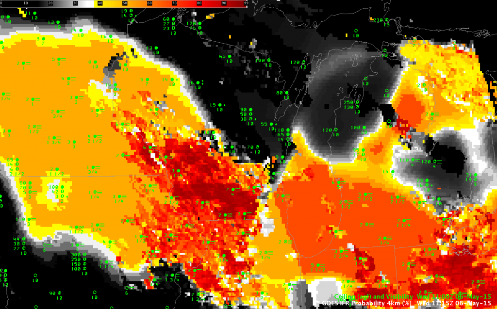
The 1115 UTC image in the animation above, shown below, includes the day/night boundary artifact. This is the straight line, roughly parallel to the terminator (it will stretch directly north-south on the Equinoxes), that parallels the Lake Michigan shoreline at Chicago. To the right, daytime predictors are used and IFR Probabilities are somewhat larger (67% vs. 51%) than they are where nighttime predictors are used to the west.


