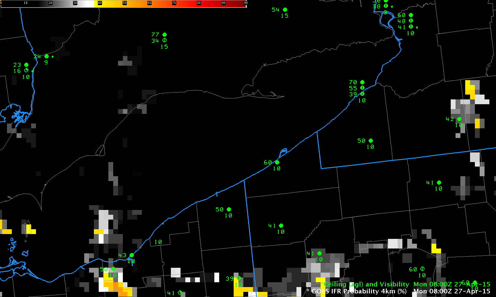
GOES-R IFR Probabilities, 0800 through 1400 UTC on 27 April 2015 (Click to enlarge)
Fog developed along Lake Erie after sunrise on Monday 27 April 2015. The fog and low ceilings were associated with a line of light showers, so multiple cloud layers were present. These layers inhibit satellite detection of fog/low stratus. GOES-R IFR Probabilities, above, computed using GOES-13 Satellite data and Rapid Refresh Model Output show very low probabilities at 0800 and 1015 UTC (stratus clouds are observed); at 1215 UTC, IFR Probabilities increase in the counties adjacent to Lake Erie in Pennsylvania and New York; at 1315 and 1400 UTC, IFR Probabilities are high, and IFR conditions are observed in both Erie PA and Dunkirk NY.
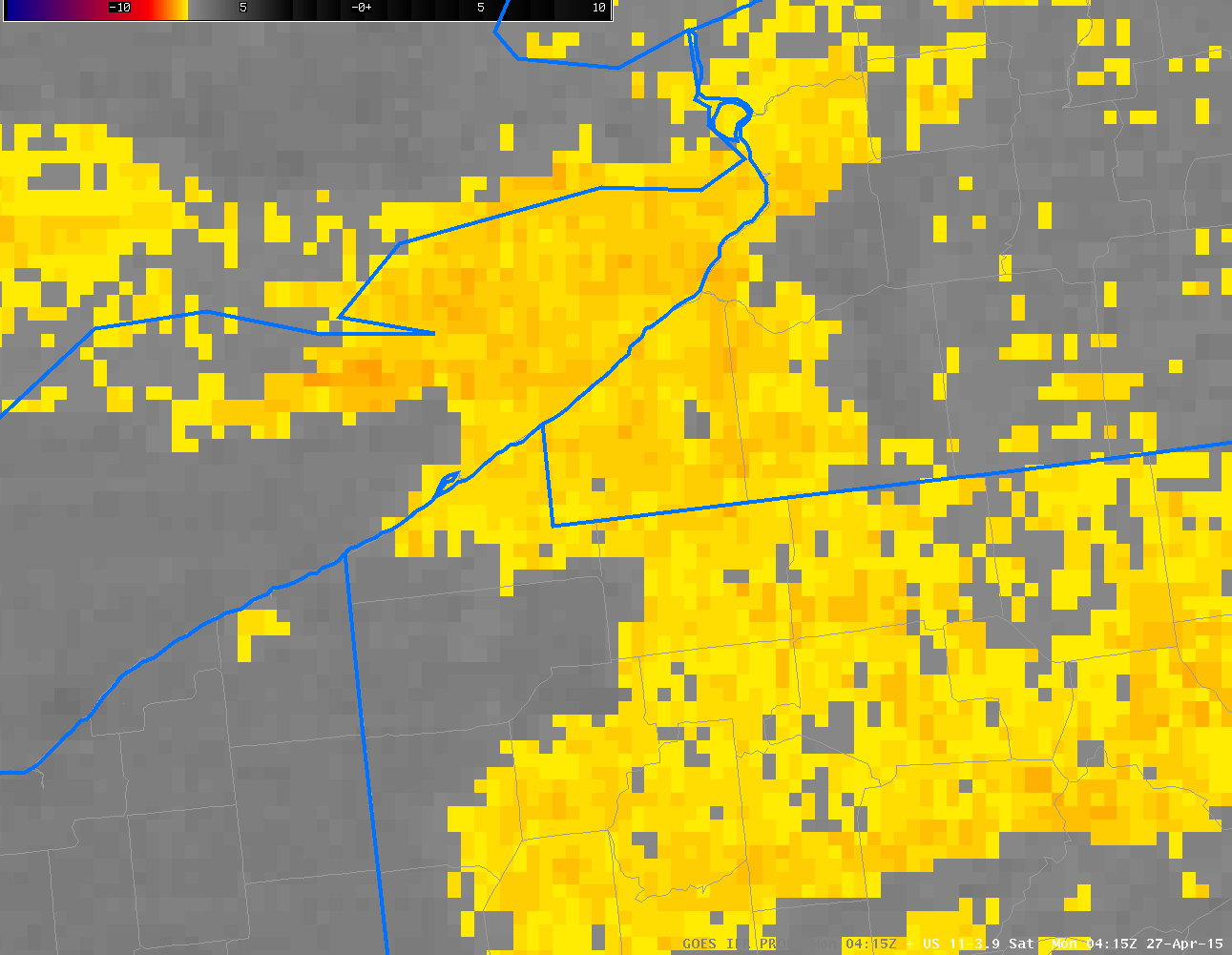
GOES-13 Brightness Temperature Difference Fields, 0400 through 1000 UTC on 27 April 2015 (Click to enlarge)
Brightness Temperature Difference fields overnight, above, showed evidence of water-based clouds over much of the area. The fields are moving south, however, leaving the lakeshore behind. The toggle below is of Brightness Temperature Difference and IFR Probability from 1215 UTC. It is far more difficult to relate features in the brightness temperature difference field with reductions in observations at the surface than it is to relate IFR Probability fields with surface observations. Note also that the character of the brightness temperature difference field below has changed because reflected solar radiation at 3.9 µm has become important.
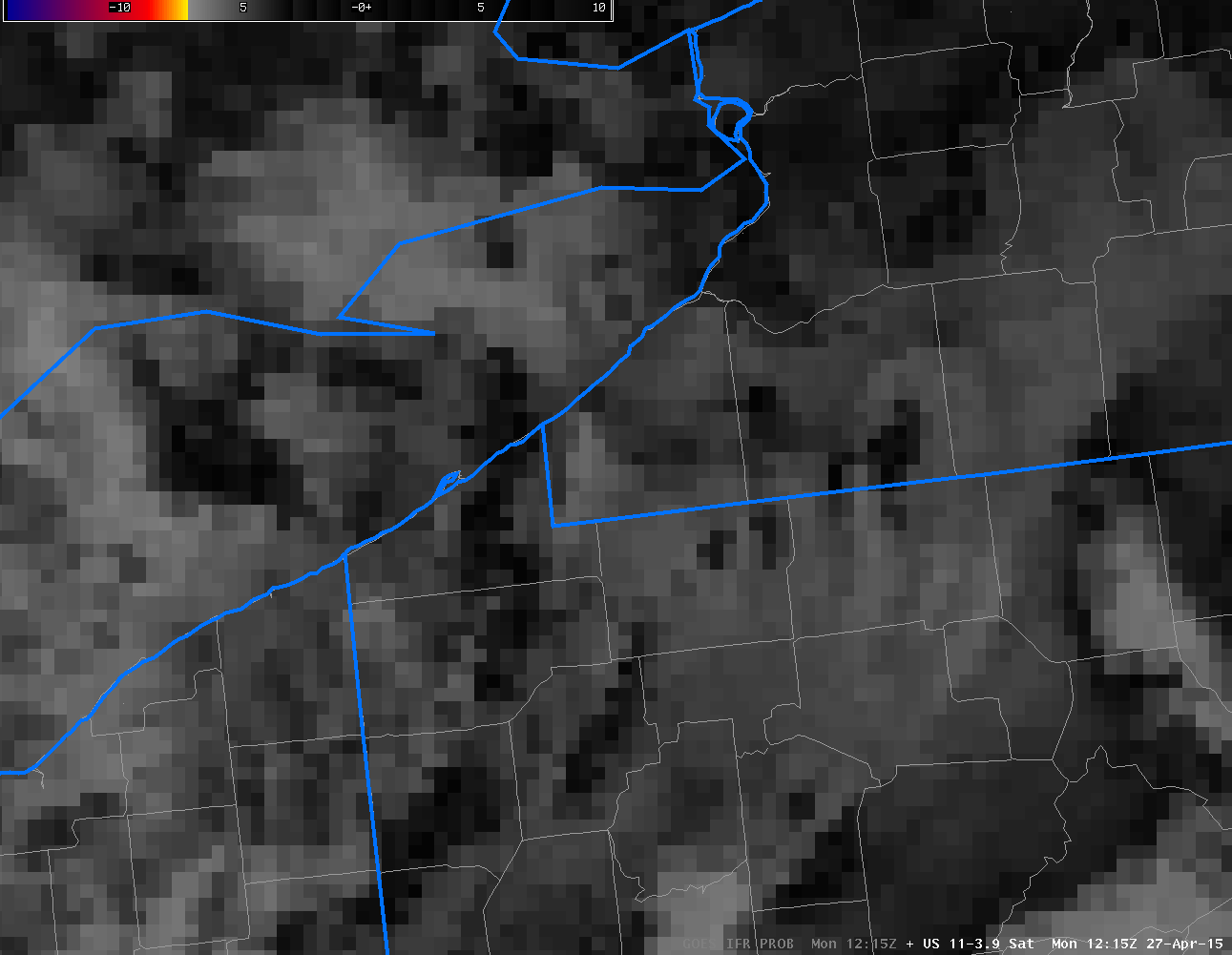
Toggle between GOES-R IFR Probability fields and GOES East Brightness Temperature Difference Fields at 1215 UTC on 27 April 2015 (Click to enlarge)