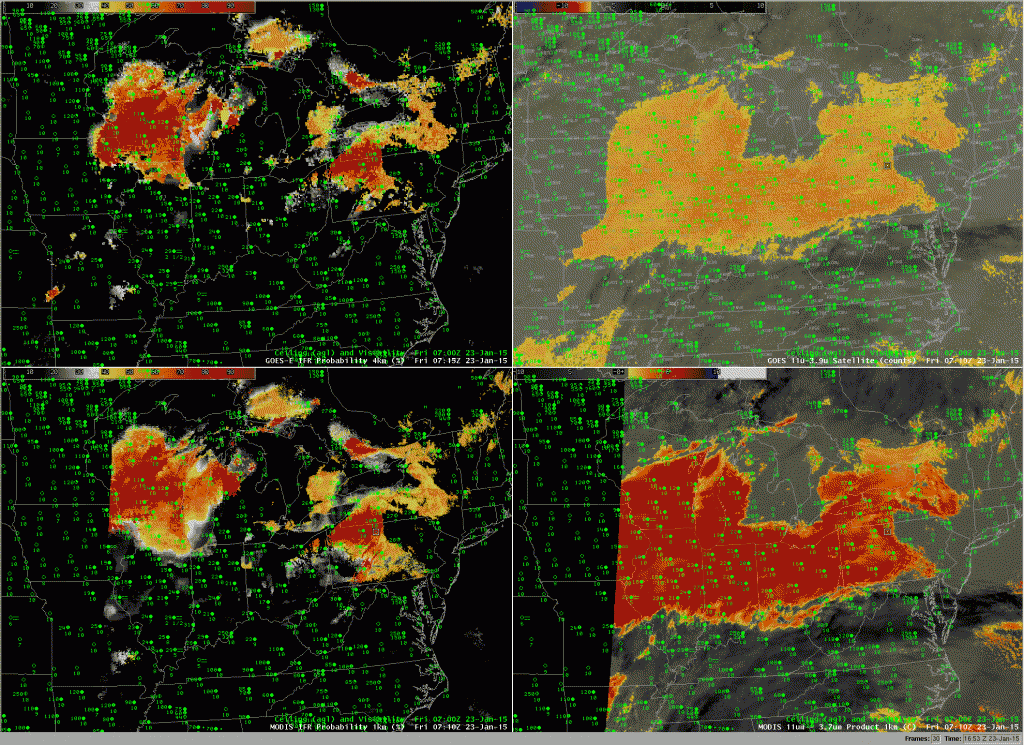
GOES-based IFR Probability (Upper Left), GOES-13 Brightness Temperature Difference (10.7µm – 3.9µm) (Upper Right), Aqua MODIS-based IFR Probability (Lower Left), Aqua MODIS Brightness Temperature Difference (11µm – 3.7µm) (Lower Right), all with observations of visibility and ceiling, around 0715 UTC 23 January 2015 (Click to enlarge)
The imagery above shows a stratus deck stretching from Wisconsin and Missouri to New York. Both MODIS and GOES Brightness Temperature Difference fields show strong returns that suggest the presence of stratus clouds comprised of water droplets (owing to the difference in emissivity from small droplets at 3.9µm and at 10.7µm). But what about the cloud base, a parameter that is very difficult to determine from satellite data alone?
IFR Probabilities suggest differences in the cloud bases. Highest probabilities are over Wisconsin — where ceilings are around 1000 feet, and where fog is reported (at Lone Rock). Over Indiana and Ohio, IFR Probabilities are low, and ceilings are generally above 2000 feet. IFR Probabilities are higher over Pennsylvania and New York, where ceilings drop again to 600-1000 feet, and where fog is again reported (At Dubois).
The inclusion of surface moisture information (from the Rapid Refresh Model) in the IFR Probability fields allows the IFR Probability fields to better distinguish between low ceilings/fog (known transportation hazards) and higher ceilings in regions of stratus where satellite data alone shows little difference.
