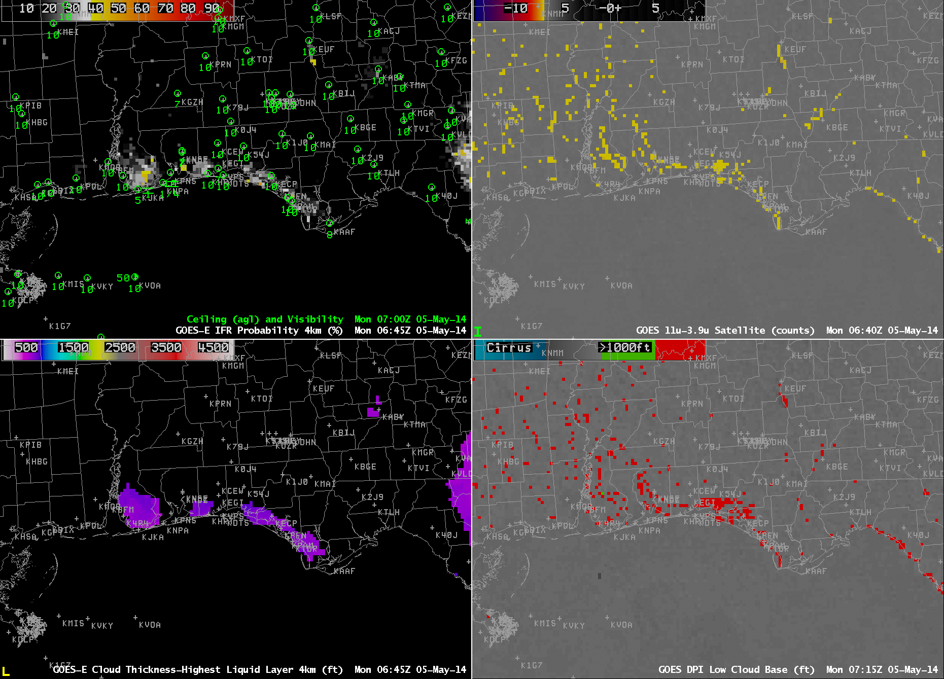
GOES-R IFR Probabilities computed from GOES-East (Upper Left), GOES-East Brightness Temperature Difference (10.7 µm – 3.9 µm) (Upper right), GOES-R Cloud Thickness (Lower Left), GOES-13 Heritage Cloud Thickness Product (Lower Right), times as indicated (Click to enlarge)
Clear skies and light winds over the Florida Panhandle allowed radiation fog to develop, and the GOES-R IFR Probability field ably captured the region of IFR conditions, as shown above. Note how the GOES-R Fields provide information that looks less ‘noisy’: the heritage products — Brightness Temperature Difference and Cloud Thickness — both have signals over interior Alabama and Mississippi where IFR conditions were not reported. In addition, the well-known co-registration error in the 10.7 and 3.9 sensors produces a faulty signal along the Florida coast east of Appalachee Bay. Eventually this signal because so strong that it bleeds into the GOES-R IFR probability.
Cloud thickness can be used to forecast fog dissipation time, using this chart and tempered by experience. The last pre-sunrise cloud thickness is shown at 1045 UTC in the loop above, and is around 1000 feet, suggesting a dissipation time around 1345 UTC. The visible animation below corroborates this estimate.
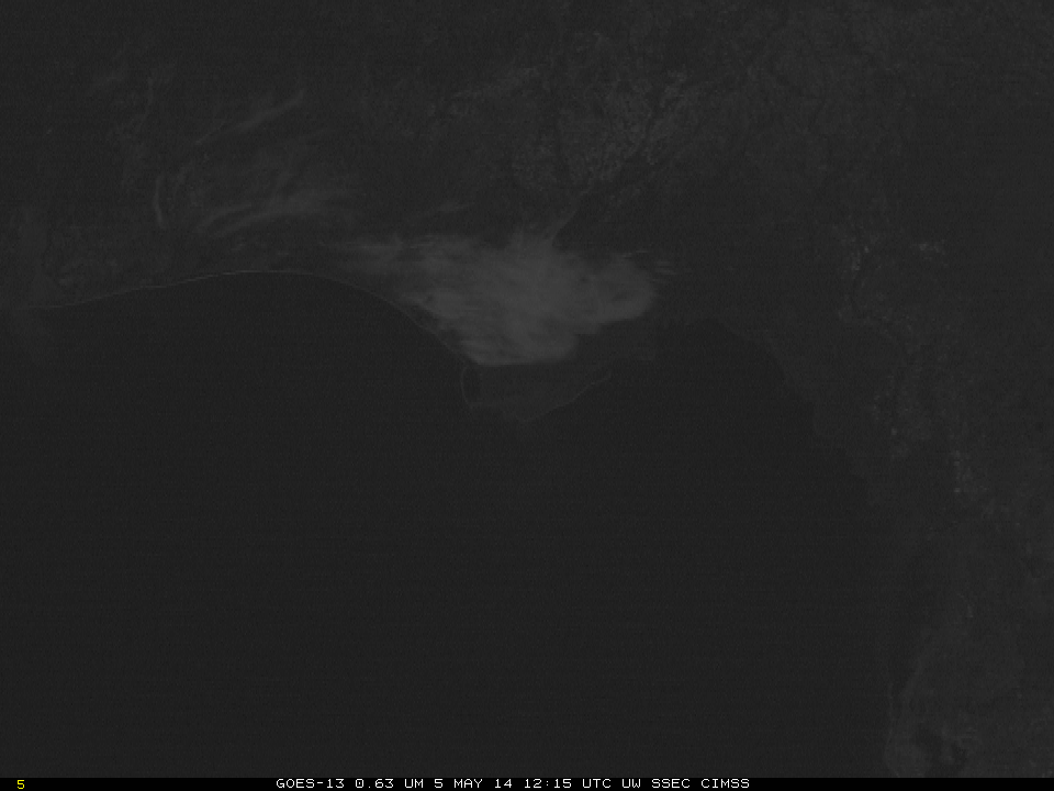
GOES-R Visible (0.63 µm), times as indicated (Click to enlarge)