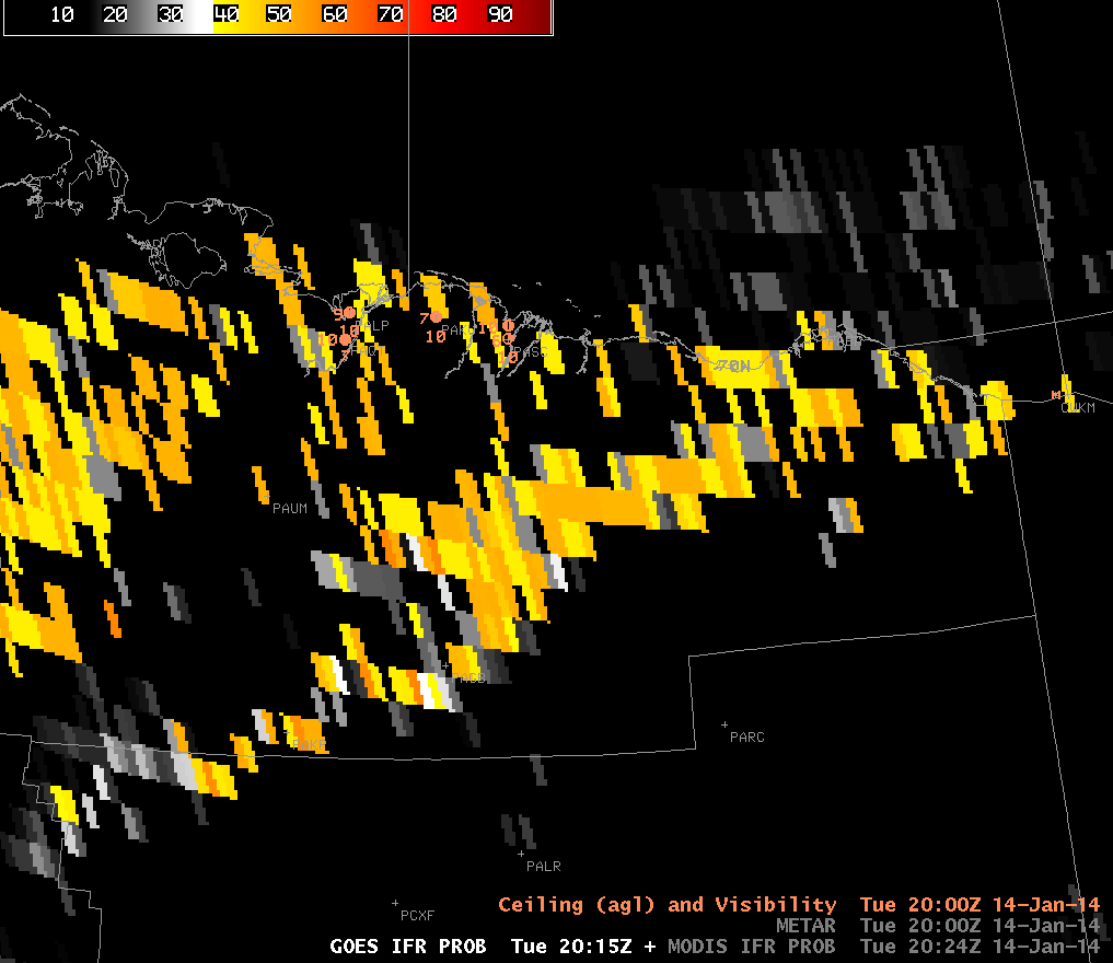
GOES-West IFR Probabilities, MODIS IFR Probabilities and surface topography over northern Alaska, ~2000 UTC on 14 January 2014 (click image to enlarge)
GOES pixels grow to large sizes at high latitudes, such as those found over northern Alaska. Consequently, the IFR Probabilities can give information that is difficult to interpret. Data from the polar-orbiting MODIS instrument (on board Aqua and Terra satellites), in contrast, have nominal 1-km resolutions even at high latitudes. In the toggle of imagery above, the MODIS IFR Probabilities suggests low clouds just north of the Brooks Range in northern Alaska. In contrast, the IFR Probabilities based on GOES-15 are difficult to interpret.
Consider using the MODIS-based IFR Probabilities. At very high latitudes, data from polar orbiters is more frequent than at mid-latitudes. Thus, there is a benefit from higher spatial resolution without an onerous loss of temporal resolution as happens in mid-latitudes.