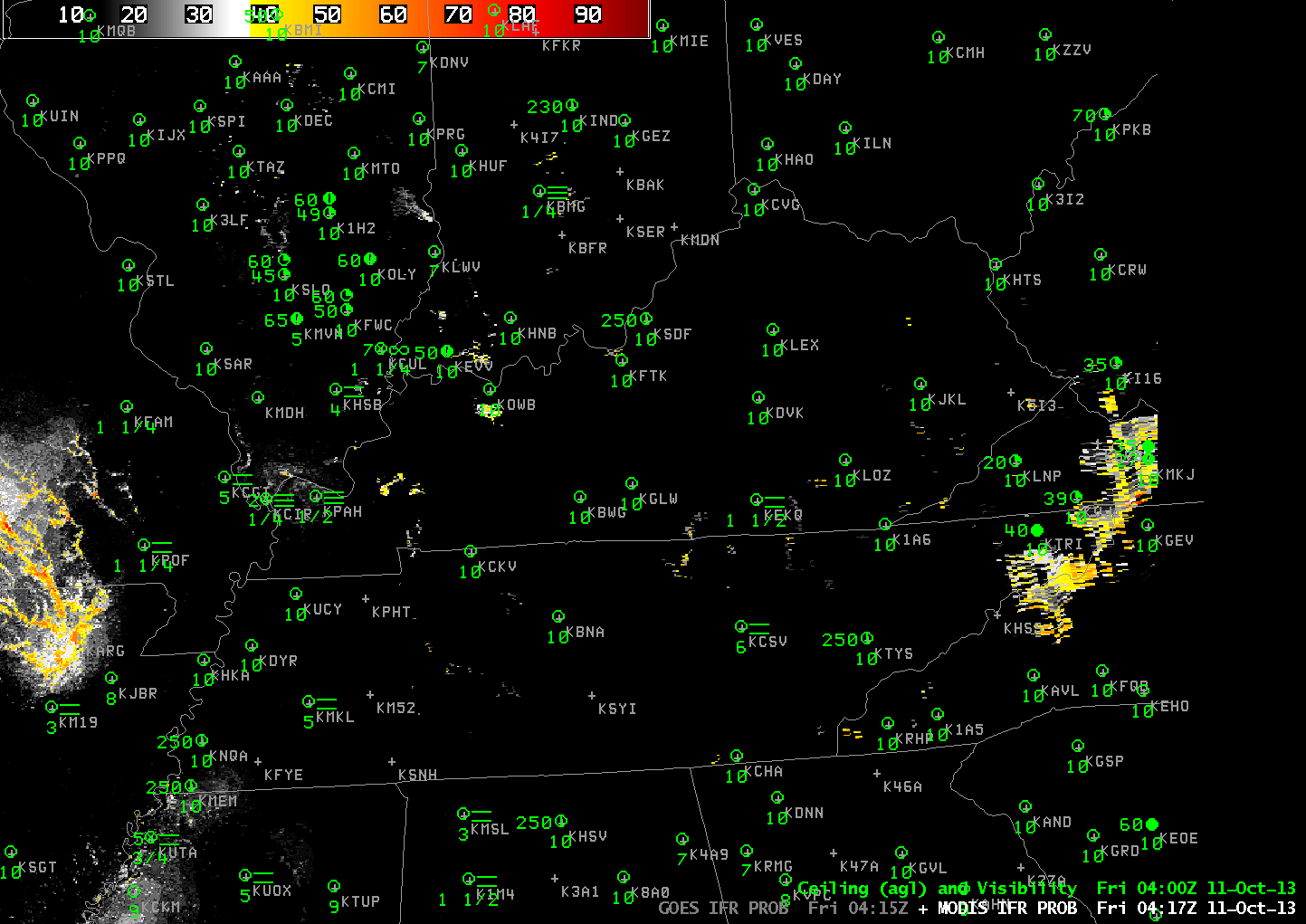
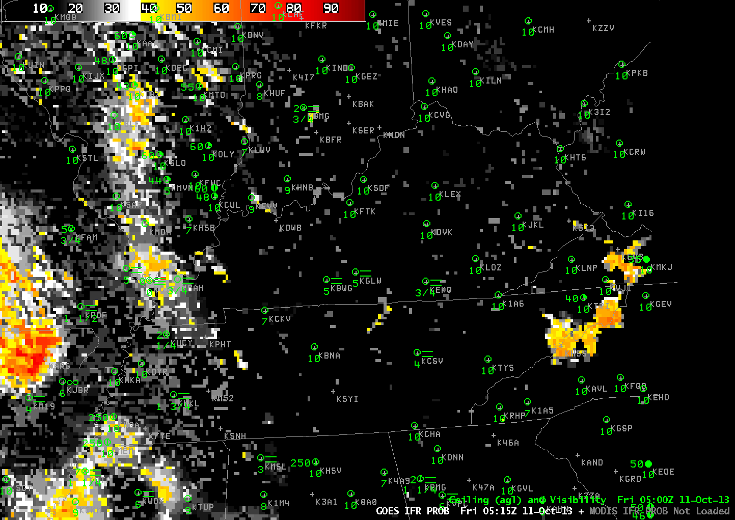
Toggle between GOES-13-based and MODIS-based GOES-R IFR Probabilities at ~0415 UTC on 11 October 2013 (click image to enlarge)
The toggle between the GOES-based and MODIS-based IFR Probabilities, above, shows how high-resolution MODIS data can give an earlier alert to the formation than is possible from GOES. Fog formed in the Cumberland Valley of central Tennessee and southeast Kentucky early in the morning of 11 October. MODIS-based IFR Probabilities over the river valley are peaking around 45% at 0415 UTC (vs. 5% for GOES-based IFR Probabilities). In fact, GOES-based IFR Probabilities do not reach 45% until about 0515 UTC, a full hour later. The toggle below shows the two brightness temperature difference products used at ~0415 UTC to make the IFR Probability fields. MODIS data are better able to resolve the small-scale river valleys where fog is forming earlier.
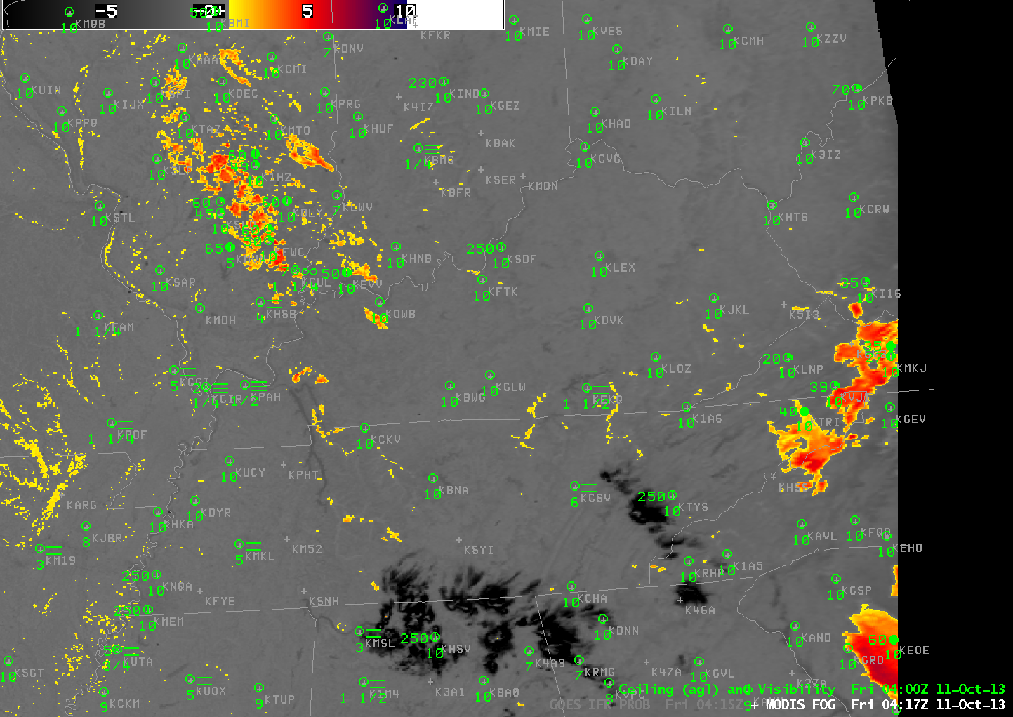
Toggle between GOES-13-based and MODIS-based Brightness Temperature Differences at ~0415 UTC on 11 October 2013 (click image to enlarge)
The animation below shows the fog quickly burning off in the morning. It has dissipated by 1500 UTC.
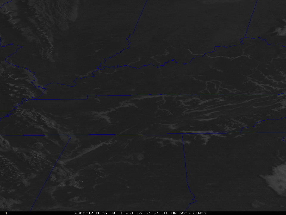
GOES-13 Visible Imagery during the morning of 11 October 2013 (click image to enlarge)