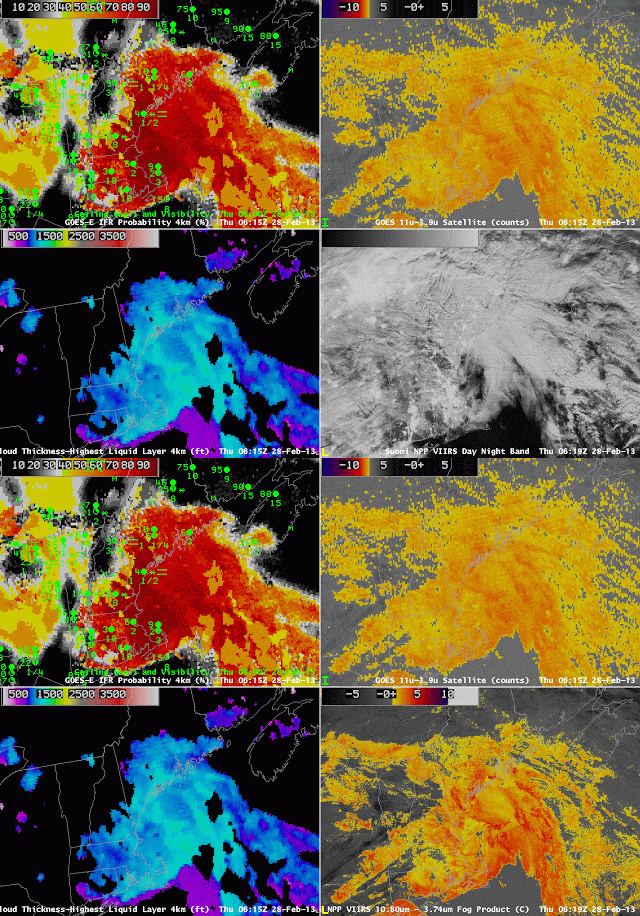
Weak Low pressure in the Gulf of Maine helped generate IFR conditions over the northeastern United States early in the morning on 28 February 2013. The brightness temperature difference fields over New England from Suomi/NPP include very sharp cloud edges (also present in the Day/Night band imagery). Because the GOES-R IFR Probability field also includes information from the Rapid Refresh, it is better able to distinguish fog and low stratus, as present over most of Maine, from elevated stratus, present over western New Hampshire and Quebec.
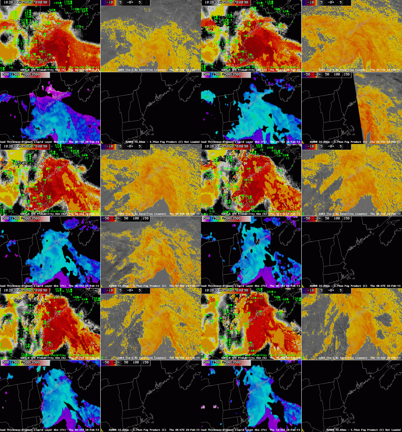
The animation of the imagery, above, demonstrates how the GOES-R IFR probability product can be used to monitor the evolving nature of a low cloud field. As the low pressure system in the Northeast starts to move away, the fog/low clouds rotate eastward. Two noteworthy events in the loop are present. The 0515 UTC imagery (mislabeled as 0510 UTC), contains stray light in the 3.9 µm field, and the traditional GOES brightness temperature difference field is therefore changed significantly, but the GOES-R IFR probability field is not. Note also that multiple cloud layers exist over coastal Maine and New Hampshire at the end of the animation, but GOES-R IFR probabilities correctly maintain high probabilities in a region where IFR conditions are present and where the traditional brightness temperature difference field does not show a signal consistent with low clouds.


