 |
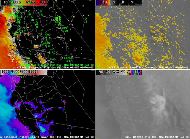
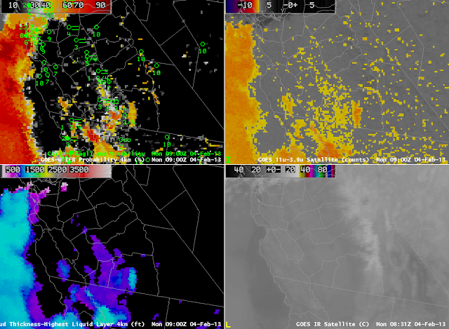
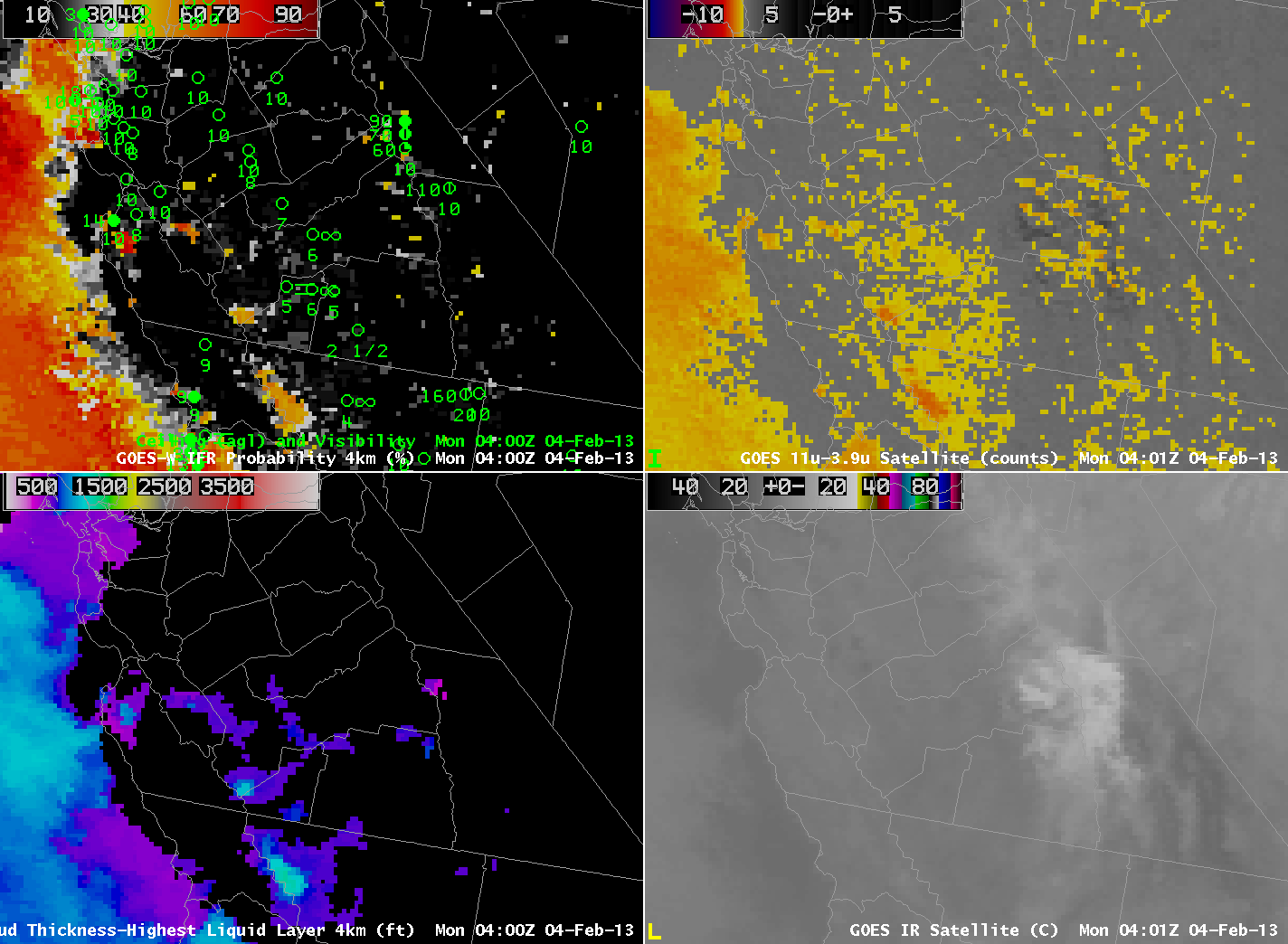
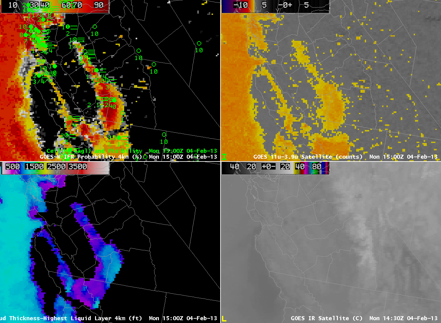
| GOES-R IFR Probability computed from GOES-West (Upper Left), GOES-R Cloud Thickness computed from GOES-West (Lower Left), GOES-West Brightness Temperature Difference (10.7 µm – 3.9 µm) (Upper Right), GOES-West 10.7 µm imagery (Lower Left) at 0400 UTC 4 February |
Fog develped over the San Joaquin and Salinas Valleys of California early on 4 February. At 0400 UTC, the Brightness Temperature Difference signal shows a noisy signal over the east part of the San Joaquin Valley, with a more coherent signal off the coast and over Kern and Kings County.
 |
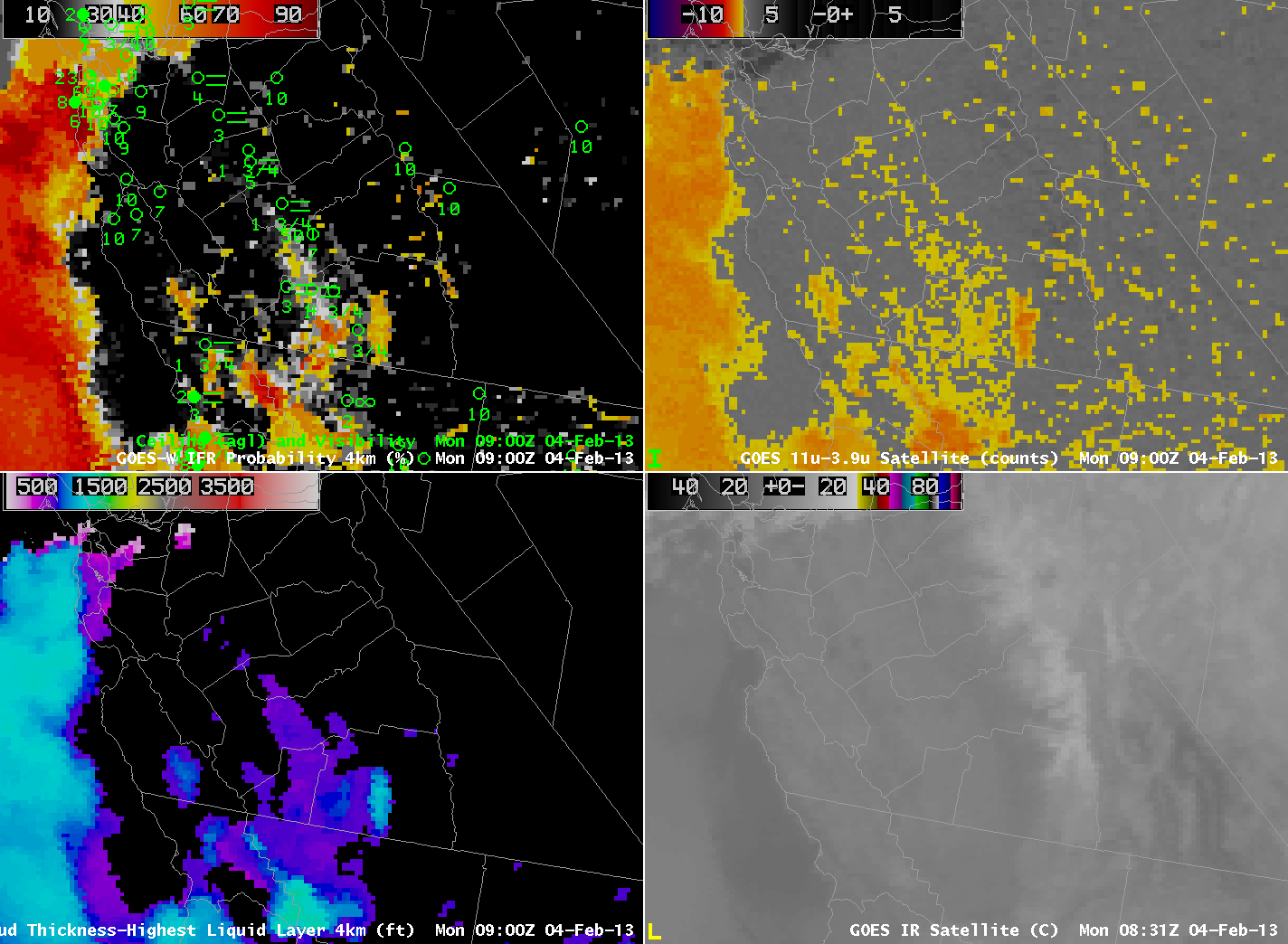
| As above but at 0900 UTC. |
By 0900 UTC, five hours later, although the seemingly noisy signal continued over the California in the brightness temperature difference product, the GOES-R IFR probability field is starting to show higher values aligned through the San Joaquin and Salinas Valleys, where IFR conditions have developed.
 |
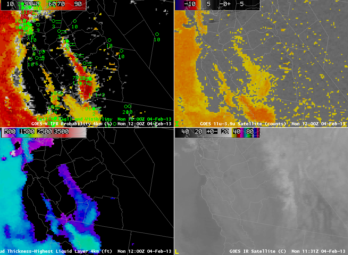
| As above, but at 1200 UTC |
At 1200 UTC, above, high IFR probabilities extend through the Salinas Valley and in the San Joaquin valley where IFR conditions are noted. IFR probability is also high over San Francisco Bay where marine stratus has moved inland.
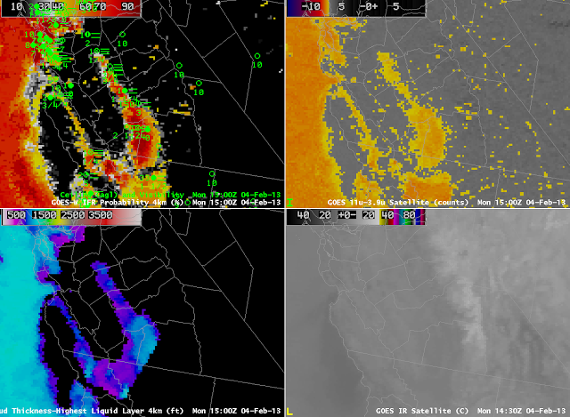 |
| As above, but at 1500 UTC |
The regions of reduced visibility continue at 1500 UTC, the last image before twilight conditions disallows computation of Cloud Thickness (indeed, the terminator is apparent in the image). The cloud thickness of 1100 feet suggests, based on this scatterplot, a dissipation time of around 4 hours. The animation below shows visible imagery at 1730, 1830 and 1930 UTC that aligns with the predictions.
 |
| GOES-15 0.62 µm Visible Imagery, times as indicated. |
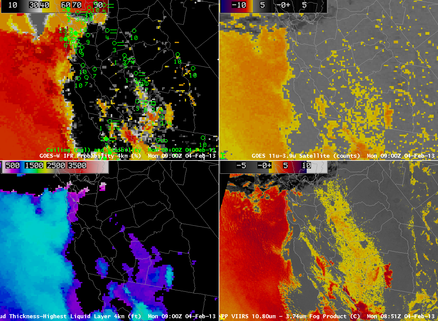
Suomi/NPP VIIRS data overflew this region twice during the night, and provided brightness temperature difference information at high spatial resolution. The GOES-R IFR algorithm is not yet applied to Suomi/NPP data (like it is to MODIS data) however.
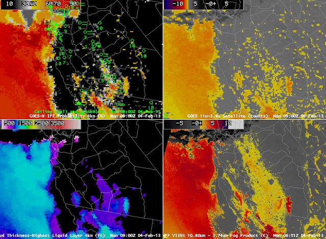 |
| As at top, but with Suomi/NPP Brightness Temperature Difference (10.8 µm – 3.74 µm) in the lower right, at ~0900 UTC. |
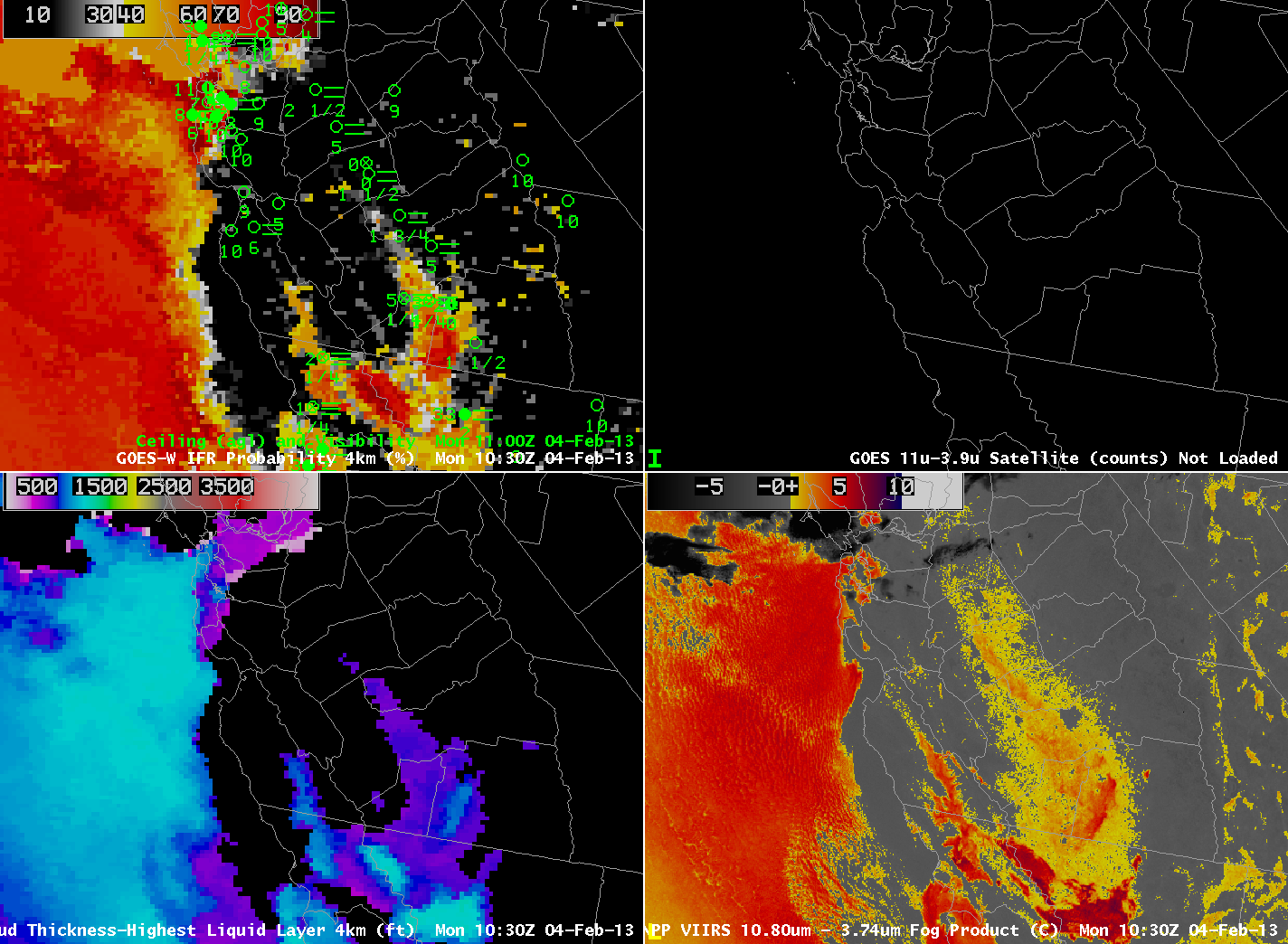
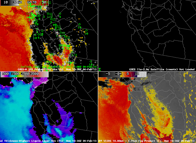 |
| As above, but at 1030 UTC. |