 |
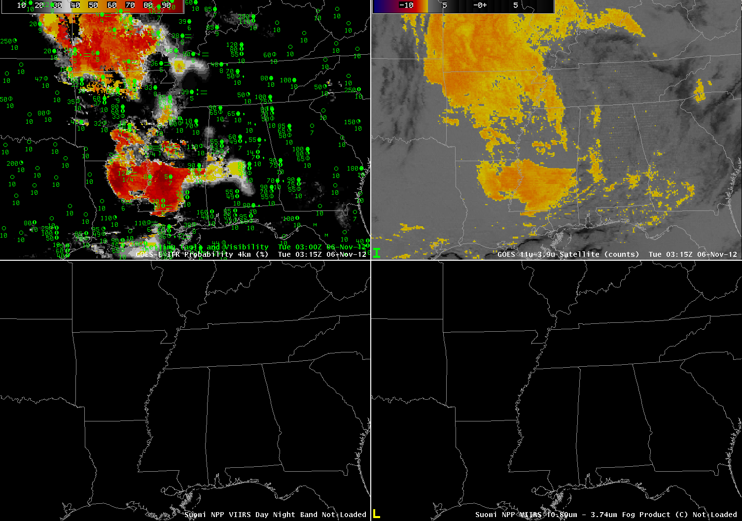
| GOES-East IFR Probabilities (upper left), GOES-East Traditional Brightness Temperature Difference (10.7 µm – 3.9 µm) (upper left), VIIRS Day/Night Band from Suomi/NPP (lower left), VIIRS Brightness Temperature Difference (10.80 µm – 3.74 µm) from Suomi/NPP (lower right) at 0315 UTC on 6 November 2012 |
IFR Conditions developed over the deep south overnight on the 5th/6th of November. How did the GOES-R IFR Probabilities capture this event, and how do the fields compare to the traditional brightness temperature difference fields? At 0315 UTC, near-IFR conditions have developed over central Mississippi and over southwest Missouri, the two regions where IFR probabilities are diagnosed to be highest. Rapid Refresh Model data are appropriately de-emphasizing the satellite signal in regions where IFR conditions are not reported (northeast Arkansas, for example).
Four hours later (below), at 0715 UTC, the area of IFR conditions over Mississippi has expanded somewhat, and the IFR Probability field continues to suggest — strongly — that IFR conditions are present. Both the traditional brightness temperature difference field and the IFR probability field suggest a sharp western edge to the fog/low stratus over north-central Louisiana, and that sharp edge is confirmed in the Day/Night band from VIIRS on Suomi/NPP. The Brightness Temperature Difference fields from both GOES and from VIIRS suggest one large field of fog, but the IFR probability field has two separate fields: one over Mississippi/extreme southern Arkansas and Louisiana, and one over southern Missouri.
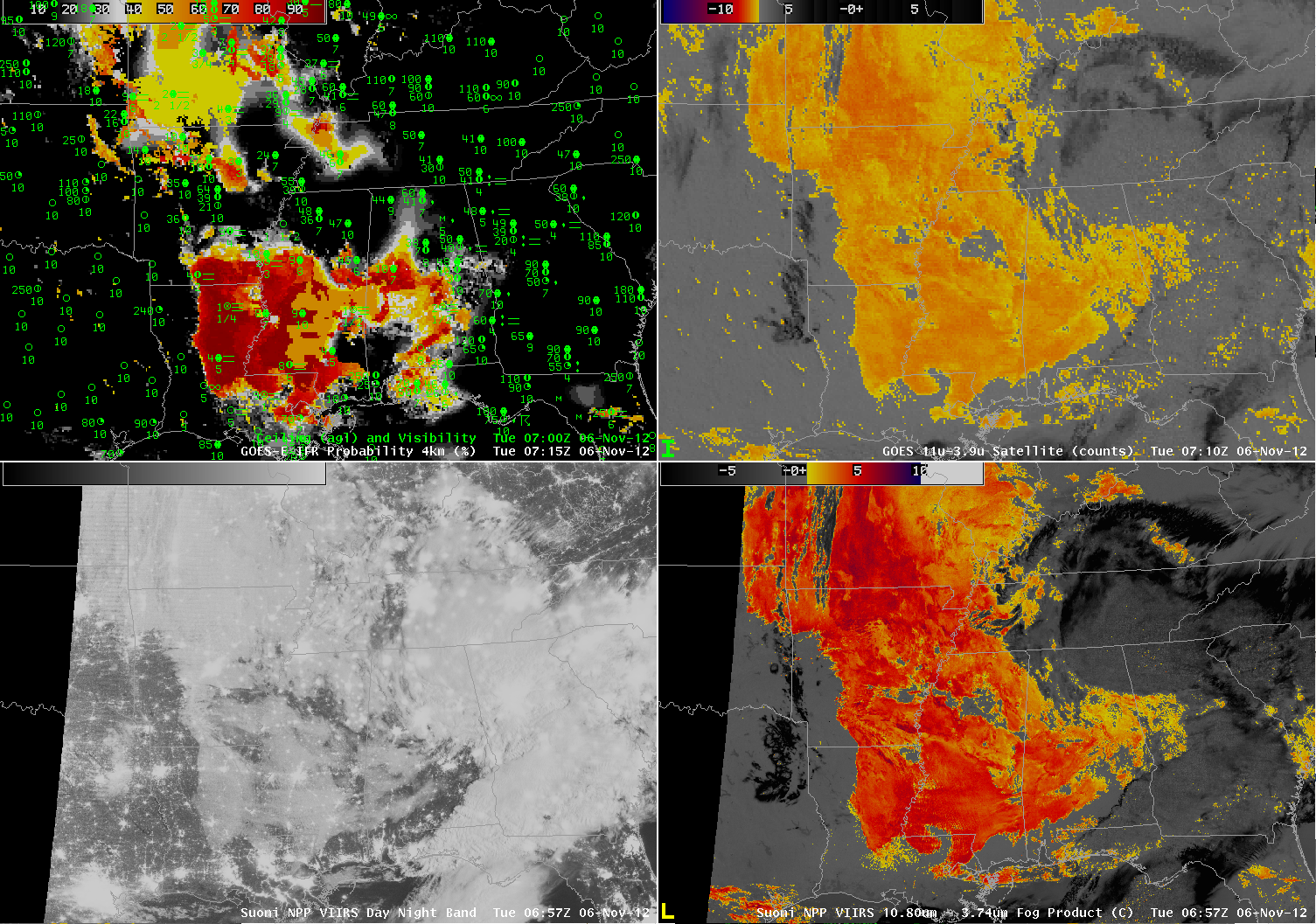 |
| GOES-East IFR Probabilities (upper left), GOES-East Traditional Brightness Temperature Difference (10.7 µm – 3.9 µm) (upper left), VIIRS Day/Night Band from Suomi/NPP (lower left), VIIRS Brightness Temperature Difference (10.80 µm – 3.74 µm) from Suomi/NPP (lower right) at approximately 0715 UTC on 6 November 2012 |