 |
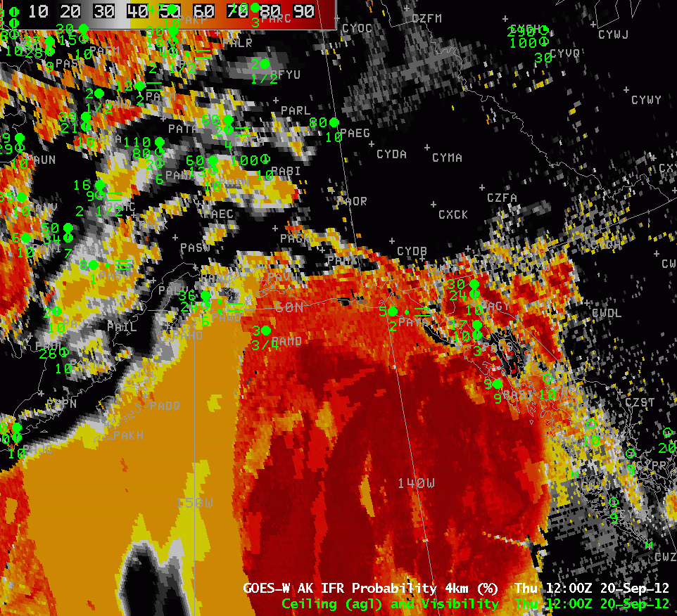
| Toggle between GOES-R IFR Probabilities computed with GOES-West (at 1200 UTC) and with MODIS (1154 UTC) over the northern Gulf of Alaska and surrounding landmass |
In regions where very small-scale terrain effects low cloud distribution — for example, in river valleys — the superior resolution of MODIS (on Terra or Aqua) or VIIRS (on Suomi NPP) allows a much better horizontal definition of cloud boundaries. In regions of larger scale variability, such as over the ocean, differences between GOES and MODIS IFR estimates aren’t quite so noticeable, as in the imagery above. Both fields show a large region of low stratus over the northern Gulf of Alaska moving inland. The regions of lower ceilings and reduced visibilities match the stream of higher IFR probabilities moving northward over the Gulf, from Middlteon Is (PAMD) on the western edge to Sitka (PASI) and Petersburg (PAPG) on the southern/eastern edge. Note also the break in high IFR probabilities where the Aleutian Peninsula attaches to the mainland, with higher probabilities, and IFR conditions, at PASV (Sparrevohn).
The character of the IFR probability field should alert you to the presence of a stream of high clouds over the western third of this image. In that region, only model values are being used to compute IFR probabilities, and the total probabilities are therefore lower.