 |
| GOES-R IFR Probabilities over Pennsylvania and surroundings hourly from 1300 to 1700 UTC on 18 September 2012, with ceiling and visibility plots overlain. |
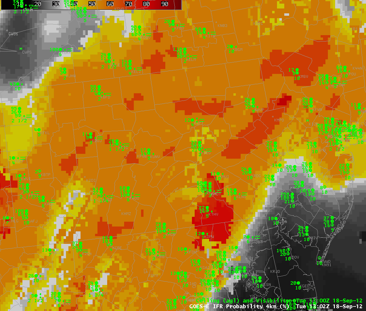
The traditional method for identifying fog and low stratus, the brightness temperature difference between the 10.7 µm and 3.9 µm channels, cannot work in cases with multiple cloud layers, or in cases with cirrus. Such a cloud environment is increasingly common in cooler weather months as extratropical cyclones and frontogenetic events cause large-scale ascent. It is still important to have a way to identify regions of low clouds/fog, and the fused product that considers both satellite data and rapid refresh model data accomplishes that task.
When only model data are used in the fused product, IFR probabilities will peak around 55% — the dark orange shading that is comon over much of central Pennsylvania — to 67% — the isolated pockets of darker red/orange over western Centre County. Higher values — such as the red values over the lower Susquehanna Valley — exceeding 75% require both a satellite and model estimate (there is likely a gap in the high-level cloudiness here that allows the satellite to view the lowest clouds).
As the thick overcast over Pennsylvania breaks apart during the course of the morning in this animation, the IFR probability field takes on a more pixelation aspect and regions of high IFR probability appear. Again, highest probabilities occur in regions where both satellite and model suggest IFR conditions are present. When satellite data are not available, IFR probabilities will not be so high.
Note in this animation that southeast Pennsylvania and New Jersey, where visibilities/ceilings exceed IFR thresholds, are regions where IFR probabilities correctly remain low. This suggests that the Rapid Refresh model is accurately simulating the evolution of the weather system.