 |
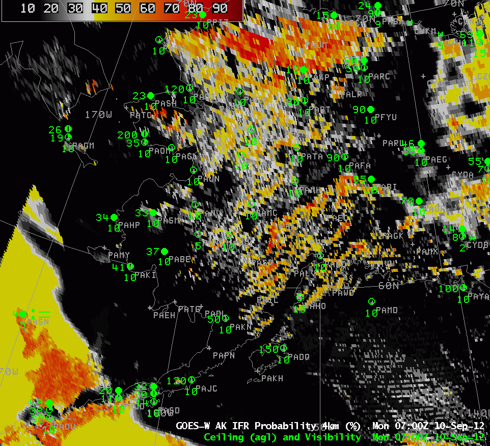
| Hourly images of GOES-West GOES-R IFR Probabilities over Alaska, 10 September 2012 |
IFR Probabilities and how they trend with time can help a forecaster determine the most likely regions where IFR conditions are occurring, and where they may occur in the near future. The animation above illustrates several key facts about the product.
The region over interior Alaska is one where both Rapid Refresh model data and satellite imagery are being used to produce the IFR product. This is related to the pixelated aspect of the field in that region. The high probabilities at the top of the image correspond to the location of the Brooks Range — higher topography there means IFR conditions are more common as the terrain rises into any low clouds that are present. There is a region of modest IFR probabilities over the Bering Sea north of the Aleutians and west of the mainland. These values are relatively low (orange and yellow color), and uniform, because they are computed with the Rapid Refresh data only. There is a region that moves in from the western edge that includes satellite data as well, and that is reflected both in the increased pixelated look to the field, and in the higher probabilities. (Note that St. Paul Island — PASN — is reporting IFR conditions during this time) When model data only are used in the computation of GOES-R IFR Probabilities (as occurs, for example, in regions of multiple cloud layers, or where a single high cirrus deck is present), probabilities are lower than in regions where satellite data also is used. Very high probabilities occur only where satellite data can be used to gauge IFR probabilities. Note also in this image that the western edge of the Rapid Refresh domain is obvious, west of 170 W longitude.
Note that in the inland region of enhanced IFR probabilities, Galena AK is near the highest values, and it is experiencing reduced visibilities and IFR conditions with freezing fog at 1400 UTC. Those conditions continued through 1600 UTC (below).
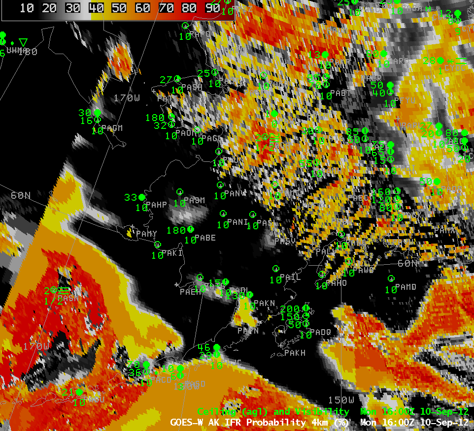 |
| GOES-R IFR Probabilities computed from GOES-West and Rapid Refresh, 1600 UTC 10 September 2012 |