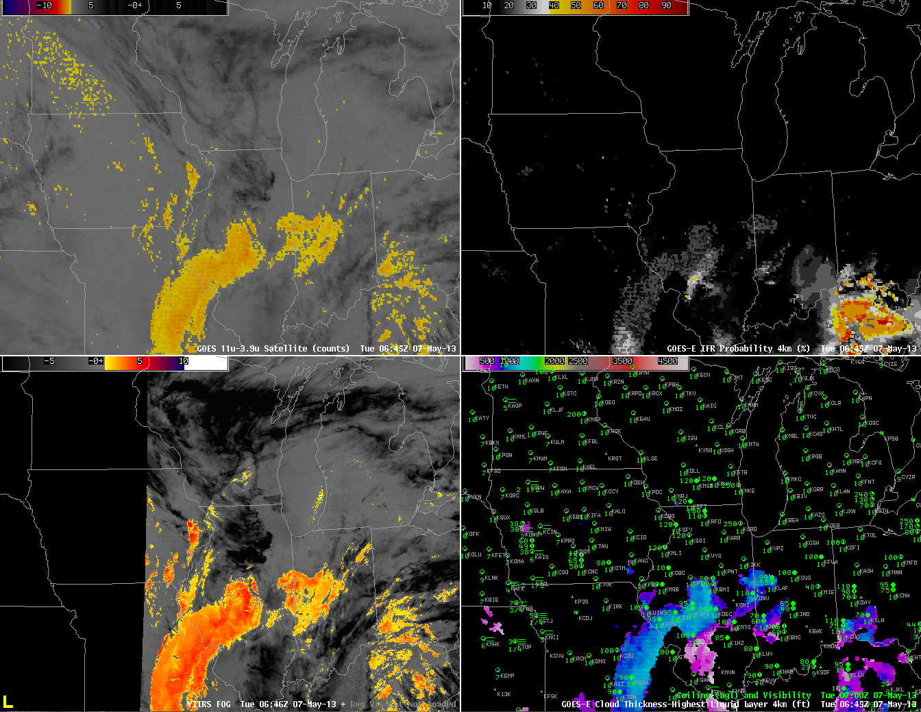
Areas of low stratus and fog developed over the upper Midwest in the morning on Tuesday, May 7th 2013. In the image above from ~0645 UTC, both GOES and Suomi/NPP detect clouds comprised of water droplets over central Illinois southwestward through St. Louis and into central Missouri. Careful examination of the ceilings/visibilities in that region, however, suggests that this is a mid-level stratus deck, and IFR Probabilities are suitably low. Fog is observed in northwest Missouri and over western Iowa. In this region, GOES does not detect water-based clouds, and IFR probabilities are low.
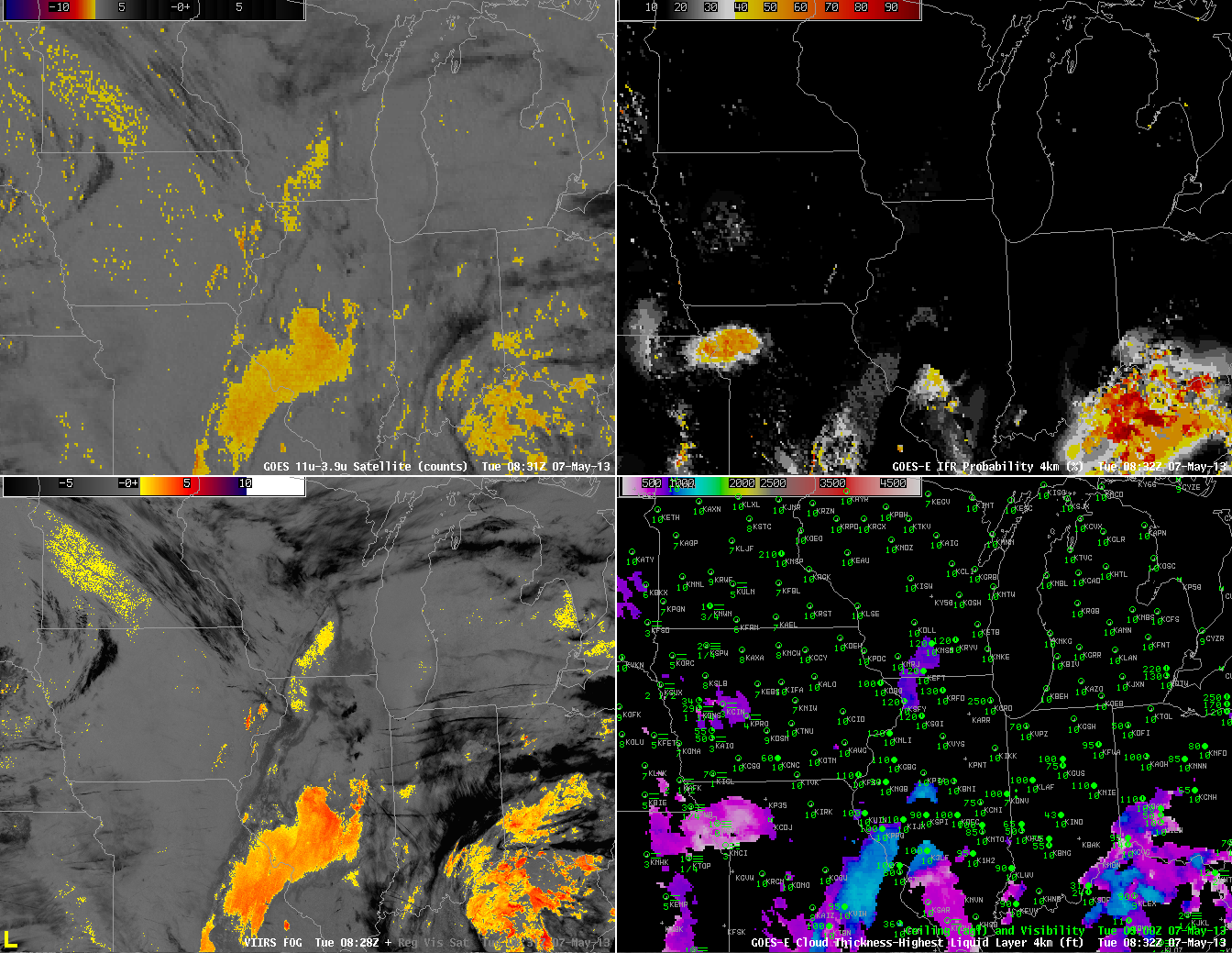 |
| As above, but for times near 0830 UTC 7 May 2013 |
Two hours later, at 0830 UTC, (above) the mid-level clouds persist near St. Louis. IFR conditions are not occurring there, however, and IFR probabilities are low. IFR probabilities have increased around Kansas City, however, and they’re increasing in western Iowa as well, where numerous reports of reduced visibilities due to fog are occurring. This is a region where the brightness temperature difference product, the heritage method for detecting fog and low stratus, gives no information because of multiple cloud layers.
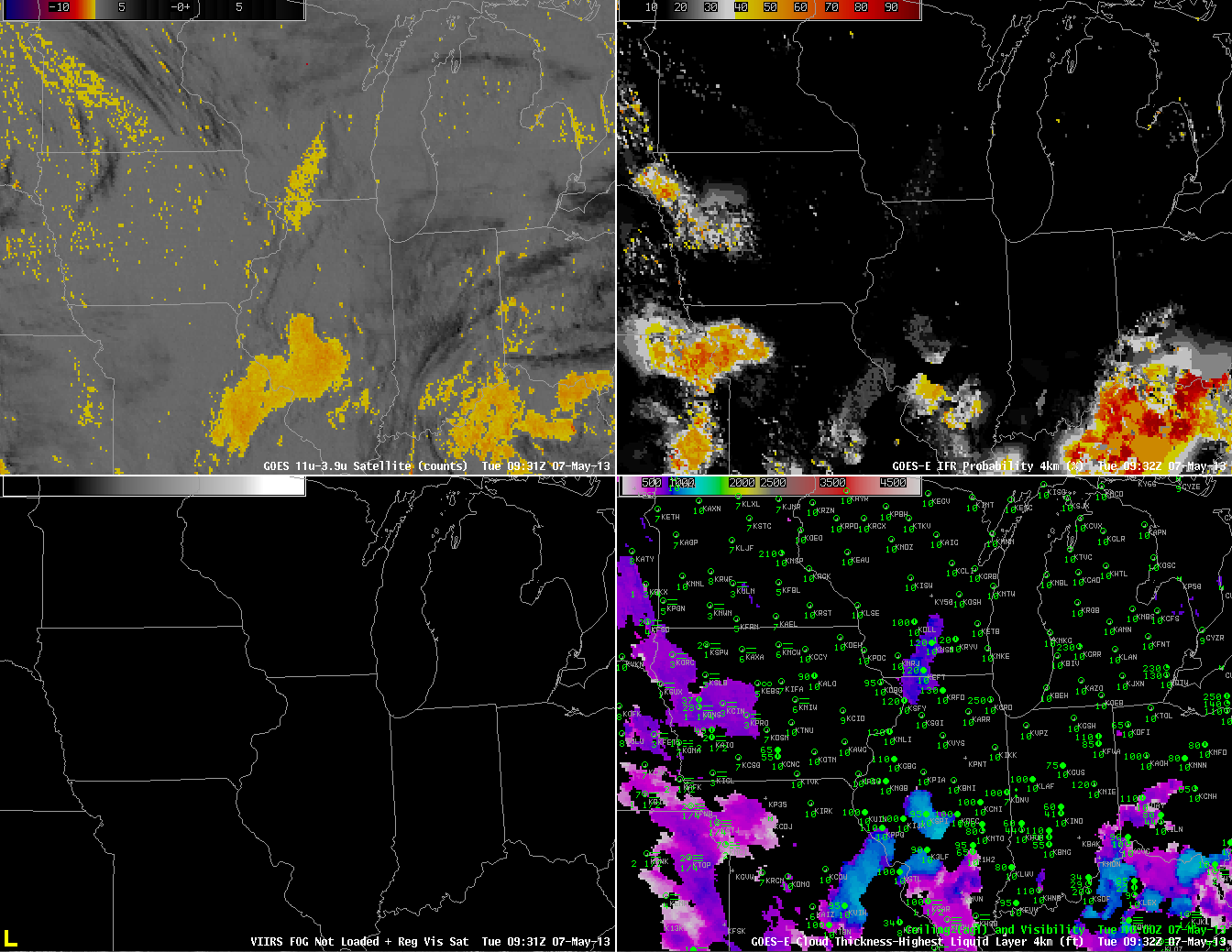 |
| As above, but for times near 0930 UTC |
At 0930 UTC (above), IFR Probabilities continue to increase over western Iowa southward into eastern Kansas, and they continue to be (correctly) suppressed near St. Louis where the traditional brightness temperature difference field notes the presence of a cloud comprised of water droplets.
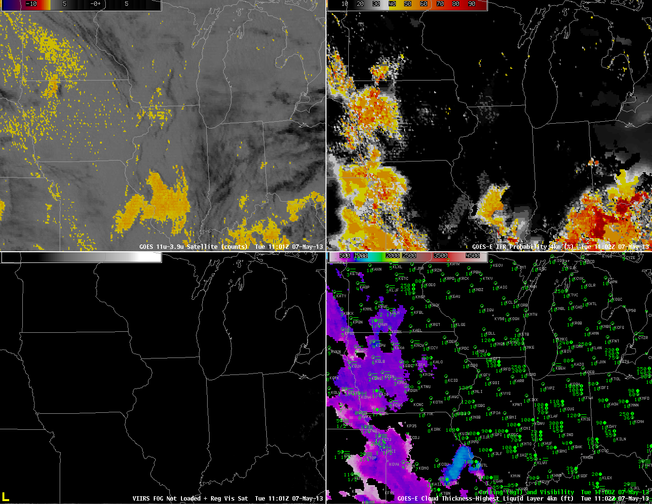 |
| As above, but for 1100 UTC |
By 1100 UTC (above), IFR probabilities are fairly high over most of western Iowa, western Missouri and eastern Kansas where many stations are reporting lowered ceilings and reduced visibility. Again, this is a region where the traditional brightness temperature difference does not indicate the presence of fog and stratus.
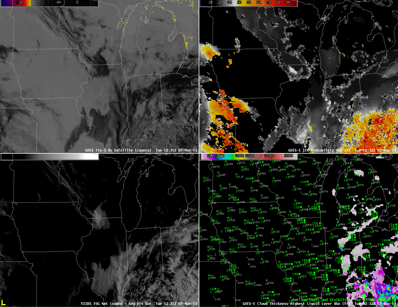 |
| As above, but for 1230 UTC 7 May. GOES-East Visible Imagery substituted for Suomi/NPP VIIRS Brightness Difference (bottom left) |
Shortly after sunrise, at 1230 UTC, above, IFR probabilities continue to be fairly high over western Missouri and eastern Kansas, a region where some stations are reporting IFR conditions (most notably in the Missouri River valley). One reason that IFR Probabilities have dropped quickly over Iowa is that visible imagery shows no fog there, so the cloud-clearing part of the IFR Probability algorithm used during daytime conditions is operating properly. Note also the false brightness temperature difference signal along the western shores of the Great Lakes. This signal arises from a co-registration error between the longwave and shortwave infrared channels. It continues through 1400 UTC (below).
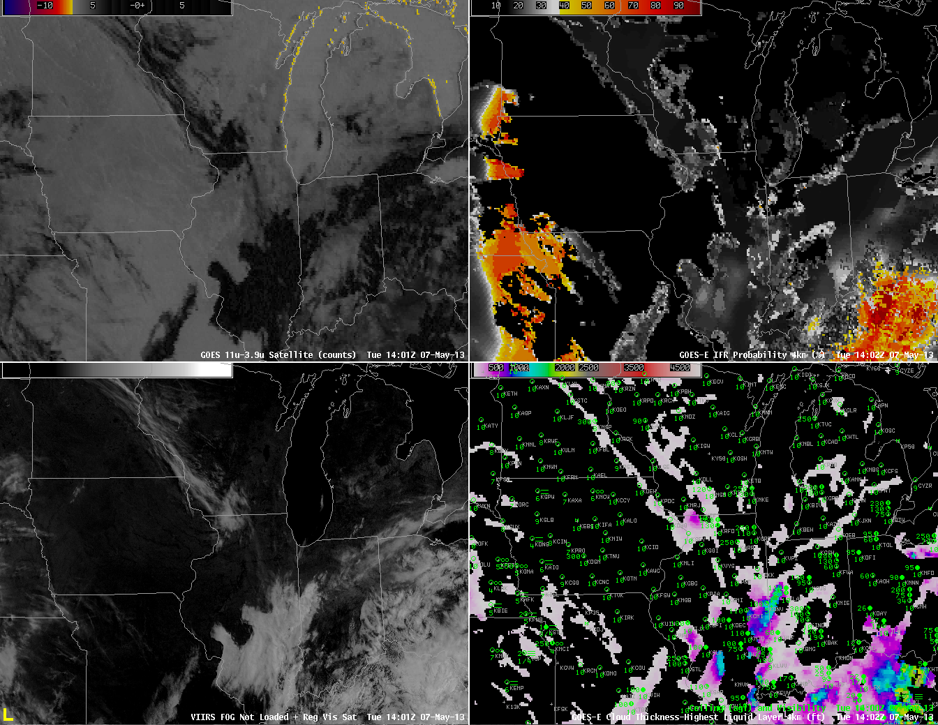 |
| As above, but for 1402 UTC |

