Category Archives: Plains

Fog and Low Clouds after evening Convection

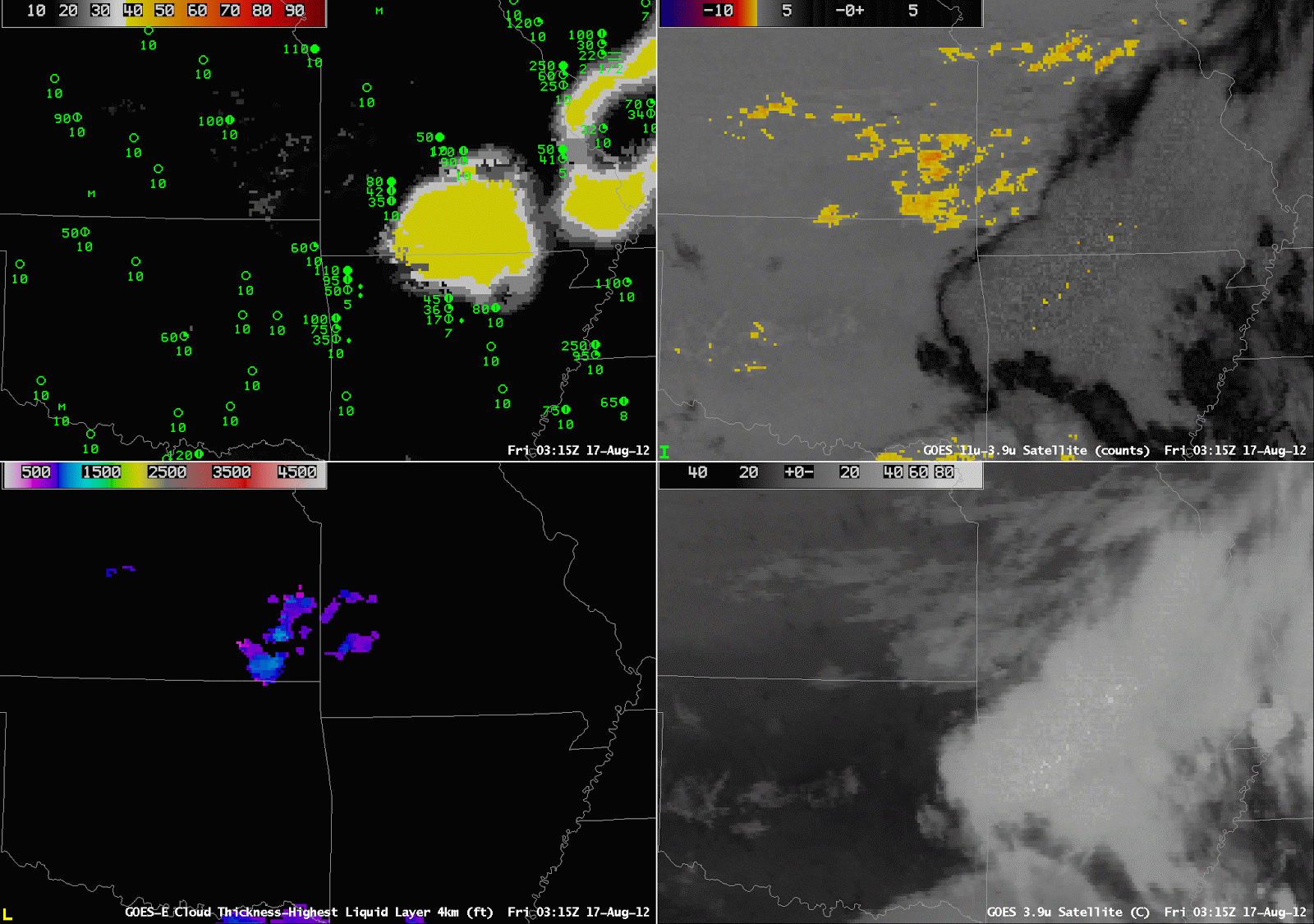
GOES-R IFR Probabilities (Upper Left), Brightness Temperature Difference (10.7 µm – 3.9 µm) (Upper Right), GOES-R Cloud Thickness (Lower Left), GOES-East 3.9 µm Brightness Temperature (Lower Right), for 0315 UTC to 1115 UTC on 17 August 2012

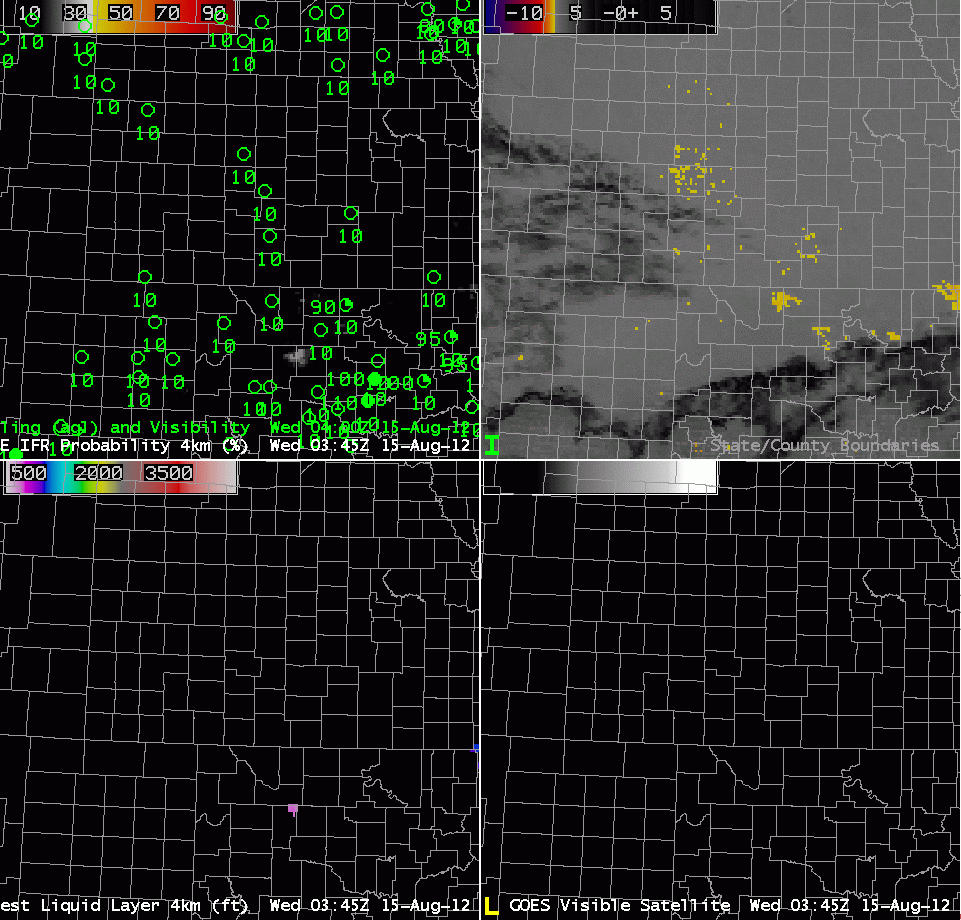
Post-sunset convection can supply the moisture that is needed for the development of overnight fog and low stratus.  But do those low clouds cause IFR conditions?  This example over NW Arkansas from the morning of 17 August shows GOES-R IFR Probabilities that successfully pinpoint the regions where IFR conditions are most likely and exclude regions where IFR conditions do not occur.  The brightness temperature difference field and the 3.9 µm both show convection before 0600 UTC. Subsequent to the convection, a brightness temperature difference signal that is consistent with fog/low stratus does develop over southern Kansas, and then over south-central Missouri and northwest Arkansas.  The GOES-R IFR Probabilities, however, suggest that IFR conditions are likely only over northwest Arkansas (where IFR conditions are observed).

This example also ably demonstrates the differences in the character of the IFR Probability field that occur when model data alone are used to predict IFR probabilities (Northeast Arkansas during most of the loop) vs. a combination of Satellite and Model data (Northwest Arkansas at the end of the loop).

Radiation Fog over Kansas

GOES-R IFR Probabilities (Upper left), GOES-East brightness temperature difference (Upper Right), GOES-R Cloud Depth (of lowest liquid layer) (Lower Left), GOES-East Visible Imagery (Lower Right) from 0345 UTC through 1645 UTC on 15 August 2012.

Radiation fog that developed over Kansas early in the morning of August 15th highlights the strengths of the GOES-R IFR algorithm.  IFR probabilities are highest in regions where the satellite signal — the brightness temperature difference — is strong;  IFR probabilities are reduced in regions where the model signal is not strong.  Thus, IFR probabilities are generally highest in regions where IFR conditions are observed.  In the loop above, high IFR probabilities do not extend into central Kansas where a satellite signal does exist.  In addition, the GOES-R IFR imagery at 0502 UTC does not include the sudden expansion in areal coverage (likely due to stray light) that appears only at that time.  The IFR Probability signal persists through sunrise (in contrast to the Brightness Temperature Difference signal that flips sign as the sun comes up).  GOES-R Cloud thickness peaks around 1200 feet at the last image before twilight;  according to this chart, that suggests that the radiation fog will burn off more than 4 hours after sunrise.  The last fog did not dissipate until shortly after 1600 UTC.