 |
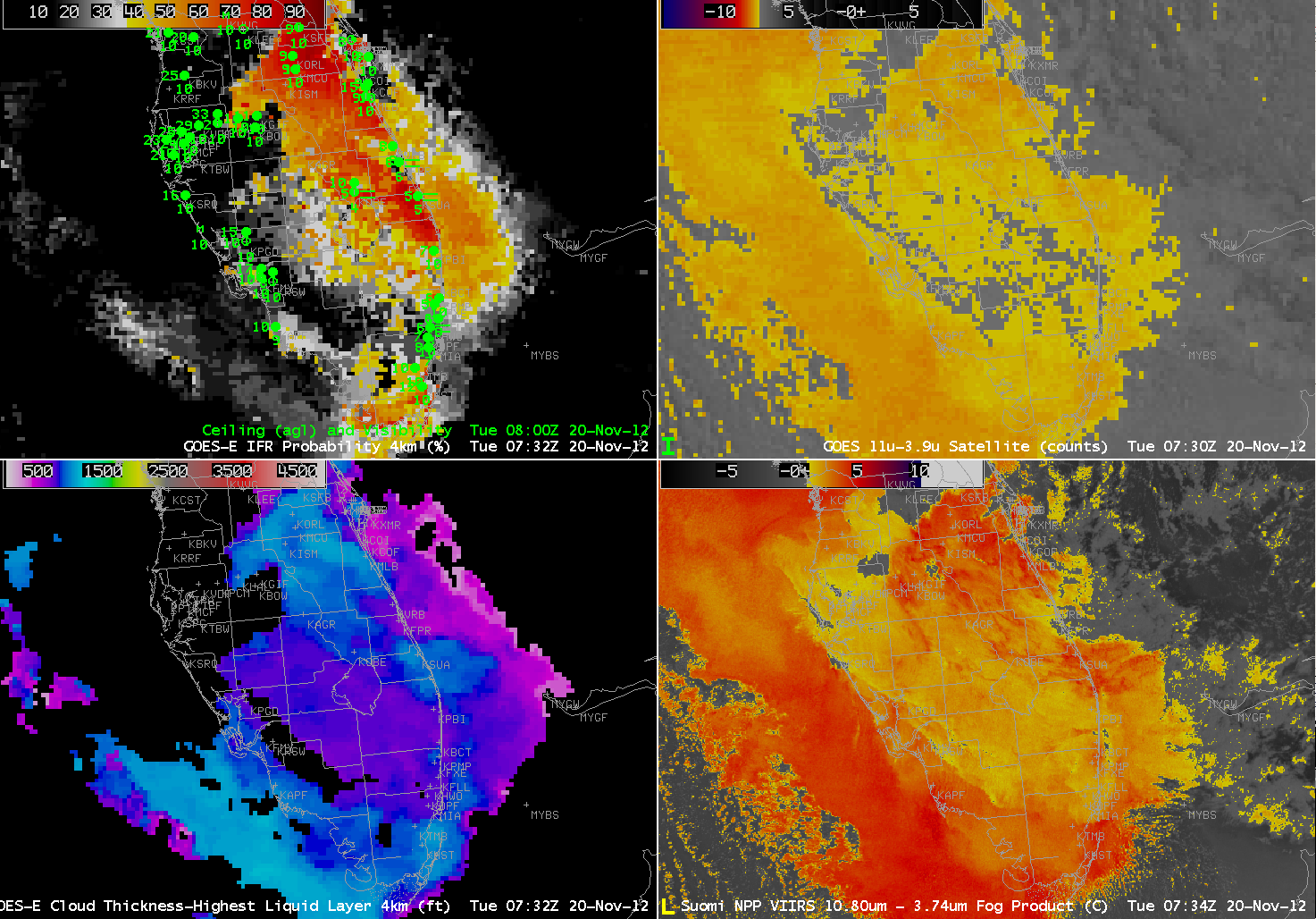
| GOES-R IFR Probability computed from GOES-East and Rapid Refresh data (Upper left), Traditional Brightness Temperature Difference (10.7 µm – 3.9 µm) Product from GOES (Upper right), GOES-R Cloud Thickness product (Lower Left), Brightness Temperature Difference (10.8 µm – 3.74 µm) Product from VIIRS on Suomi/NPP (Lower Right) |
Tuesday morning’s low cloud/fog event over southern Florida is an excellent example of how the fused product better distinguishes between fog (that reduces visibility at the surface) and low stratus (that does not reduce visibility at the surface). The traditional brightness temperature difference products from both GOES (Upper Right) and VIIRS (Lower Right) show a strong signal over both Florida coasts — Atlantic and Gulf — but the IFR probabilities are highest along the Atlantic Coast — where IFR and near-IFR ceilings/visibilities are observed. Over and off the west coast of Florida, despite the very strong satellite signal, IFR probabilities are low because saturation is not occurring in the lowest part of the Rapid Refresh Model — and IFR conditions are not observed.