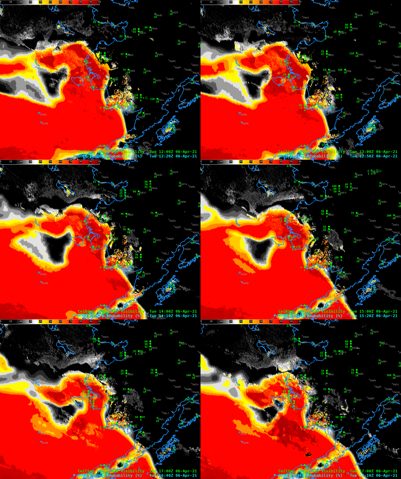
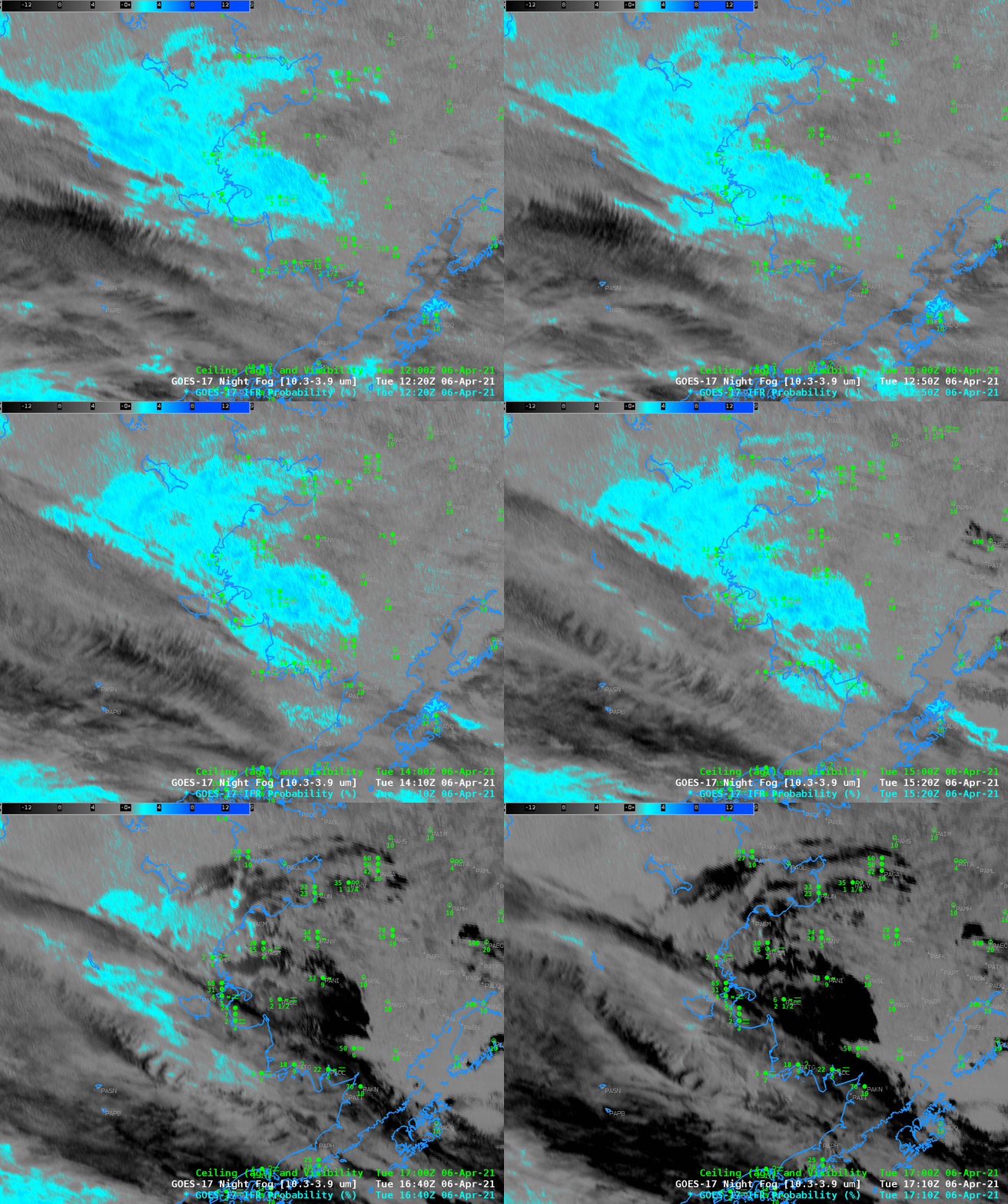
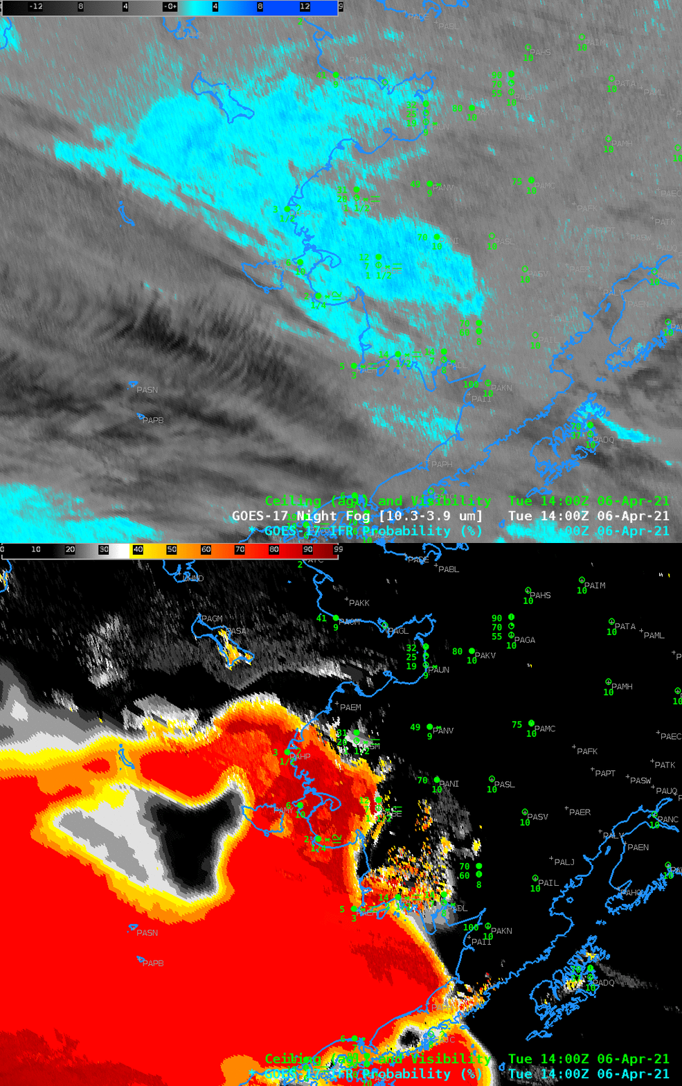
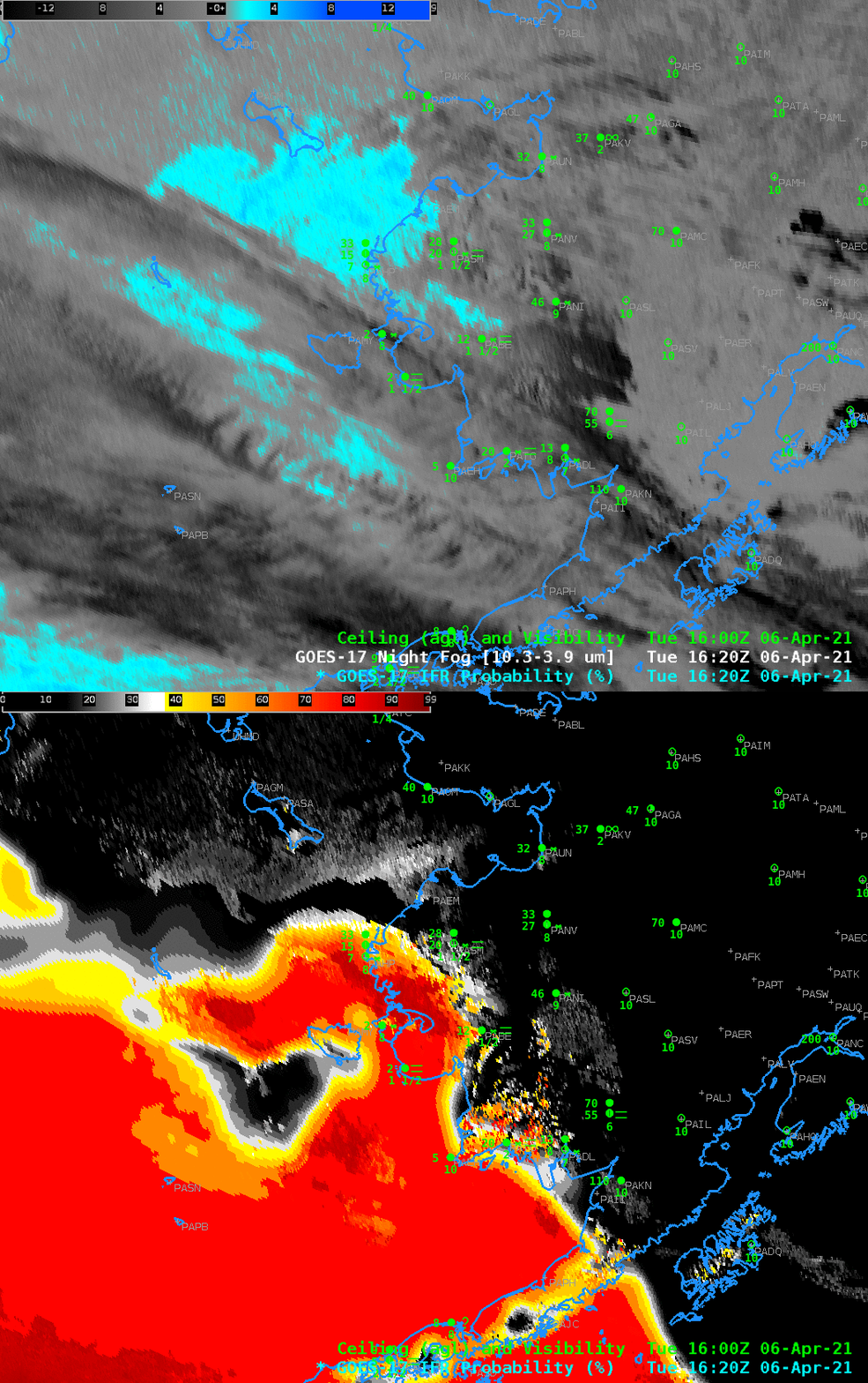
GOES-17 IFR Probability fields, above, show a large region of high probabilities to the south and west of Alaska over the Bering Sea. This region of low clouds is encroaching onto shore and demonstrates how the field could be used to predict the onset of lower ceilings. The Night Fog brightness temperature difference animation, below, spanning the same times, documents how high clouds can make mask the satellite detection of low clouds. The animation also shows how the signal changes when the Sun rises (mot noticeable after about 1600 UTC). The Night Fog Brightness Temperature difference field is a component of the Nighttime Microphysics RGB; if the Night Fog Brightness Temperature difference cannot detect low fog because of high clouds, then the Nighttime Microphysics RGB similarly will not detect low clouds.
The toggles below of Night Fog Brightness Temperature difference and GOES-17 IFR Probability at 1400 UTC (below) and 1620 UTC (bottom) underscore how the IFR Probability field can give useful information in regions underneath high clouds. If you were scheduled to be on a boat in the Bering Sea on this day, for example, would you expect any visibility?
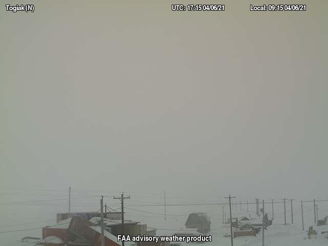
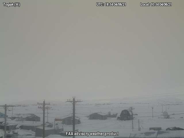
The imagery below, from webcams at Togiak (at 1700 UTC) (source), show the low clouds along the coast.
