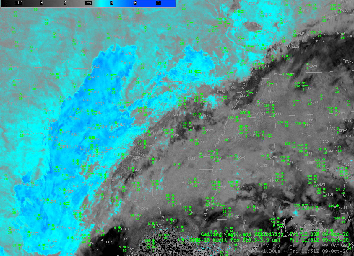
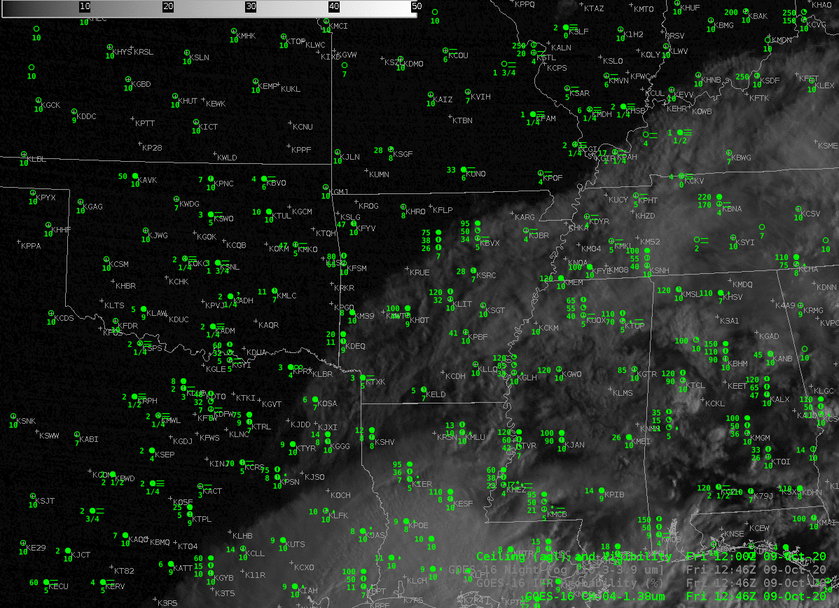
The extensive cirrus shield from Hurricane Delta in the Gulf of Mexico made difficult the satellite-based detection of stratus and low clouds over much of the Deep South on Friday 9 October. The Night Fog Brightness Temperature Difference is also affected by increased solar reflectivity at 1246 UTC in the imagery above. The low clouds over southern Illinois are no longer detected, for example, and the high cirrus of Delta becomes much darker — in both cases because of increased reflectivity of 3.9 µm solar radiation.
The toggle below between the Night Fog Brightness tempreature difference and the Band 4 near-infrared “Cirrus” channel just after sunrise (1246 UTC) shows the extensive cirrus signal in both images. Widespread cirrus is not uncommon, thus the difficulty in detection is not uncommon
GOES-R IFR Probability fields, below, compared to the Night Fog Brightness Temperature fields highlight how IFR Probability, which fields include information about low-level saturation in the Rapid Refresh model, capably fills in regions of fog/low stratus underneath high clouds. It is useful for situational awareness in fog detection when satellite imagery is showing only upper-level clouds. For example, note the large values of IFR Probability in western Kentucky, under the high cirrus, or in northeast Texas! There is good spatial correlation between high IFR Probabilities and reduced ceilings/visibilities. The correlation between the Night Fog Brightness Temperature difference field and reduced ceilings/visibilities is smaller because of low visibility under cirrus (as occurring over northwestern TN and much of LA, for example). Note that IFR Probability fields also give information where IFR conditions are not occurring under cirrus: central Mississippi, for example.
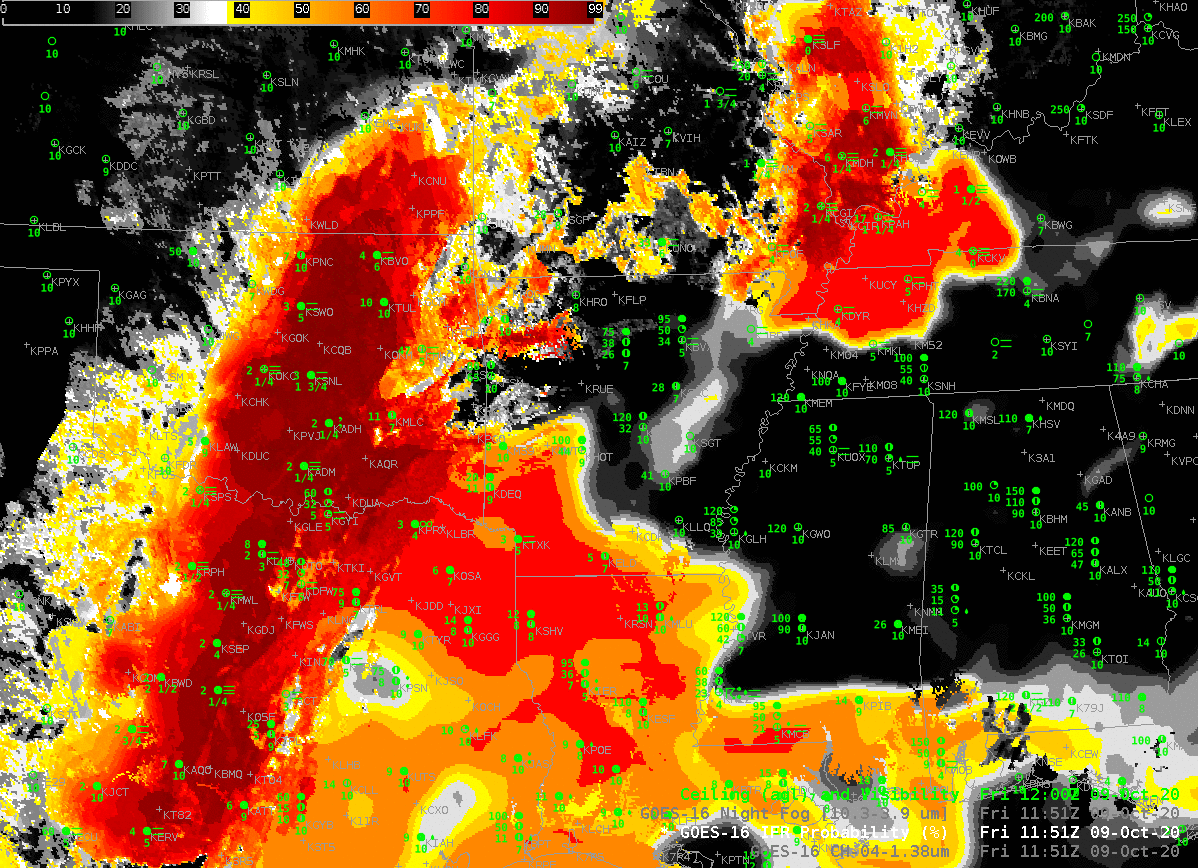
IFR Probability fields through sunrise (below) show a consistent signal, in part because of the Rapid Refresh model information on saturation.

The CIMSS-driven LDM feed that has supplied GOES-16 IFR Probability fields (and before GOES-R’s launch, GOES-13 and GOES-15 IFR Probability fields) to NWS offices will be terminated on or about 20 October. Operational creation of GOES-16 IFR Probability fields has shifted to NOAA/NESDIS, and the fields are now sent over the SBN to forecast offices. TOWR-S Build 19 is required to access and display these fields in AWIPS.