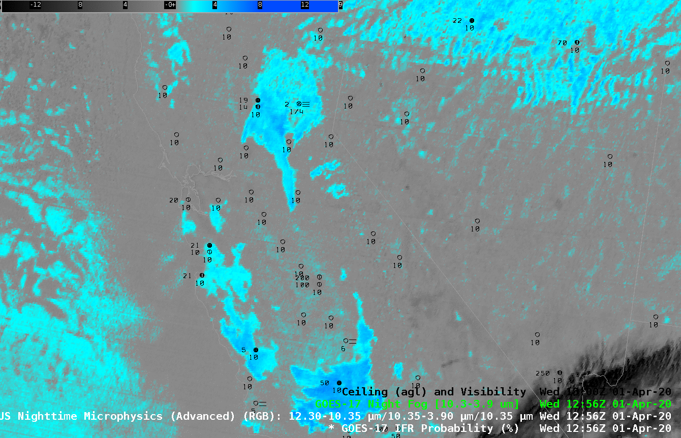
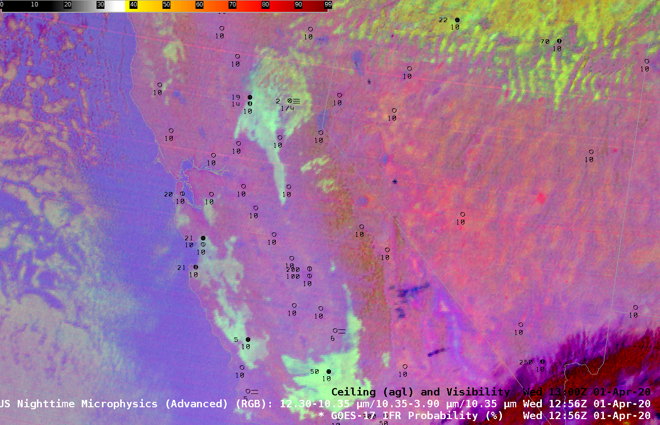
Detecting stratus at night, and thereby inferring the presence of fog, usually involves the Night Fog Brightness Temperature Difference (10.3 µm – 3.9 µm) field that identifies clouds made up of water droplets owing to the droplets’ different emissivity properties at 10.3 µm (droplets emit energy at that wavelength mostly as a blackbody) and at 3.9 µm (droplets do no emit energy at that wavelength as a blackbody). This difference field is a crucial component in the Night Time Microphysics Red-Green-Blue (RGB) Product as evinced in the toggle above. The regions shown to have low clouds (blue and cyan in the Brightness Temperature Difference field, pale yellow in the RGB) are not necessarily those regions with IFR conditions, i.e., where fog and low ceilings are present. The satellite can sense the top of the cloud, but it is a challenge to infer from the satellite data alone where the cloud base sits.
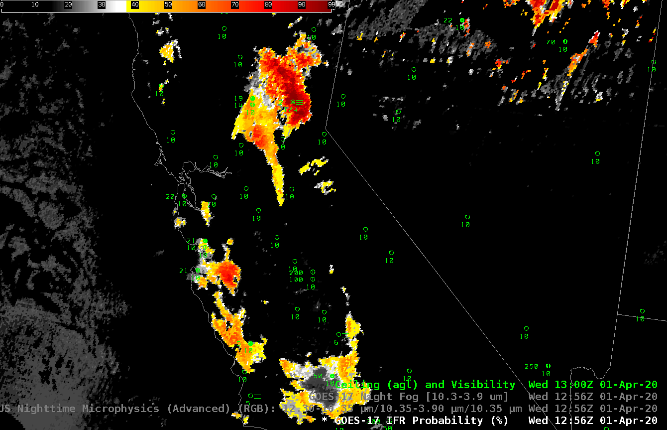
GOES-R IFR Probability fields combine satellite information with model estimates of low-level saturation. An accurate model simulation can allow the product to highlight regions of low ceilings (where fog is more likely) and screen out mid-level stratus. Consider the toggle below, and note how is emphasizes regions where observations show low ceilings and/or reduced visibilities (Blue Canyon airport northwest of Lake Tahoe and Paso Robles airport). Note also how the signal at Bakersfield, at the southern end of California’s Central Valley, is de-emphasized.
GOES-R IFR Probability fields provide a consistent signal for low ceilings and reduced visibility. The fields marry the strengths of satellite detection and model data.