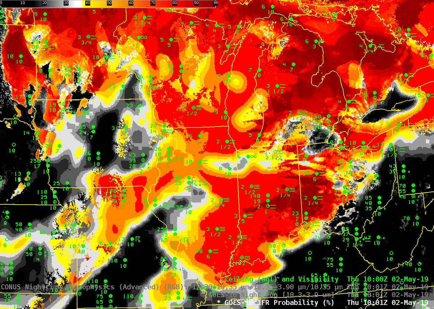
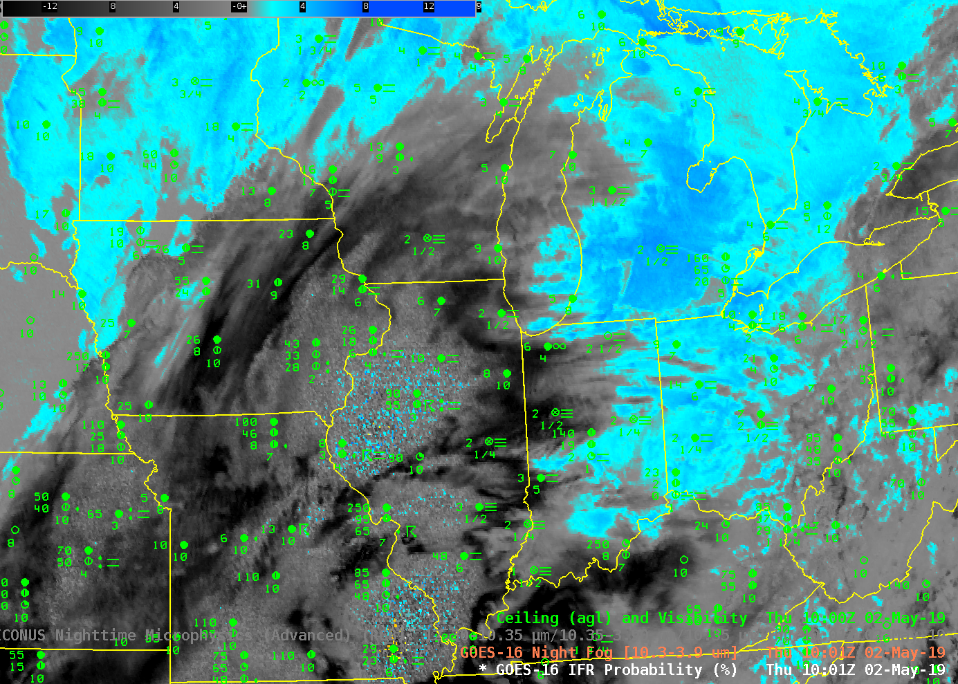
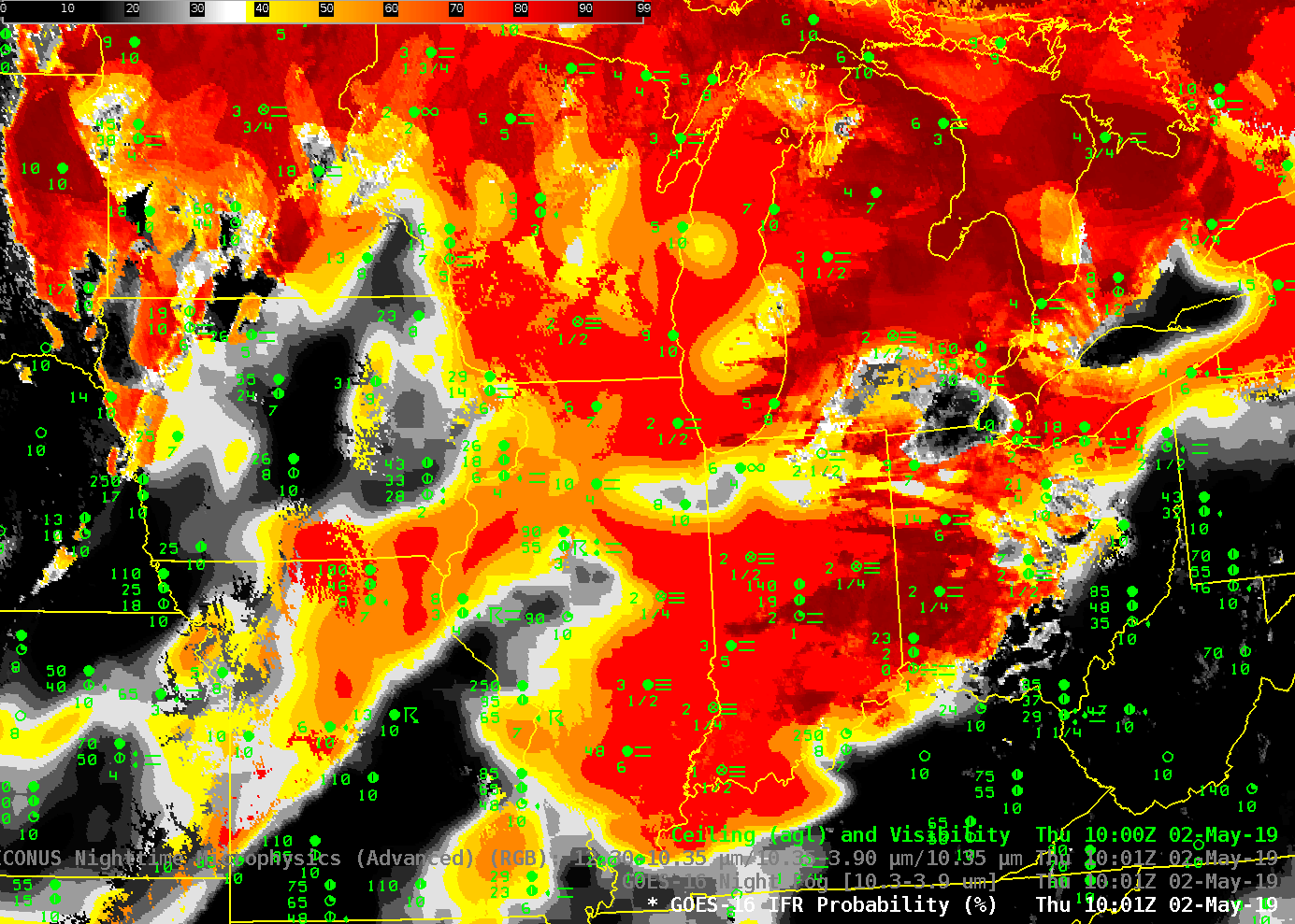
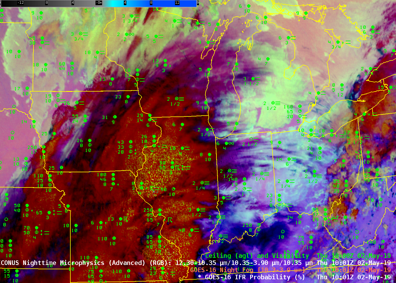
GOES-16 IFR Probability and GOES-16 ‘Night Fog’ Brightness Temperature Difference (10.3 µm – 3.9 µm) at 1001 UTC on 2 May 2019, along with surface observations of ceilings and visibility (Click to enlarge)
Widespread Fog occurred over the midwestern United States on Thursday morning, 2 May 2019, with some Dense Fog Advisories issued. Some of the fog developed under an extensive cirrus canopy associated with strong convection over north-central Illinois, and those cloud layers make satellite-based detection of stratus near the surface (i.e., fog) a challenge. The toggle above between the Night Fog Brightness Temperature Difference (10.3 µm – 3.9 µm) and GOES-16 IFR Probability highlights the difficulty in using the brightness temperature difference alone to outline regions of fog. In contrast, the Rapid Refresh model information on low-level saturation allows IFR Probability to alert a forecaster to the likelihood of fog in regions underneath cirrus, regions such as southeastern Illinois and southwestern Indiana.
There is an excellent spatial correlation between regions with high IFR probability and low ceilings/reduced visibilities, and also with regions with low IFR probability and non-IFR conditions (central Iowa, for example, and central Illinois southwestward into central Missouri).
Because the Night Fog Brightness Temperature difference is a central feature of the Nighttime Microphysics RGB product — Night Fog Brightness Temperature difference is the green part of that RGB, as apparent in the toggle below — Nighttime Microphysics also is challenged to identify fog in regions under cirrus
