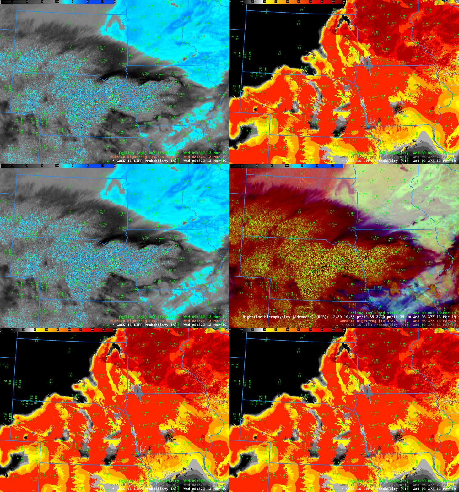
GOES-16 Night Fog Brightness Temperature Difference (10.3 µm – 3.9 µm), Low IFR Probability and Advanced Nighttime Microphysics RGB at 0837 UTC on 13 March 2019 (Click to enlarge)
An intense early Spring storm produced blizzard conditions over the western Great Plains on 13 March 2019 (See this blog post for example). The southerly flow in advance of the storm moved moist air over a dense snowpack over the upper Midwest, resulting in dense Advection Fog. The animation above cycles between the Night Fog Brightness Temperature Difference (10.3 µm – 3.9 µm), the Advanced Nighttime Microphysics RGB that uses the Night Fog Brightness Temperature Difference as the ‘green’ and GOES-16 Low IFR Probabilities.
At 0837 UTC, high clouds had not yet covered all of the upper Midwest, and the satellite still viewed stratus clouds over Wisconsin and Minnesota (bright cyan in the Night Fog Brightness Temperature difference enhancement). Note the difference in the Low IFR Probability field in regions where high clouds are present (Iowa and states to the south and west) and where they are not. Low IFR Probability has a pixelated look over Wisconsin because modest satellite pixel-level variability is included in the IFR probability field. Over Iowa, in contrast, satellite data gives no information about reductions to visibility under the thick cloud cover; low-level data from the Rapid Refresh model drives the Low IFR Probability field there. Probabilities are high in regions where observations suggest IFR/Low IFR conditions are present. This suggest the Rapid Refresh is simulating the evolution of the atmosphere well over the Plains.
The Advanced Nighttime Microphysics RGB can detect low clouds — but only when high clouds are not in the way. For this case, the RGB signal over Wisconsin is consistent with stratus and fog, but over Iowa the signal is consistent with cirrus that is occurring there. Surface restrictions in visibility and lowered ceilings are similar in the two states, and the IFR Probability field has similar values in the two states.
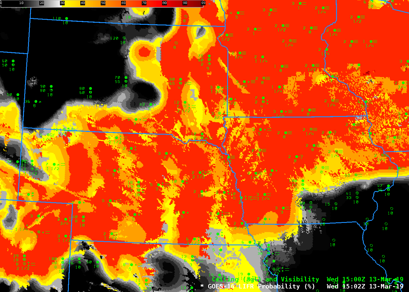
By 1502 UTC on 13 March (below), high clouds had overspread the entire Midwest; Low IFR Probability relies almost entirely on Rapid Refresh Model estimates of low-level saturation. That is why the field over northern Minnesota and northern Wisconsin is flat. Some holes in the high clouds are suggested by the pixelated look of the field in Iowa and southern Wisconsin.

