, GOES-West Brightness Temperature Difference (Upper Right, 10.7 µm - 3.9 µm), GOES-R Cloud Thickness (Lower Left), Suomi/NPP Brightness Temperature Difference (click image to play animation)")
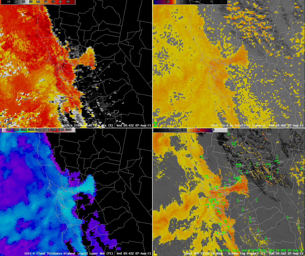
GOES-based GOES-R IFR Probabilities (Upper Left), GOES-West Brightness Temperature Difference (Upper Right, 10.7 µm – 3.9 µm), GOES-R Cloud Thickness (Lower Left), Suomi/NPP Brightness Temperature Difference (click image to play animation)
GOES-based IFR Probabilities track the incursion of a deck of marine stratus into metropolitan Sacramento and its surroundings on the morning of August 7. The cloud movement is also captured in the GOES-West (GOES-15) Brightness Temperature Difference fields. Note, however, how the GOES-R IFR Probability fields correctly suppress the signal in regions surrounding the stratus deck. These are regions where emissivity differences at 10.7 and 3.9 µm are more likely due to soil variability than to the presence of small liquid clouds droplets.
Suomi/NPP overflew the region at approximately 0945 UTC. The brightness temperature difference field for that time is shown here. The sharp edges of the stratus deck are readily apparent.
Although IFR Probabilities are high in this cloud bank, widespread IFR conditions were not reported. Much of the stratus was apparently elevated off the ground.
Some forecast models ably captured the evolution of this cloud field. A brightness temperature difference field from the 0000 UTC 7 August NSSL WRF, shown here (Courtesy of Dan Lindsey, NOAA) shows a cloud field evolving between 0900 and 1900 UTC on 7 August. Combining the forecast model output with real-time IFR Probability observations allows anticipation and monitoring of an evolving stratus deck.