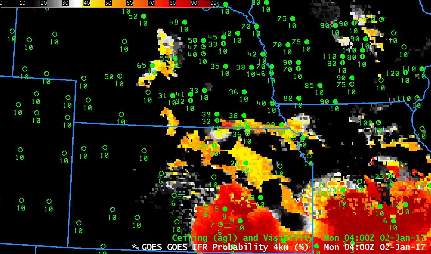
GOES-R IFR Probability fields, 0400-1700 UTC on 2 January 2017 (Click to enlarge)
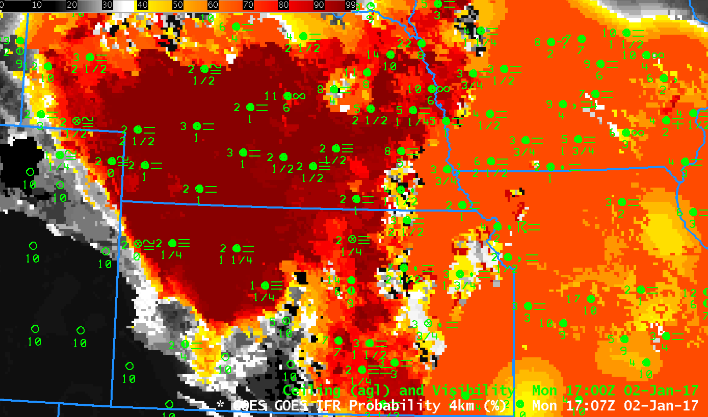
Late in the morning on Monday 2 January 2017, the weather.gov website shows Dense Fog Advisories persisting in parts of Kansas and Nebraska. The animation above shows GOES-R IFR Probabilities from 0400 through 1700 UTC on the 2nd. High IFR Probabilities show excellent correspondence with very low ceilings and reduced visibilities. Note, for example, the sharp demarcation at 1700 UTC between IFR conditions (and large IFR Probabilities) and VFR/MVFR conditions (and very low IFR Probabilities) over northwestern Kansas/east central Colorado.
In the animation above, large parts of central Kansas have IFR Probabilities that are uniform, and around 52% (indicated by the mustard orange color). The IFR Probability field has this character at that time — and later in the animation over much of eastern Kansas and Missouri/Iowa — because of high clouds that are present. When high clouds prevent the satellite from viewing low clouds, model data in the form of Rapid Refresh estimates of low-level saturation are the driving force behind the IFR Probability value. The animation below of Brightness Temperature Difference fields shows the characteristic dark streak that in the enhancement used represents high clouds at night. High clouds then spread over Missouri and Iowa during the day.
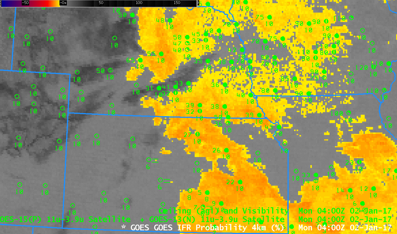
GOES-13 Brightness Temperature Difference fields (3.9 µm – 10.7 µm), 0400-1700 UTC on 2 January 2017 (Click to enlarge)
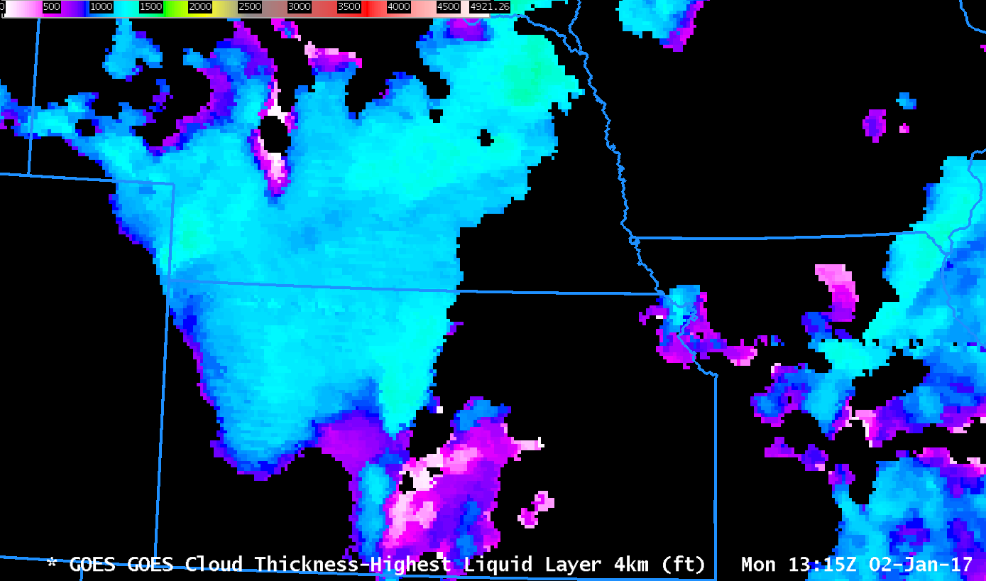
GOES-R Cloud Thickness can be used in cases of radiation fog to estimate dissipation time, using the value just before sunrise, here, and this scatterplot. Low clouds on 2 January however were synoptically forced so it would be inappropriate to expect the GOES-R Cloud Thickness field to estimate dissipation times correctly.