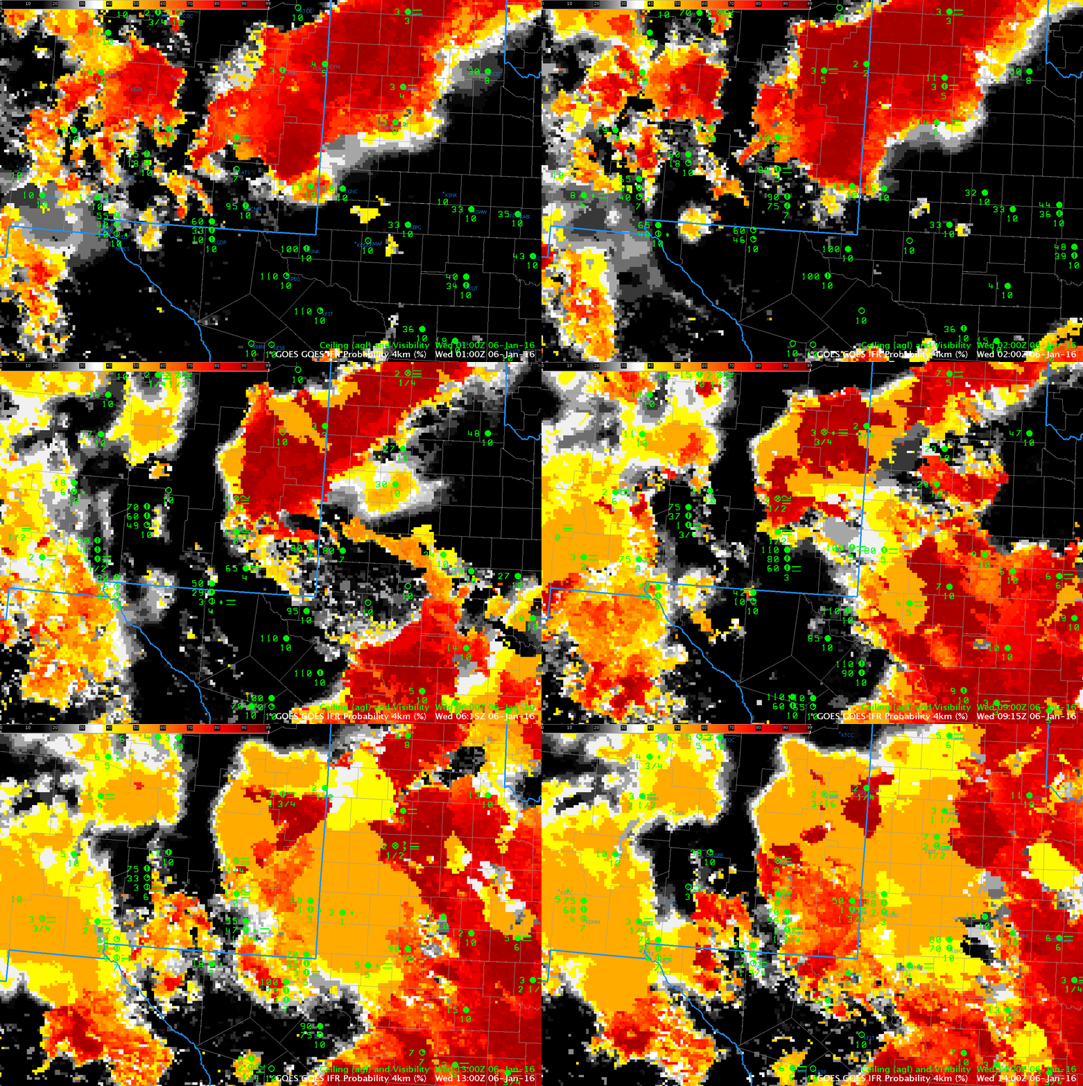
GOES-13 IFR Probability fields, 0100-1400 UTC, 6 January 2015, and surface observations of ceilings and visibility (Click to enlarge)
National Weather Service offices in El Paso and in Lubbock issued dense fog advisories for portions of their respective CWAs early on 6 January 2016. Moisture from a storm entering from the Pacific Ocean (as suggested by this graphic showing the GFS 00-h analysis from 1200 UTC showing the 300-mb jet) means multiple cloud layers. Higher clouds make satellite-only detection of low clouds difficult, and the animation above shows regions (north of Roswell — KROW — at the end of the animation, for example) where the flat GOES-R IFR Probability field suggests only Rapid Refresh data are diagnosing the probability of IFR conditions.
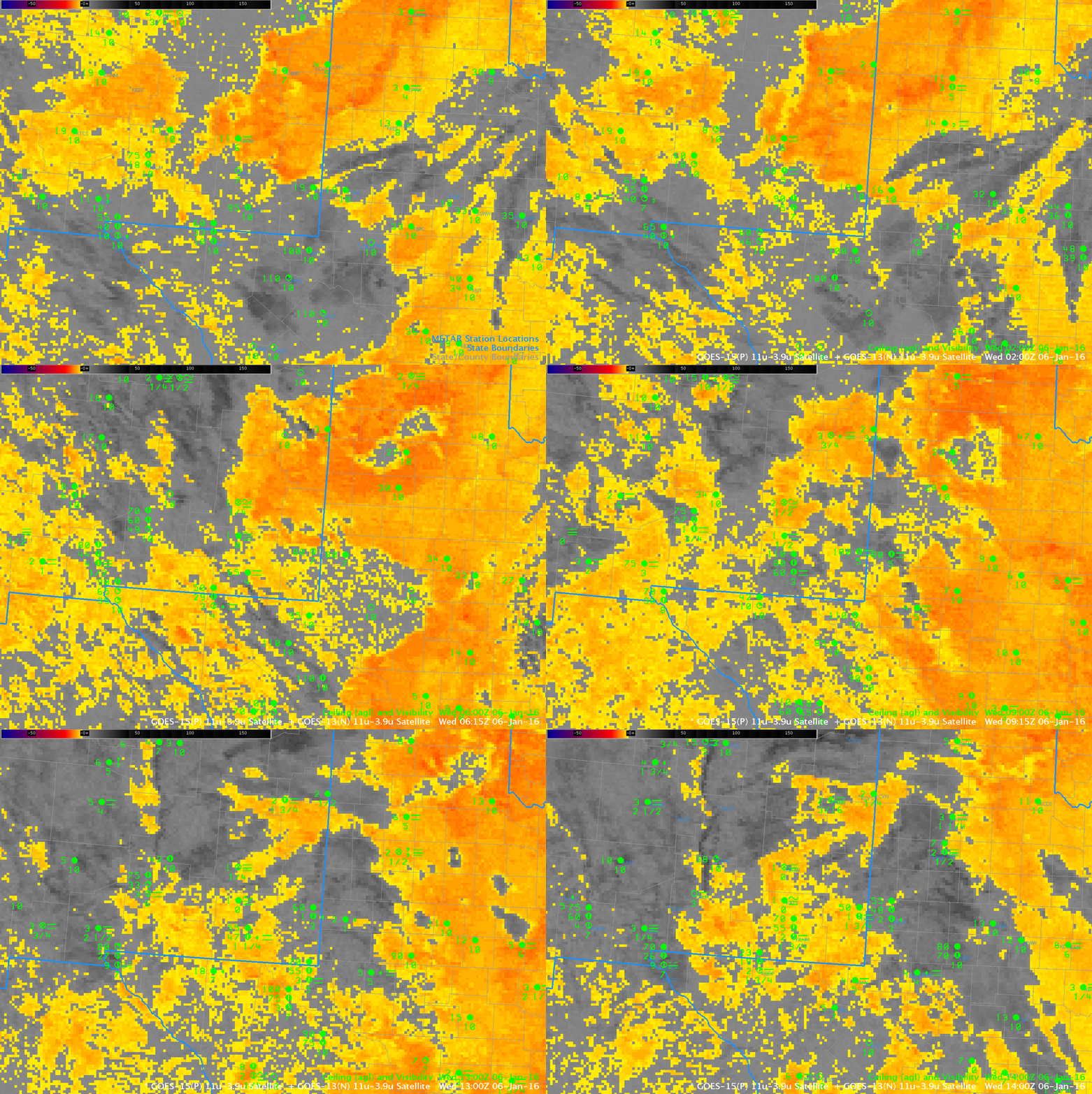
The Brightness Temperature Difference fields, below, for the same times as the IFR Probability fields at top, miss regions of reduced visibility under multiple cloud layers, and also have strong returns in regions of mid-level stratus. Because GOES-R IFR Probability incorporates information about saturation in the lowest 1000 feet of the atmosphere (in the form of Rapid Refresh Model Output), regions that are saturated in low levels that cannot be diagnosed as foggy by satellite alone because of mid-level/high-level clouds can be flagged as likely having IFR conditions, and regions that are flagged by the satellite as having stratus (stratus and fog can look very similar to a satellite) can be screened out if low-level saturation is not diagnosed in the model. Both of these actions serve to increase the GOES-R IFR Probability’s ability to diagnose correctly areas of low clouds/fog relative to brightness temperature difference fields alone.
One other advantage to GOES-R IFR probability fields: They are not strongly affected by changing amounts of 3.9 µm radiation around sunrise/sunset. In the animation below, note how at 1400 UTC (just past sunrise) the brightness temperature difference signal is collapsing. This is because increasing amounts of reflected solar 3.9 µm radiation are changing the difference between observed 10.7 µm and 3.9 µm radiation above water-based clouds. Little change occurs in the IFR Probability fields at this time however.

