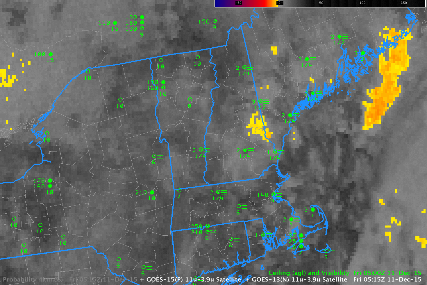
GOES-13 Brightness Temperature Difference Fields (10.7 µm – 3.9 µm), hourly from 0515 through 1315 UTC 11 December 2015 (Click to enlarge)
The brightness temperature difference field (10.7 µm – 3.9 µm), above, over New England during the morning of 11 December 2015 shows extensive cirrus cloud cover (a hole in the high clouds moves over Southern New England just before sunrise). Surface observations of ceilings and visibility show widespread IFR conditions, yet cirrus and mid-level clouds prevent a diagnosis of the low clouds.
GOES-R IFR Probability fields for the same times, below, do show a strong signal (that is, higher probability of IFR conditions) in regions where IFR conditions are observed or where they have recently developed. Because GOES-R IFR Probability fields incorporate information from the Rapid Refresh about low-level saturation. Even if clouds decks obscure the view of near-surface clouds, as in this case, GOES-R IFR Probability fields, because they fuse together satellite data and surface information from the Rapid Refresh model, can provide useful information.
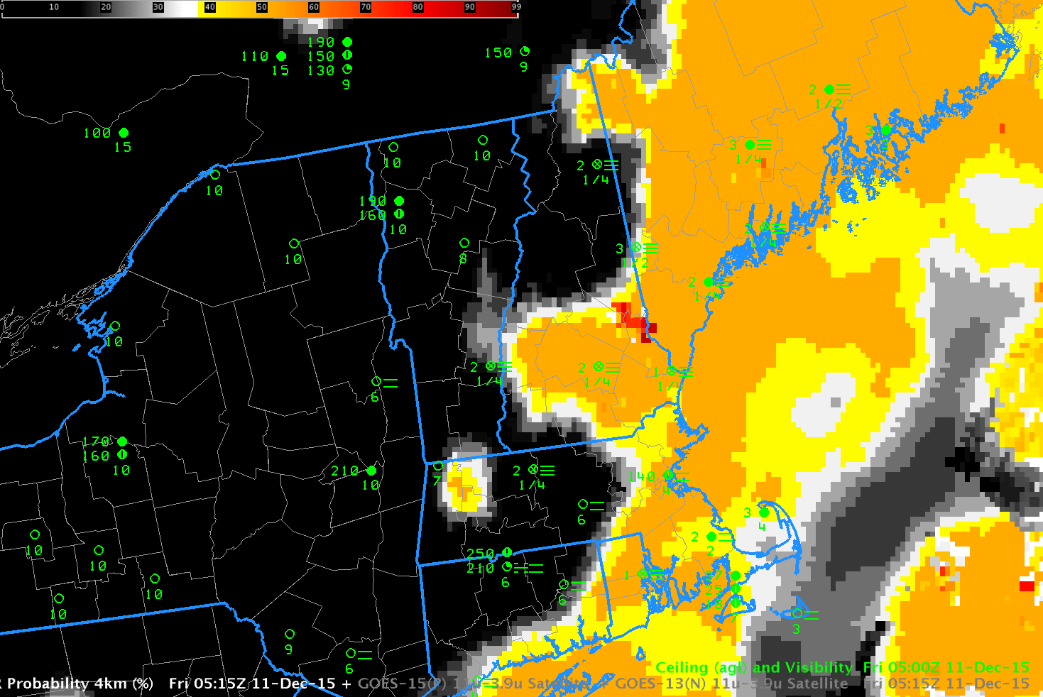
GOES-R IFR Probability Fields, hourly from 0515 through 1315 UTC 11 December 2015 (Click to enlarge)