 |
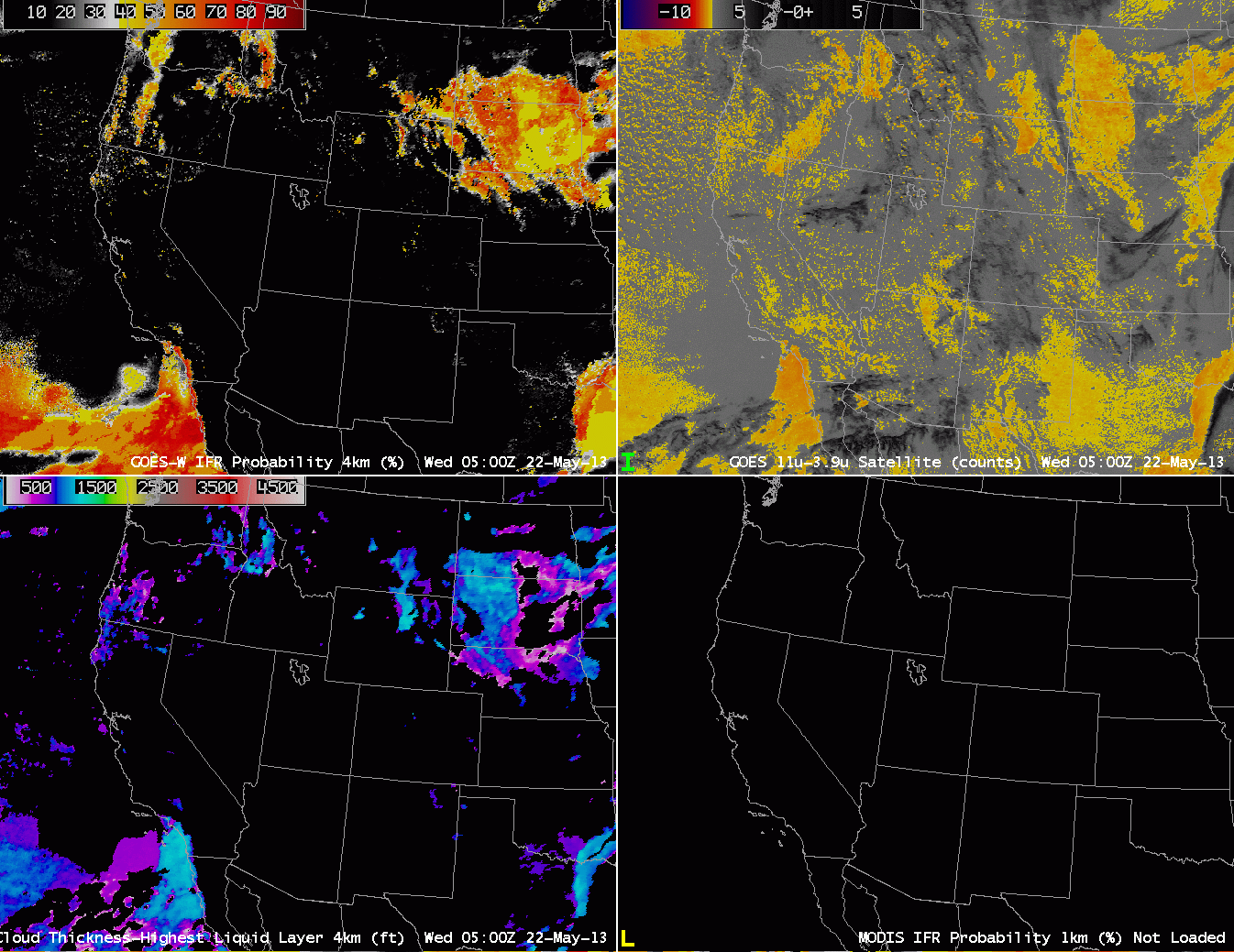
| Half-hourly imagery of GOES-R IFR Probability (Upper Left) computed from GOES-West, GOES West Brightness Temperature Differences (10.7 – 3.9) (Upper Right), GOES-R Cloud Thickness (Lower Left), GOES-R IFR Probability from MODIS (Bottom right) |
GOES-13 has experienced an anomaly, and is in safe mode. While this occurs, GOES-15 will operates in full-disk mode. GOES-R IFR Probability coverage is therefore limited east of the Missouri River Valley. When GOES-14 starts transmitting imagery, starting at around 0500 UTC 23 May, GOES-East projections of GOES-R products will resume. In the meantime, coverage along the East Coast is provided — at high resolution — by the MODIS-based GOES-R products, shown below. Temporal resolution is degraded in this polar-orbiter-based product, however.
The image loop above spans several MODIS IFR Probability products, but the MODIS products are not close enough to the half-hourly time steps to be included in the imagery. The GOES-West-based IFR probability products identify the four main regions of reduced visibilities overnight: the Pacific Northwest, southern California, the northern Plains, and east Texas. Other regions that show a strong return in the brightness temperature difference product have either elevated stratus (Texas Panhandle) or soil with variable emissivity properties (the intermoutain West).
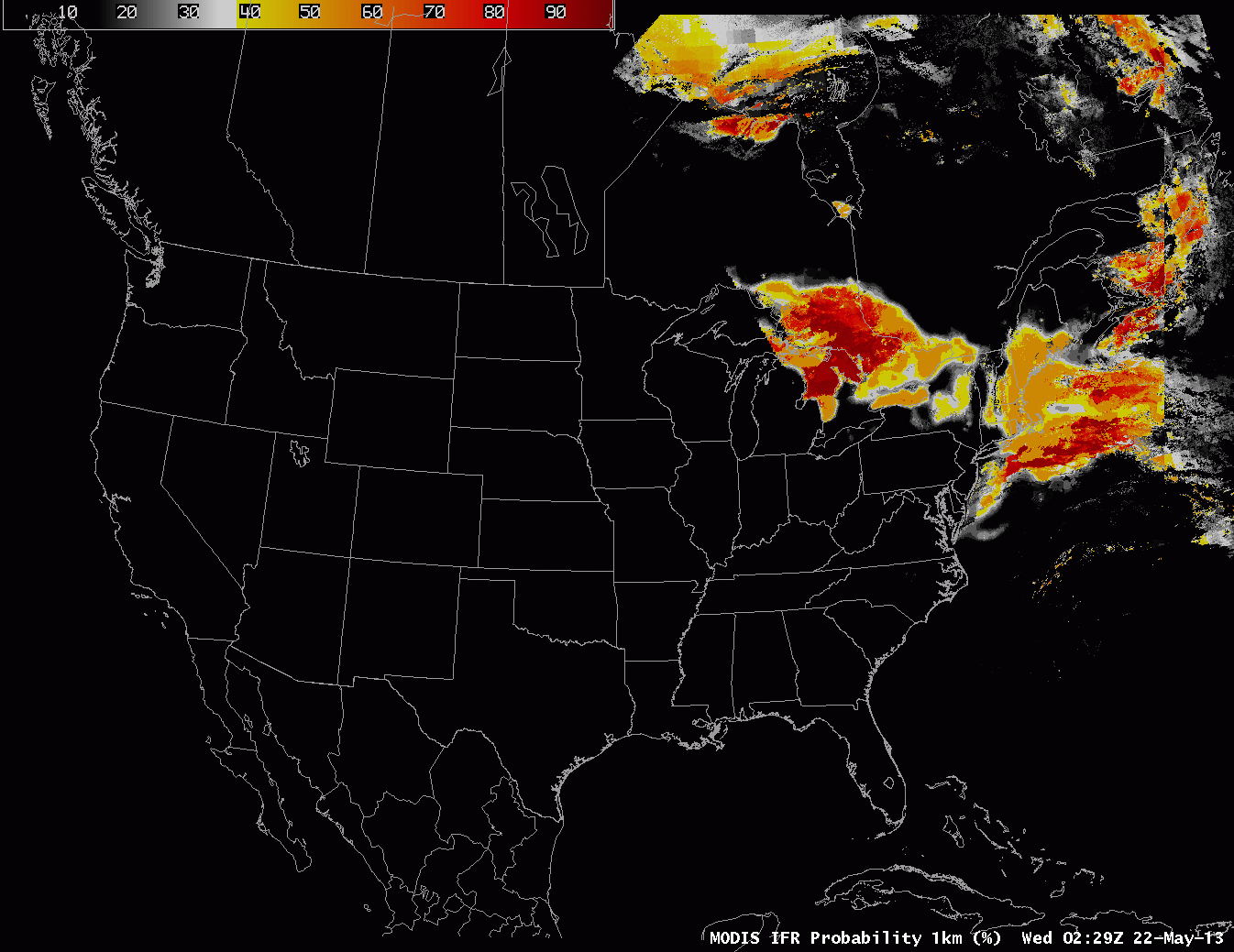 |
| GOES-R IFR probabilities computed from MODIS data, 0230 UTC – 1000 UTC, 22 May 2013 |