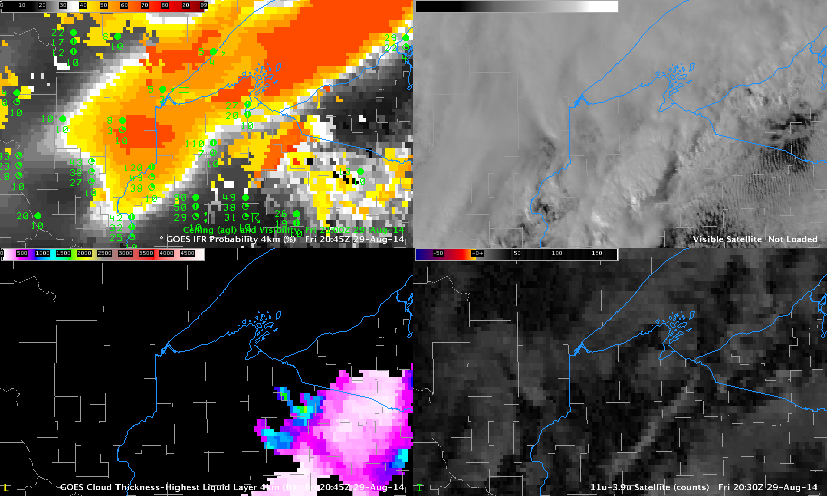
GOES-R IFR Probabilities with surface observations of ceilings and visibilities (Upper Left), GOES-East Visible Image (Upper Right), GOES-East Brightness Temperature Difference (10.7 µm – 3.9 µm) (Lower Right), GOES-R Cloud Thickness (Lower Left), all near 2100 UTC (Click to enlarge)
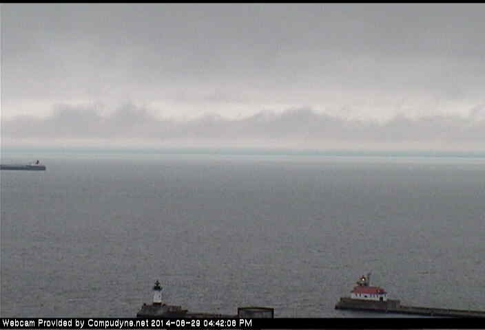
IFR and near-IFR conditions existed near Duluth Minnesota during the day on 29 August 2014; How does information from the satellite help to diagnose the IFR conditions? Both the visible and brightness temperature difference fields, above, show widespread cloudiness, with convective features over Wisconsin and multiple cloud decks over Wisconsin and Minnesota. These multiple cloud decks show no apparent relationship the observed IFR or near-IFR conditions. In cases such as these, the low-level information available through the Rapid Refresh Model is key to providing information defining exactly where the lowest ceilings and visibilities exist. In the case above, that region is centered near Duluth, extending to the southwest. IFR Probabilities are elevated in regions where visibilities and ceilings are low, and they increase as the cloud ceiling increases. The image below shows Duluth Harbor at about 2140 UTC; the low ceiling is apparent (Source).