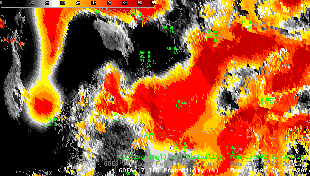
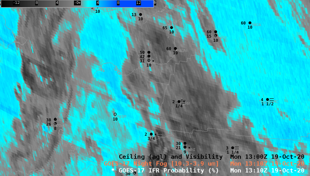
CIMSS is now creating GOES_17 IFR Probability fields for Alaska and will presently be distributing them to the Alaska Region. An example of the utility of the products occurred on 19 October over western Alaska. The toggle above between the Night Fog brightness temperature difference field and the IFR Probability field at 1310 UTC 19 October shows several regions where IFR Probability refines where ceilings and visibilities might restrict aviation — an important piece of information in Alaska.
The default Night Fog Brightness Temperature enhancement is constructed so that stratiform clouds containing water droplets are colored different shades of blue. Higher clouds are various shades of grey.
Consider station PANV — Anvik, AK, near 62.7 N, 160 W. This is a station reporting IFR conditions, and IFR probabilities are near 80%. However, it is also under high clouds; GOES-17 is prevented from viewing low clouds, but the Rapid Refresh model data used in IFR Probability is showing saturation. Model data fills in regions of IFR conditions where high (of mid-level) clouds prevent the satellite from viewing near-surface clouds. Note how IFR Probability is also able to distinguish — correctly — between the IFR conditions at Anvik with the more benign sky conditions to the north at St. Michaels (PAMK), Unalakleet (PAUN) and Shaktoolik (PFSH) along Norton Sound.
In contrast, station PASM — St. Mary’s AK, near 62 N, 163 W — is beneath a strong signal in the Night Fog brightness temperature difference field. However, IFR conditions are not reported, and IFR probabilities are near 40% (and decreasing abruptly to the south). In this region, IFR Probability fields are screening out a region of mid-level stratus.
Station PAMC — McGrath, AK, near 63 N, 155 W — shows near-IFR conditions with a local minimum IFR Probability near 40% and a strong signal of stratus clouds in the Night Fog Brightness Temperature difference. For this station it would be prudent to see how IFR Probabilities were changing with time.
IFR Probability combines the strengths of satellite detection of low clouds with the strength of Rapid Refresh model predictions of low-level saturation to create a product useful in regimes with single or multiple cloud layers.