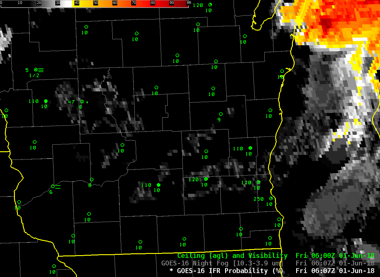
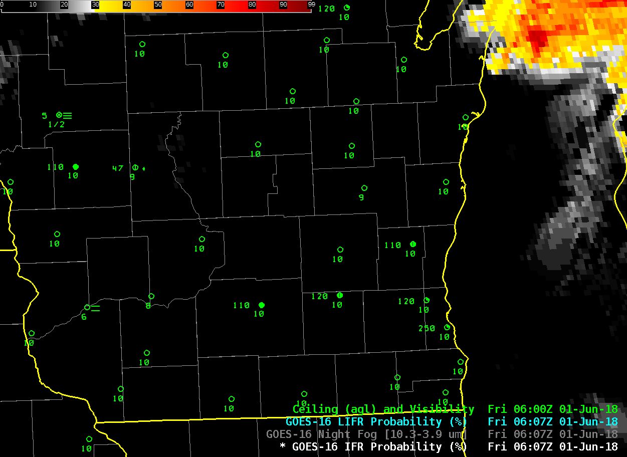
GOES-16 IFR Probability Fields, 0607-1422 UTC on 1 June 2018 (Click to enlarge)
The animation above shows increasing amounts of IFR Probability moving southward and westward over eastern Wisconsin as a cold front with Lake-influenced air pushed inward. Ceilings lowered and visibilities reduced as the front passed, and the IFR probability field’s motion could be used to predict when the temperature change occurred. High clouds did not impede the satellite view of this event, so the brightness temperature difference field, below, also showed the stratus deck as it moved inland. Missing from the satellite-only view of this event, of course, is the information on whether the cloud is extending to the surface. Furthermore, the cloud signal vanishes from the brightness temperature difference product at sunrise, as it flips sign from positive at night to negative during the day as amounts of reflected solar 3.9 µm radiation increase.
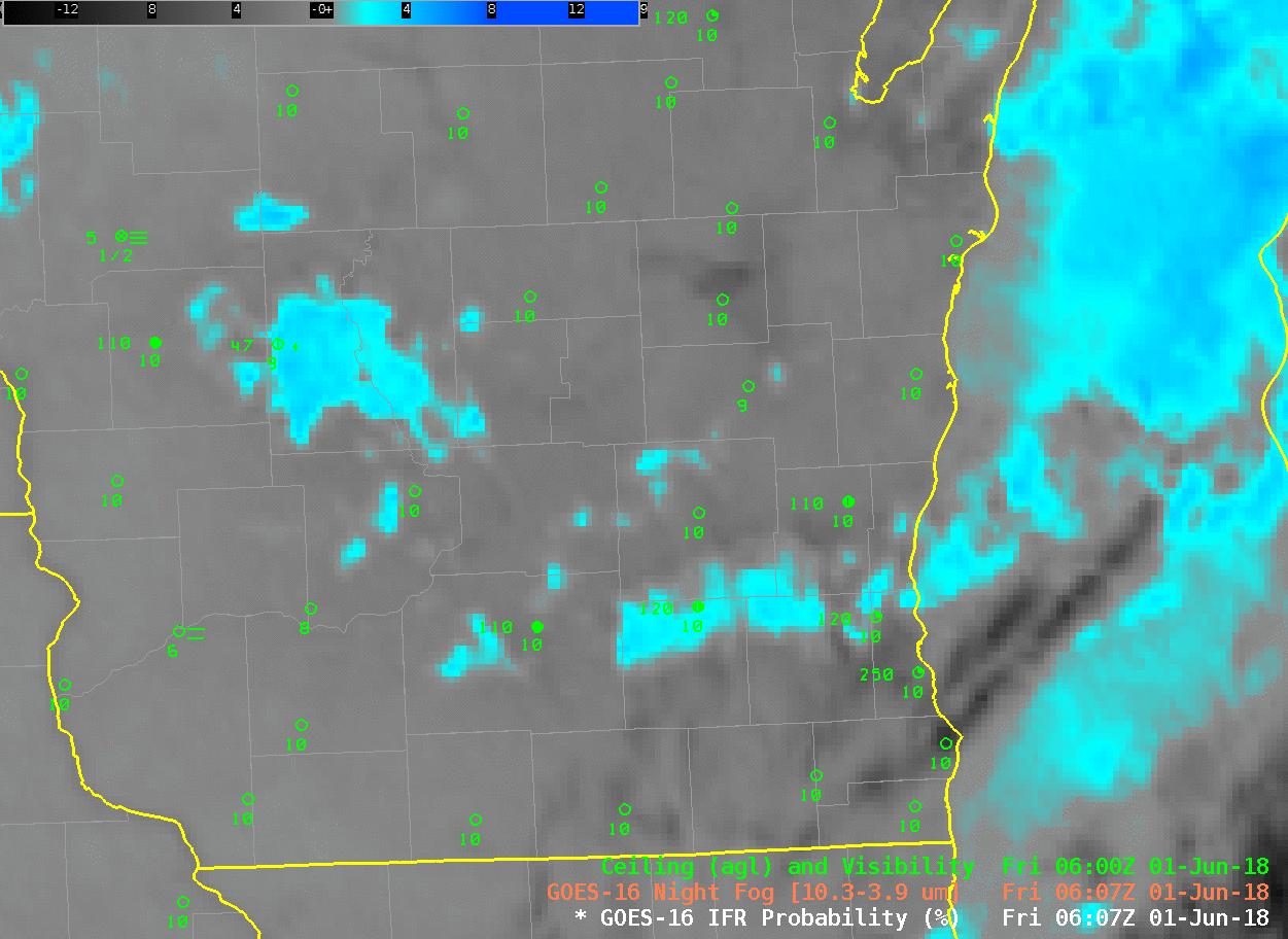
GOES-16 Night Fog Brightness Temperature Difference (10.3 µm – 3.9 µm), 0607-1422 UTC on 1 June 2018 (Click to enlarge)
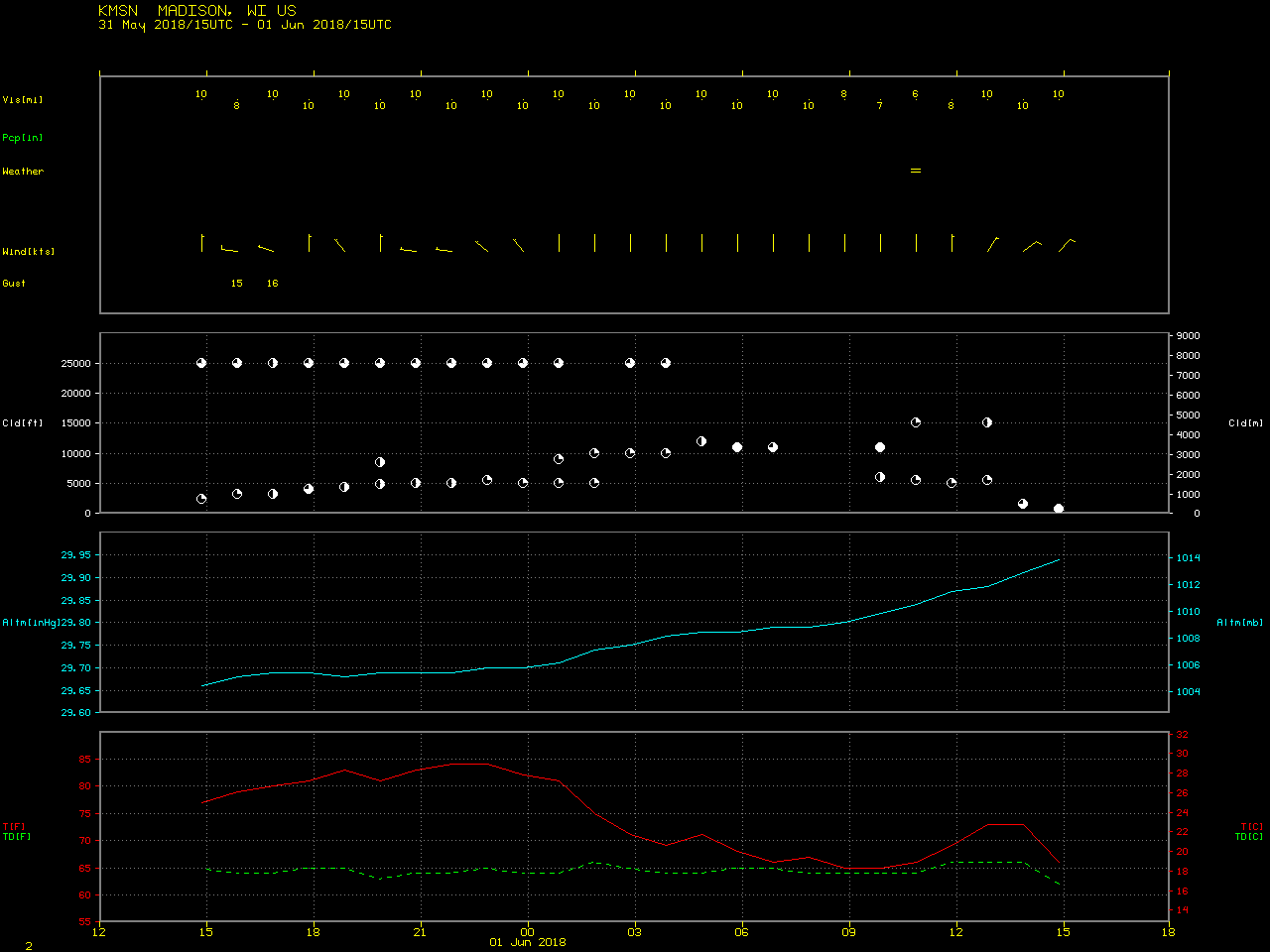
A Meteorogram for Milwaukee for the 24 hours ending at 1500 UTC on 1 June shows the dramatic change in ceilings, temperature and wind between 10 and 11 UTC on 1 June. A similar meteorogram for Madison (here), shows a less dramatic change at 1400 UTC on 1 June.
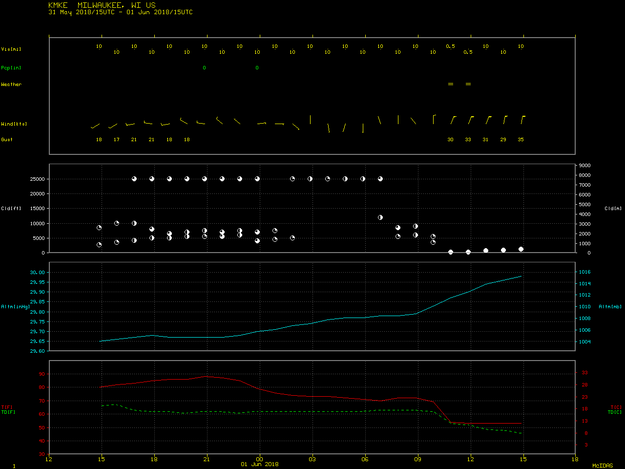
Meteorogram for KMKE (Mitchell International Airport, Milwaukee, WI) from 1500 UTC 31 May through 1500 UTC 1 June. Note the abrupt change in surface conditions at 1100 UTC on 1 June as the front moved through (Click to enlarge)
An animation of Low IFR Probabilities is shown below.
GOES-16 Low IFR Probability Fields, 0607-1422 UTC on 1 June 2018 (Click to enlarge)