Monthly Archives: March 2018

Advection Fog with a Spring Storm in the Ohio River Valley

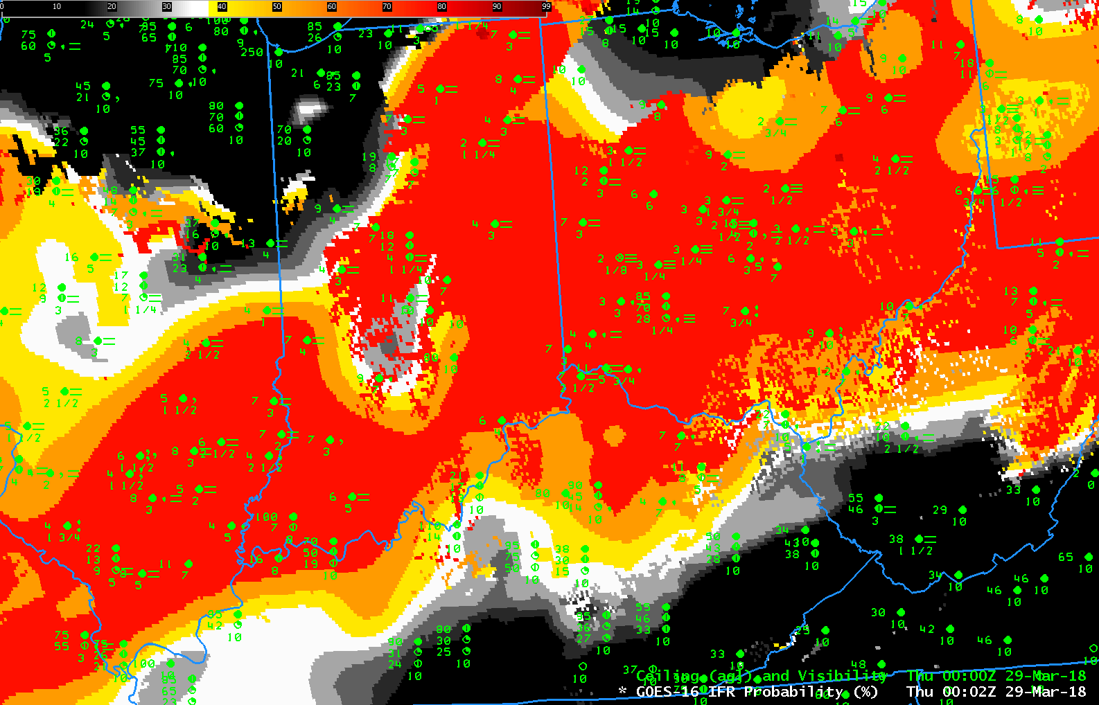
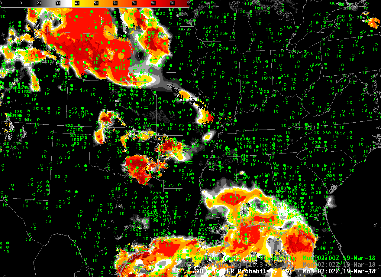
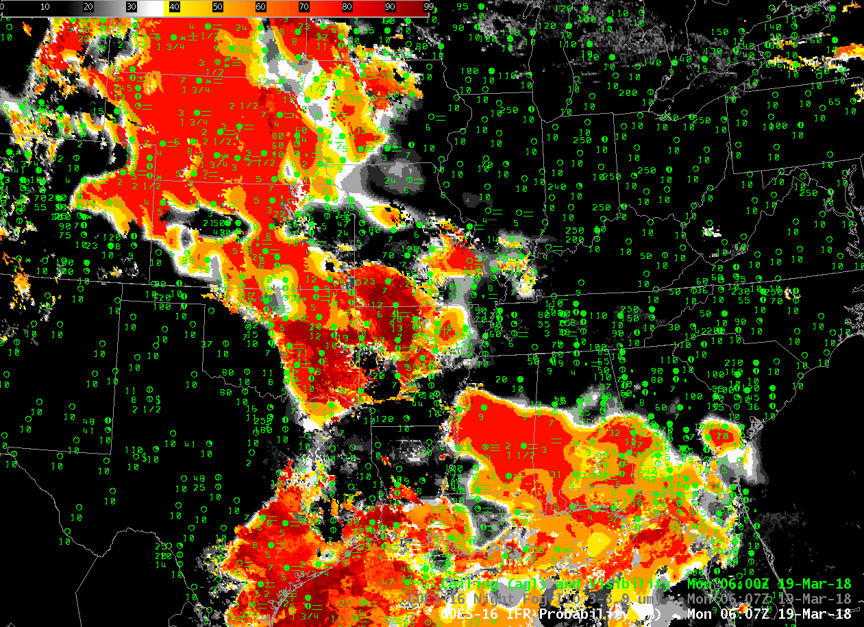
GOES-16 IFR Probability fields, 0002 UTC through 1152 UTC on 29 March 2018, every 20 minutes (Click to enlarge)

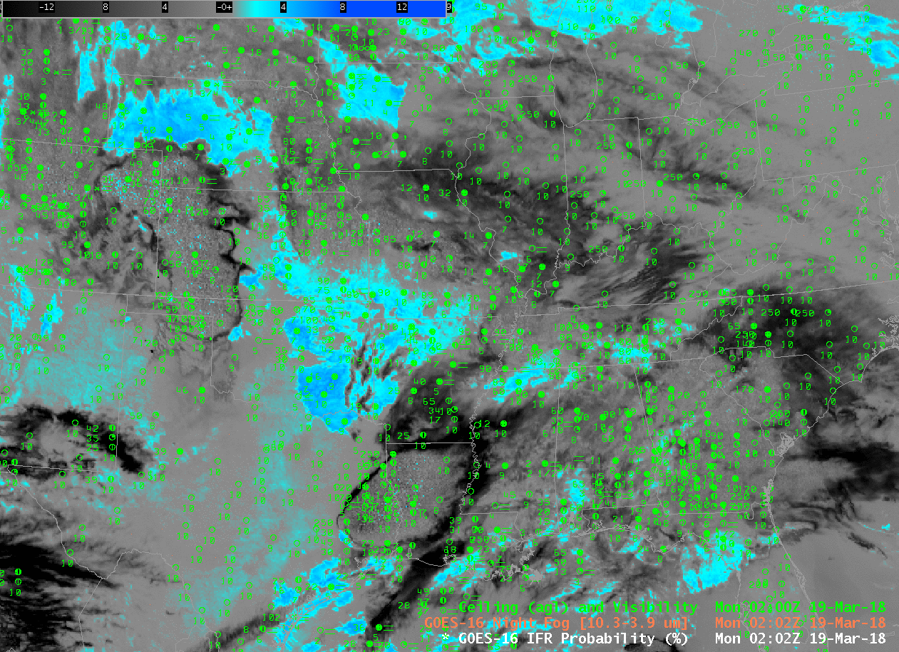
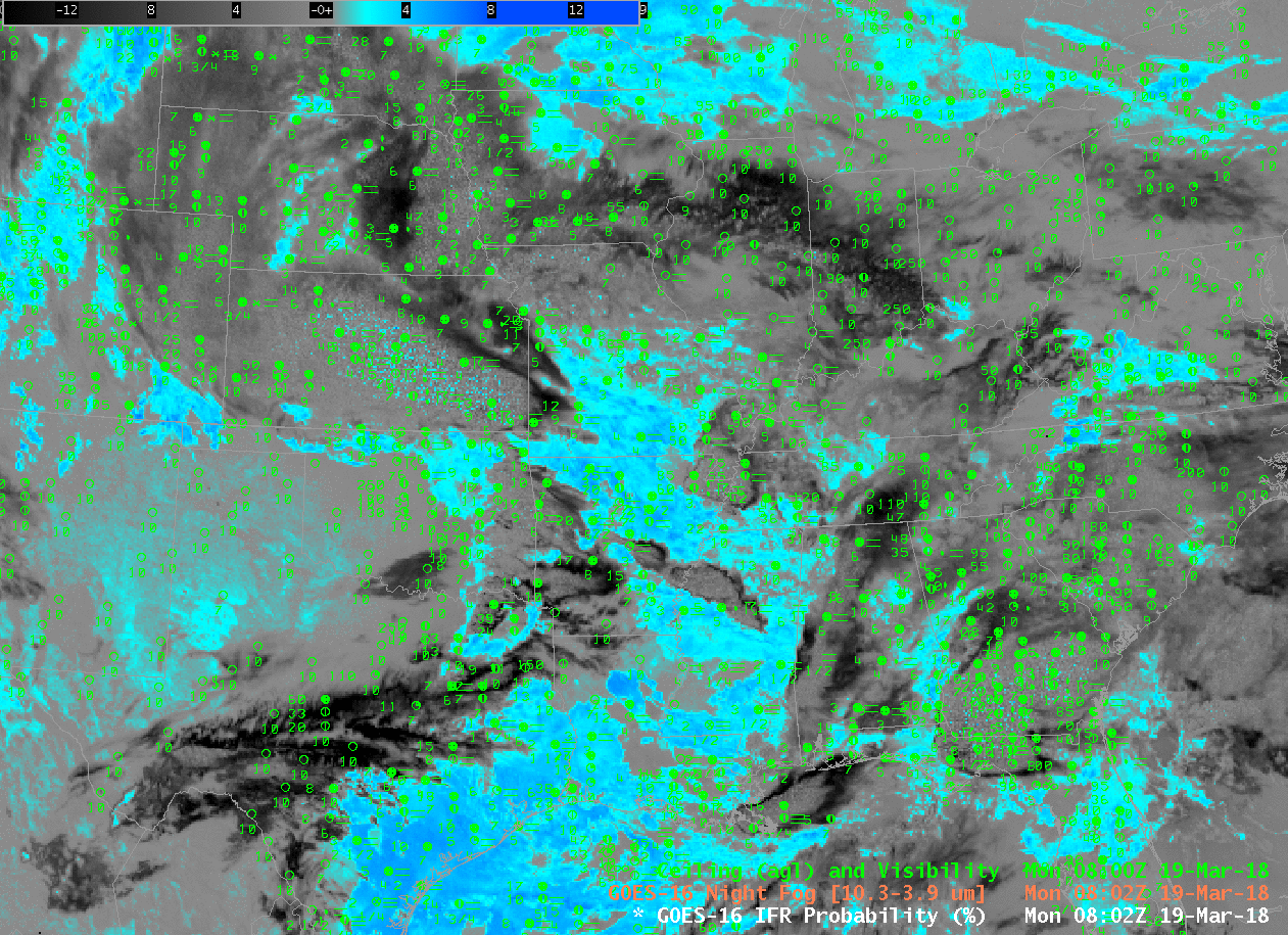
Advection fog in the Spring, when high dewpoints overrun very cold ground surfaces, usually in association with an extratropical cyclone, are very difficult to detect using satellite-only products, as shown in the Brightness Temperature Difference field animation below (Click here for the same animation but with a 5-minute time step as observed in the CONUS domain by GOES-16). GOES-16 IFR Probability, above (Click here for an animation with a 5-minute cadence), is able to highlight the region of low ceilings and visibilities because Rapid Refresh Data supplies information about near-surface saturation that is lacking in satellite-only products such as the Brightness Temperature Difference, below, or, say, the Nighttime Microphysics RGB that uses the Brightness Temperature Difference. A toggle including IFR Probability, Night Fog Brightness Temperature Difference, and Nighttime Microphysics is below (from 0902 UTC on 29 March). Only the IFR Probability has an obvious signal difference between regions with IFR Conditions and regions without.

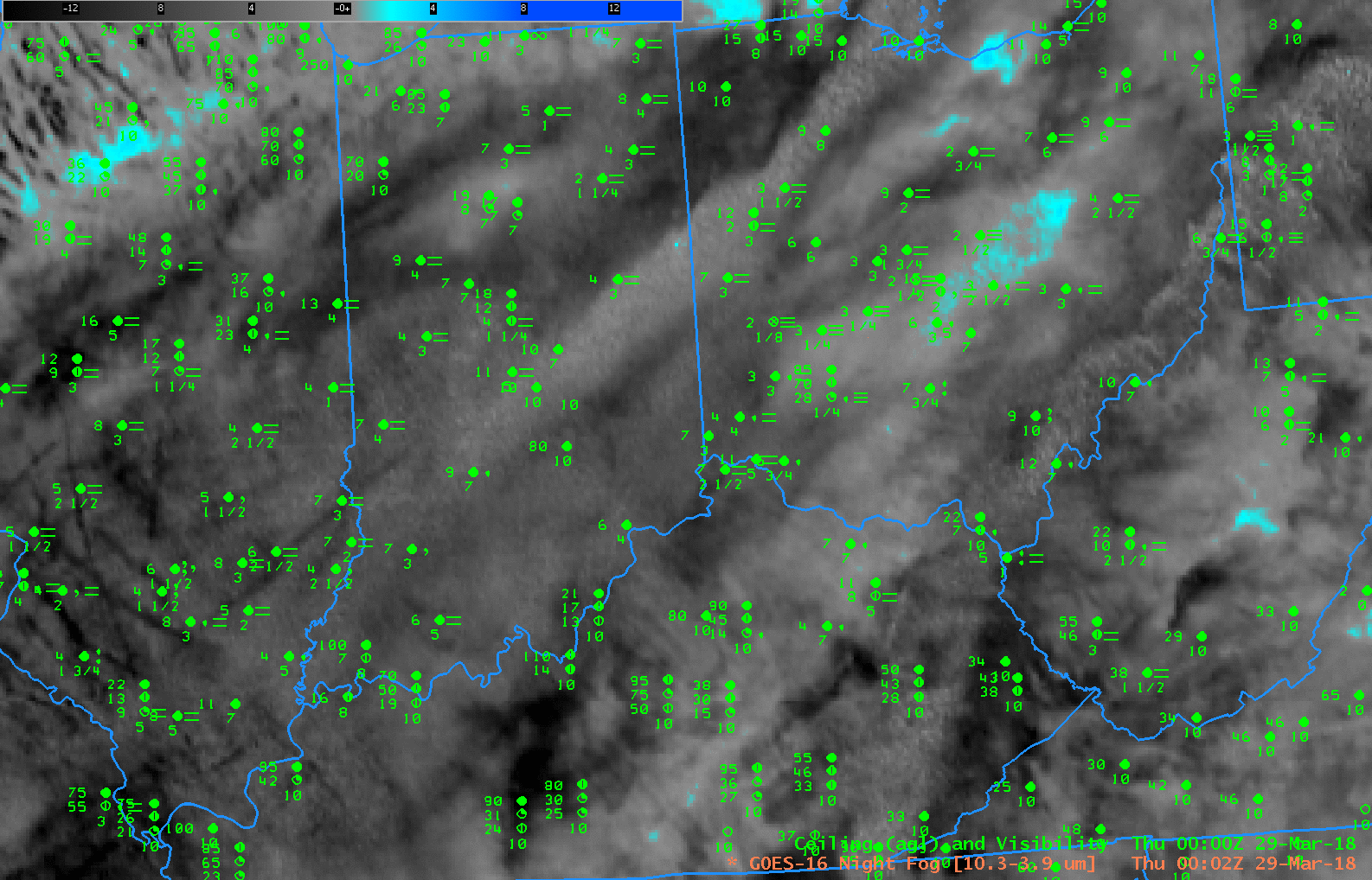
GOES-16 Night Fog Brightness Temperature Difference (10.3 µm – 3.9 µm), 0002 – 1152 UTC at 20-minute timesteps (Click to enlarge)

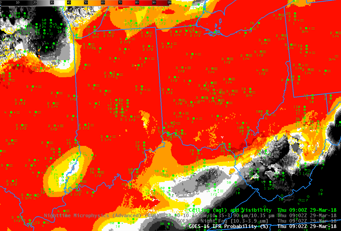
GOES-16 IFR Probability, Night Fog Brightness Temperature Difference (10.3 µm – 3.9 µm), and Nighttime Microphysics at 0902 on 29 MArch 2018 (Click to enlarge)

IFR Conditions with a Spring storm over the central United States

GOES-16 IFR Probability fields, every 10 minutes, from 0202 through 1412 UTC on 19 March 2018 (Click to animate)

Dense Fog Advisories (click here for graphical image from this site) and widespread IFR Conditions (click here for graphical image from this site) occurred as a nearly-occluded system spun slowly eastward across the central part of the United States on 19 March 2018. (Surface; 500-hPa). GOES-16 IFR Probability, shown above, (Click the image to see the animation) outlines two large areas where consistent IFR conditions develop/persist: the upper Plains, in states around Nebraska, and the Deep South.

The GOES-16 Night Fog Brightness Temperature Difference field (10.3 µm – 3.9 µm), animation shown below, historically has been used to identify low stratus that is assumed to be fog at night. That detection suffers when high clouds are present (consistently on the morning of 19 March over Nebraska and surrounding states; occasionally over the Deep South as convection expels high-level cirrus into the atmosphere). Because IFR Probability fuses satellite data with Numerical Model estimates of low-level saturation (from the Rapid Refresh Model), it retains a strong signal of fog in regions where multiple clouds layers prevent the satellite from observing observed low stratus causing IFR conditions, such as over Nebraska, or over Mississippi at 0607 UTC.

GOES-16 Night Fog Brightness Temperature Difference (10.3 µm – 3.9 µm), 0202-1412 UTC on 19 March 2018 (Click to animate)

Note that there exists a Brightness Temperature Difference signal over the High Plains of Texas and New Mexico at, for example, 0800-0900 UTC. (See below). Persistent drought exists in that region (linked image from this site) and the dryness can alter the relative emissivities of the soils so that a signal develops (Click here for an earlier example).  There are no clouds in this region;  the Rapid Refresh model shows very dry air and the IFR Probability algorithm correctly diagnoses very small probabilities of IFR conditions.

GOES-16 Night Fog Brightness Temperature Difference (10.3 µm – 3.9 µm), 0802-0902 on 19 March 2018 (Click to enlarge)