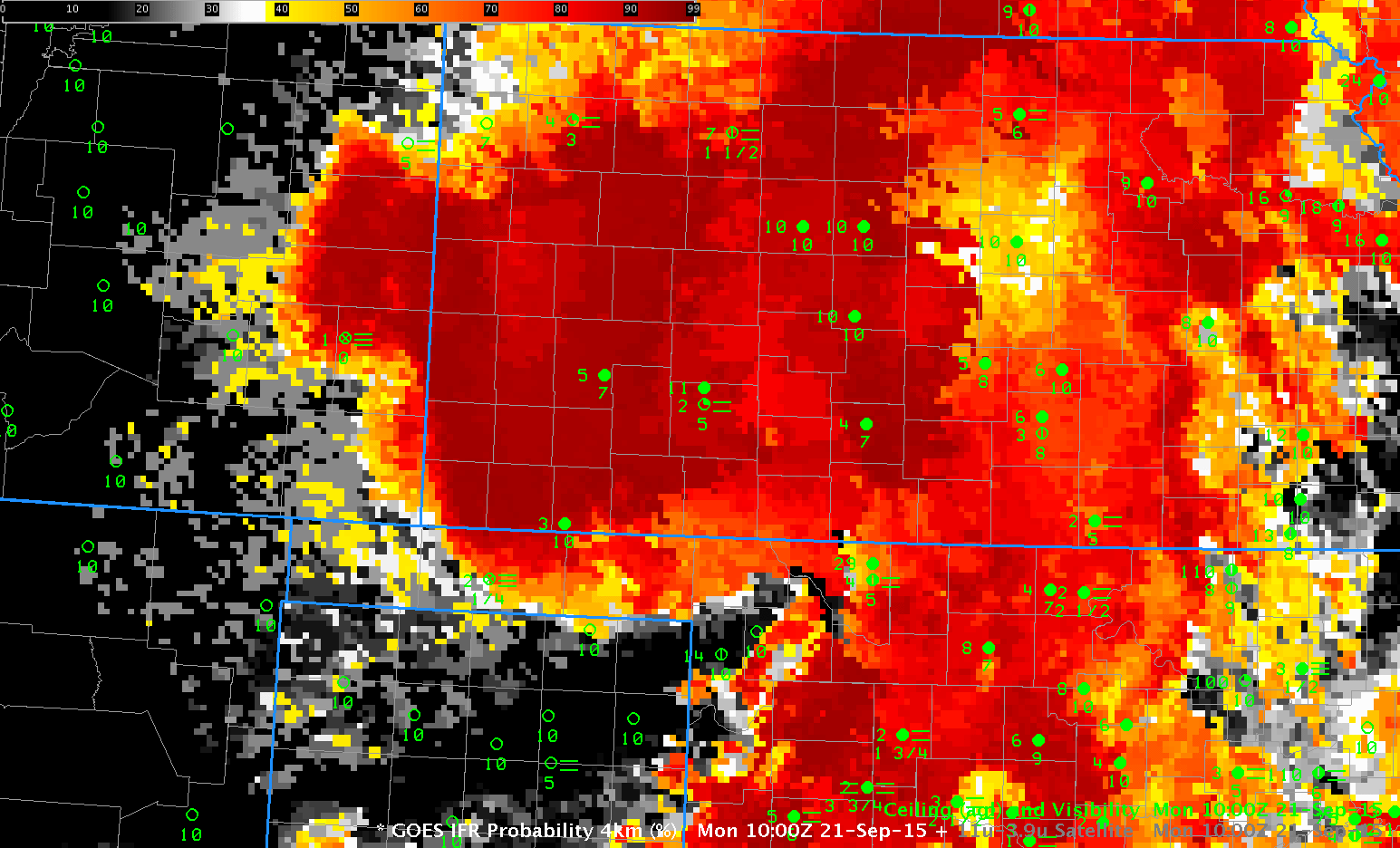
GOES-R IFR Probability and GOES-13 Brightness Temperature Difference (10.7 µm – 3.9 µm) at 1000 UTC on 21 September 2015 (Click to enlarge)
The toggle above compares GOES-R IFR Probability fields and GOES-13 Brightness Temperature Difference fields at 1000 UTC on 21 September 2015. A shortcoming of Brightness Temperature Difference fields, or indeed of any low cloud detection algorithm that relies solely on cloud-top measurements, is that low stratus that does not reduce visibility and fog that does reduce visibility can look very similar from the cloud top. By incorporating surface and near-surface moisture information from the Rapid Refresh Model, the GOES-R IFR Probability algorithm can correctly screen out regions of stratus and highlight only those regions where fog and low stratus might affect transporation. In the example above, Guymon OK and Lamar CO are at the outer edge of the highest IFR Probability, and both report IFR conditions. South and west of those stations, IFR Probabilities drop quickly, but brightness temperature difference signals remain strong.