 |
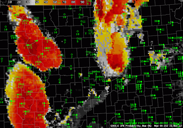
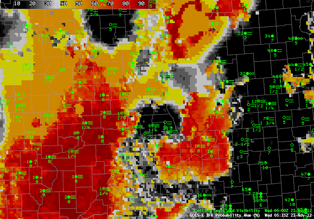
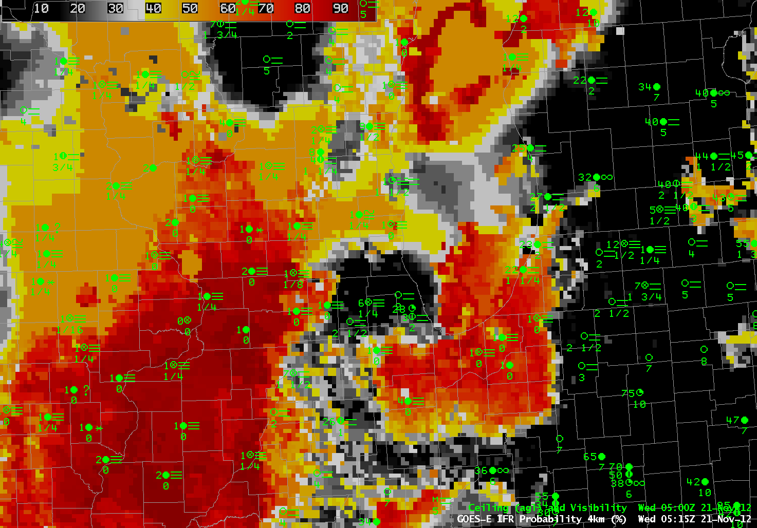
| GOES-R IFR Probabilities, computed from GOES-East, and surface observations of ceilings and visibilities, hourly from 00:15 UTC to 13:15 UTC on 21 November 2012 |
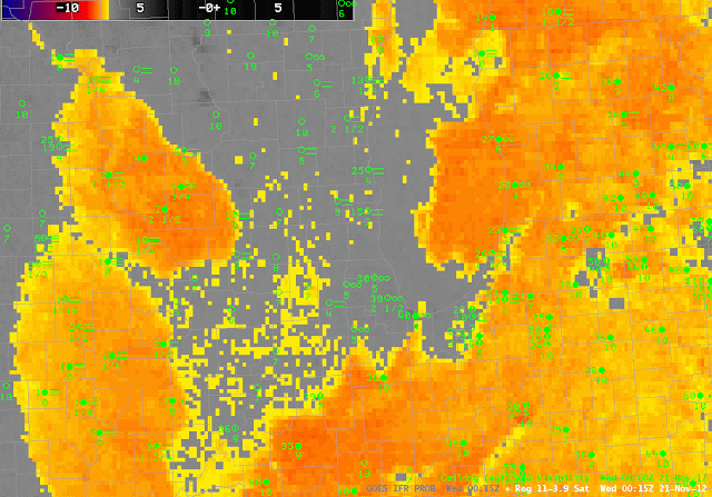 |
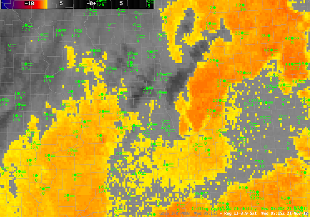
| Heritage Fog Detection product, that is, brightness temperature difference 10.7 – 3.9, hourly from 00:15 UTC to 13:15 UTC on 21 November 2012 |
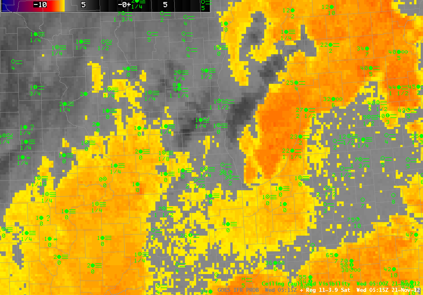
Dense fog has developed over the midwest on one of the busiest travel days of the year. The GOES-R IFR Probabilities, top loop, above, show the fog initially over the Mississippi River Valley (this fog had actually formed the night before and persisted through the day — link) and then spreading eastward towards Chicago’s O’Hare Airport. The animation of GOES-R IFR probabilities and surface observations depicts the widespread nature of the fog. Compare the fields above to the fields of the brightness temperature difference, the Heritage Fog Detection product, just above. Several notable differences are obvious. Note, for example, that at the start of the loop, much of Michigan is covered by a strong brightness temperature difference signal, but IFR conditions are not common. The GOES-R IFR Probabilities correctly shows low probabilities of reduced visibilities under the elevated stratus deck over Michigan. There are several upper cloud features that propagate across Illinois during the course of the night. These features prevent the Heritage Cloud Product from detecting low clouds. For example — the region over southern Wisconsin at 0515 UTC. The IFR probabilities decrease in this region (and acquire the characteristically smooth appearance that arises when model predictors predominate in the computation of probabilities), and rebound once the higher clouds move off to the south and east. The 0515 UTC images for both products are below.
 |
| GOES-R IFR Probabilities from 0515 UTC on 21 November |
 |
| Heritage Fog Detection from 0515 UTC on 21 November |
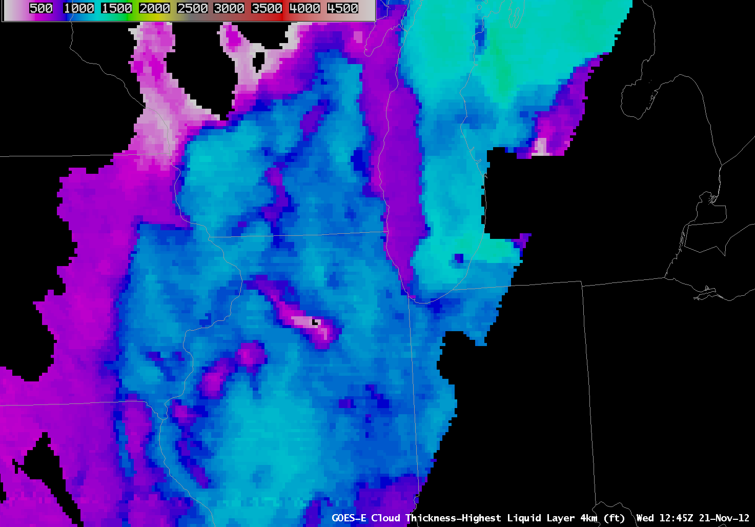
The Wednesday before Thanksgiving is a very busy travel day through O’Hare, the timing of the fog dissipation is therefore of utmost importance. The depth of the fog/low stratus at that time just before twilight conditions (when the product is not computed) can be related to dissipation time, as shown in this graph. The last cloud thickness estimate just before sunrise, below, was around 1000 feet over O’Hare, suggesting that the Fog will burn off about 3 hours after sunrise (13:00Z).
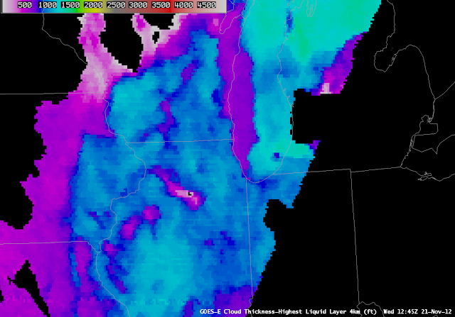 |
| GOES-R Cloud Thickness from 1245 UTC on 21 November |
The images below show the fog clearing across the area. Note how the areas where the last cloud thickness estimate before sunrise was thicker (Central Illinois and SW Wisconsin where thicknesses were close to 1200 ft) takes longer to clear than areas where the clouds were thinner (E Wisconsin and NE Illinois around O’Hare where thicknesses were around 1000 ft).
 |
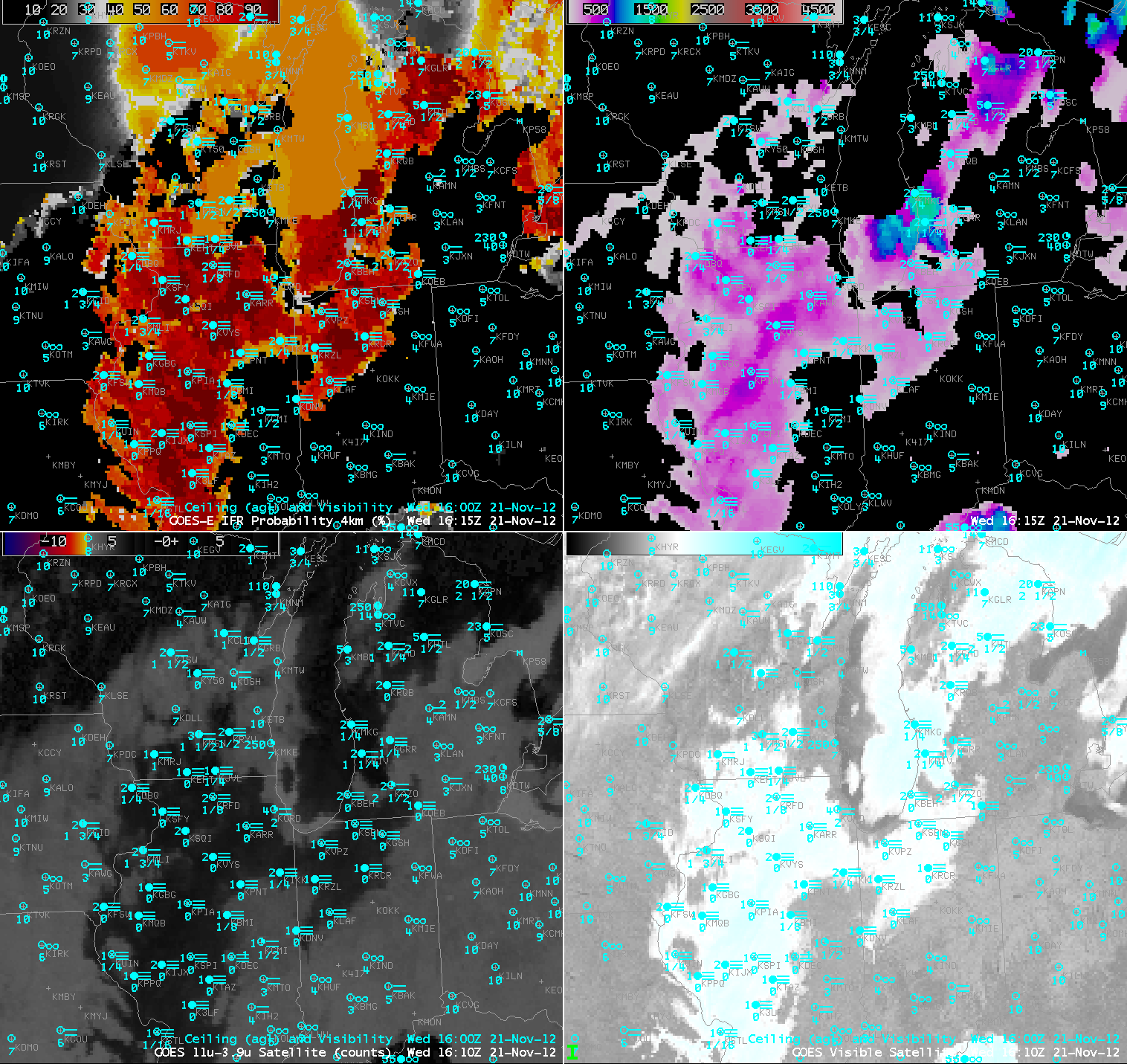
| GOES-R IFR probabilities (top left), GOES-R cloud thickness (top right), heritage 3.9-11 micron BTD product (bottom left) and visible satellite image (bottom right) for Nov 21, 2012 at 16:15 UTC. Surface observations of ceiling and visibility are in blue. |
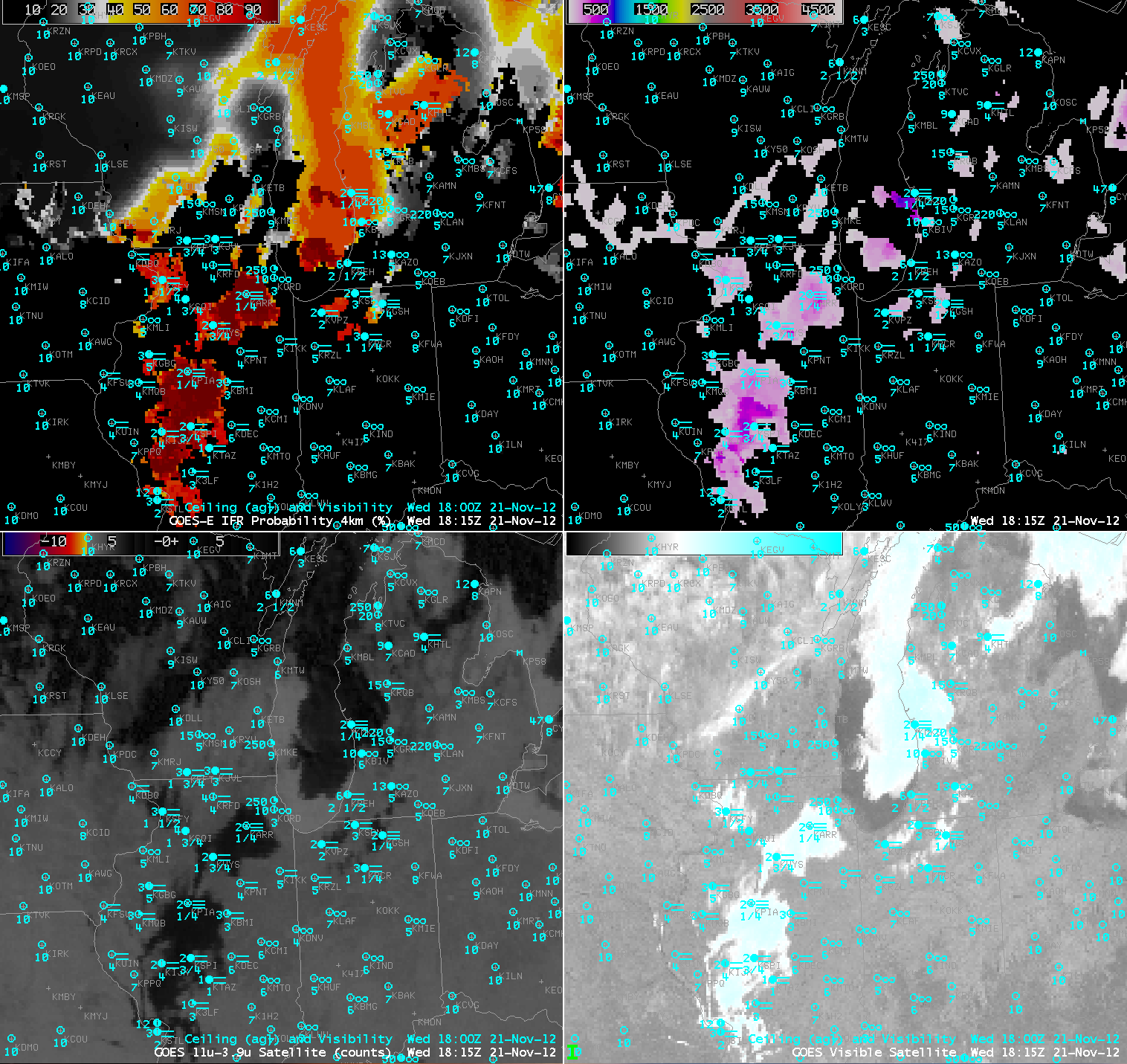
In the above image at 16:15 UTC (about 3hrs after sunrise) the fog has cleared near O’Hare, in SE Wisconsin and other areas where pre-sunrise cloud thicknesses were ~1000 ft. In the image below at 18:15 UTC (about 5 hours after sunrise) the fog has cleared everywhere except central Illinois where the largest pre-sunrise thicknesses were estimated.
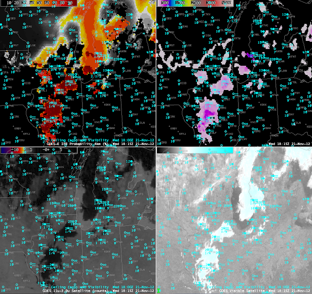 |
| GOES-R IFR probabilities (top left), GOES-R cloud thickness (top right), heritage 3.9-11 micron BTD product (bottom left) and visible satellite image (bottom right) for Nov 21, 2012 at 18:15 UTC. Surface observations of ceiling and visibility are in blue. |
As seen below, by 19:32 UTC (about 6.5 hrs after sunrise) the last small pockets of fog finish burning off. It was noted by a NWS forecaster in Sullivan, WI that a strong low-level inversion was present that took longer to erode than usual. This likely resulted in some of these lingering areas of fog to persist a little longer than was estimated using the last pre-sunrise GOES-R cloud thickness relationship. The complete animation is available here. 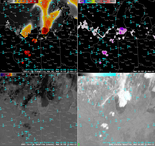
|
| GOES-R IFR probabilities (top left), GOES-R cloud thickness (top right), heritage 3.9-11 micron BTD product (bottom left) and visible satellite image (bottom right) for Nov 21, 2012 at 19:32 UTC. Surface observations of ceiling and visibility are in blue. |
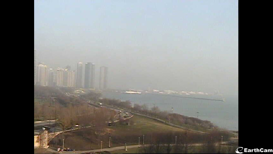
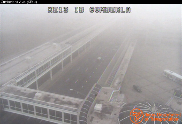
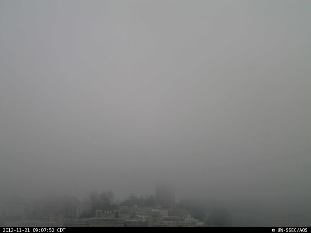
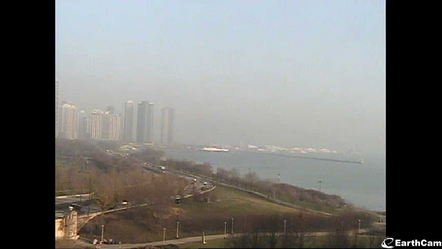
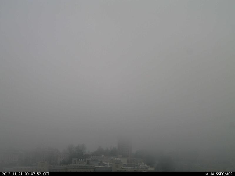
Fog was considerably less dense at the Lakefront in Chicago. Various web-cam captures, below, demonstrate the variable denseness of the fog in Chicago, and also in Madison, WI.
 |
| North-Facing Webcam, Madison WI, time as indicated. Source. |
 |
| North-Facing Webcam from Field Museum in Chicago, ca. 1445 UTC 21 November. Source. |
 |
| Kennedy Expressway at Cumberland Ave, ca. 1445 UTC 21 November 2012. Source. |


