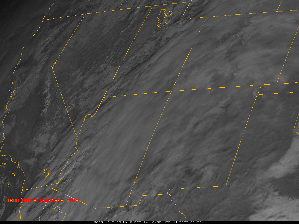
GOES-13 Visible Imagery at 1600 and 2300 UTC from 6 December through 13 December 2014 (Click to enlarge)
Northern Arizona experienced a wet start to December (From 2-4 December, Flagstaff received 1.79″, Winslow received 0.80″ and Grand Canyon Airport received 0.41″). When High Pressure and an inversion then settled over the region (an animation of surface weather charts is here), the stage was set for a prolonged period of fog and low stratus, as noted here, for example. The visible imagery, above, testifies to the persistence of the low clouds and fog. It is apparent on 6 December during the day, and persists through the 12th. Visible imagery also shows the presence of high clouds; the presence of those high clouds makes ongoing detection of lower clouds difficult. In addition, both the visible imagery and brightness temperature difference product (10.7 µm – 3.9 µm on GOES-13, historically and still routinely used to detect water-based clouds) give information about the top of the cloud. There is great difficulty in using this information to infer a surface visibility or ceiling (that is, information about the bottom of the cloud).
Fused products have an advantage of incorporating surface-based data (assimilated into the model — the Rapid Refresh in this case) to provide information on whether saturation is occurring in the lowest kilometer of the atmosphere. If that is the case, IFR Probabilities will be larger. The animation below shows Brightness Temperature Difference products and IFR Probabilities at 3 different times (~0700, ~1700 and ~2300) during the days on 8-11 December. IFR Probability fields continually show a strong signal in the region of fog/low stratus over eastern Arizona; the brightness temperature difference field does not, as it is affected by cirrus clouds and by solar reflectivity during the day. Clear skies on 10-11 December at night did allow the brightness temperature difference product to highlight the low clouds over Arizona.
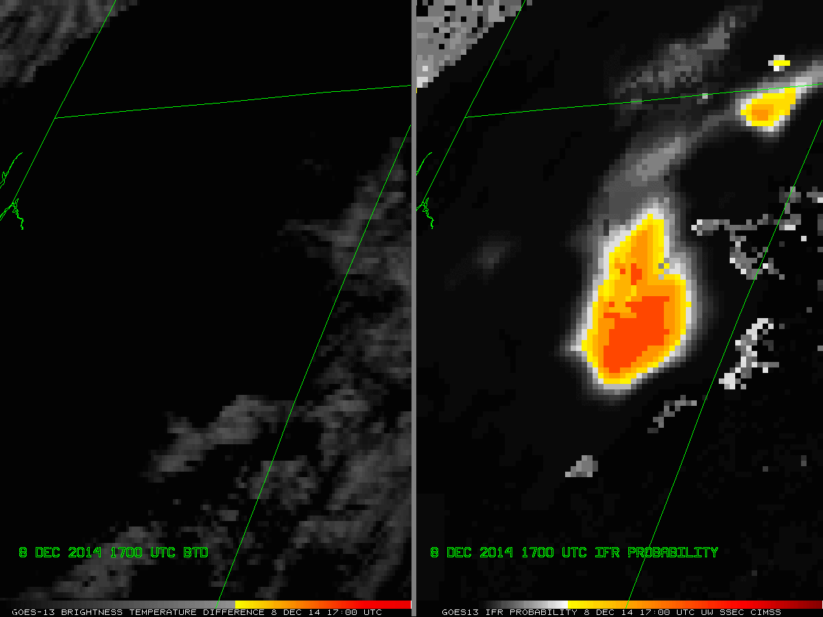
GOES-13 Brightness Temperature Difference (Left, 10.7 µm – 3.9 µm) and IFR Probability (Right) from 8 December through 11 December at ~0700, ~1700 and ~2300 UTC. The Brightness Temperature Difference is enhanced so that fog/low stratus are yellow/orange/red at night, black during the day. (Click to enlarge)