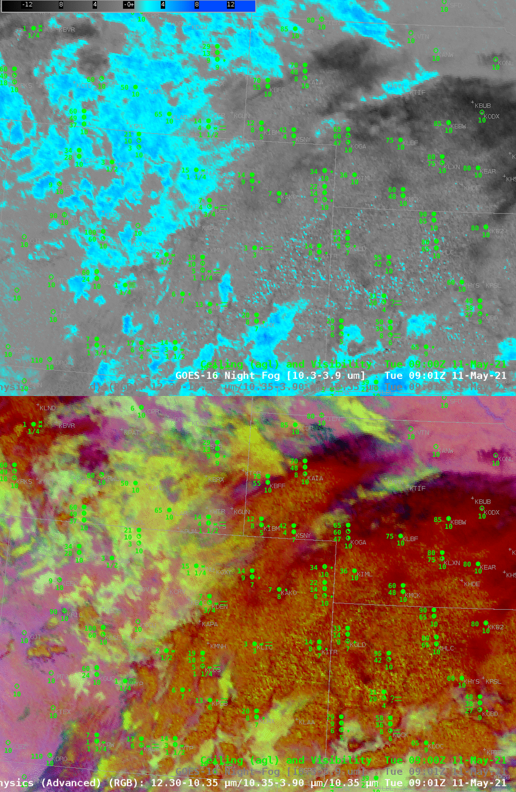
The toggle above compares Night Fog Brightness Temperature difference fields at 0901 UTC on 11 May over Colorado and surrounding states. Both fields can be used to identify regions of stratus/low stratus — and by inference, fog. At this time, however, it is a challenge to use these satellite-only products because of widespread mid/upper-level clouds over eastern Colorado, Kansas and Nebraska. Note how the blue/cyan regions in the Night Fog Brightness Temperature Difference field show through into the Nighttime Microphysics RGB; the green component of that RGB is the Night Fog Brightness Temperature Difference field.
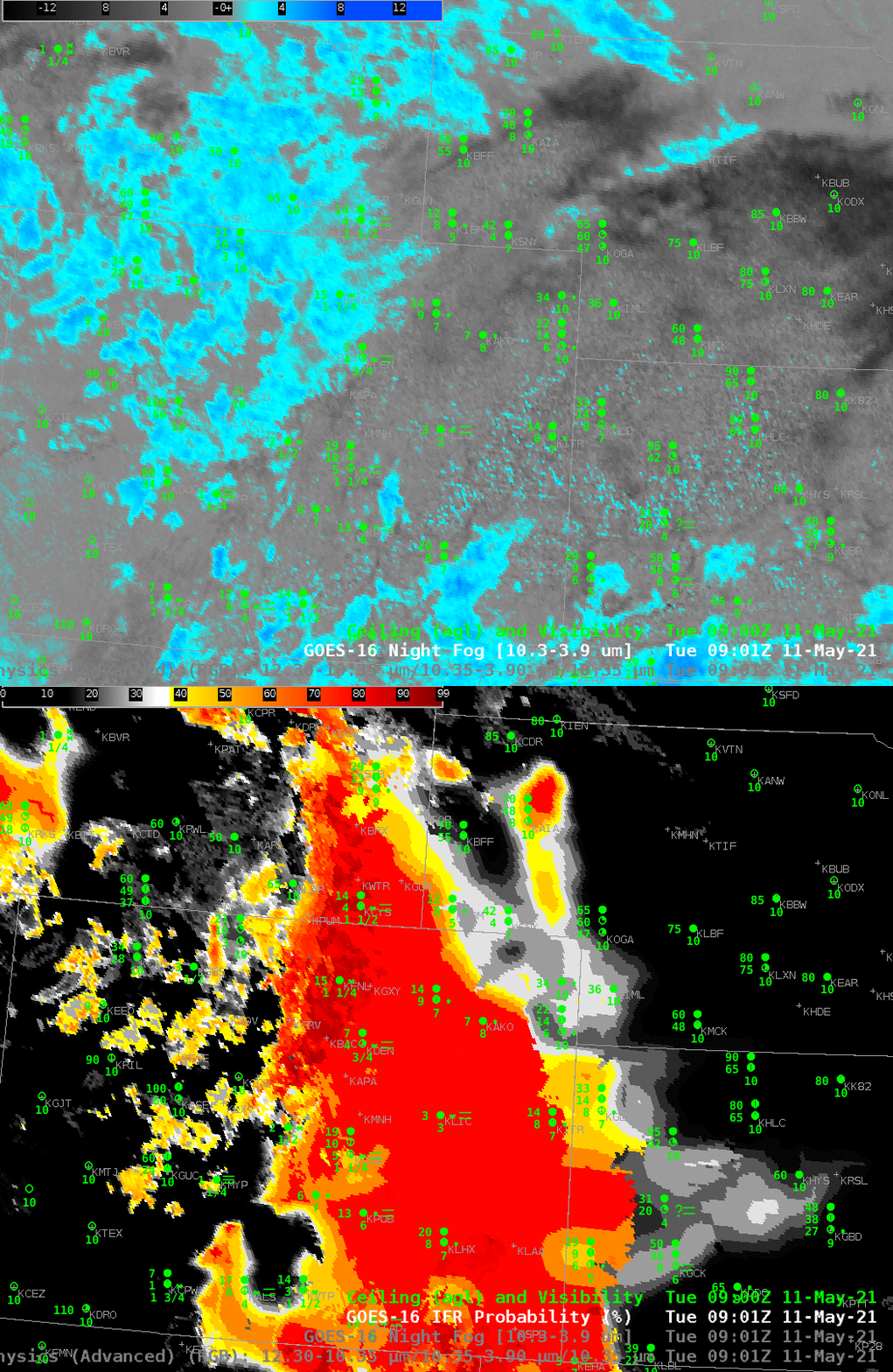
On this day, the high clouds prevented the Brightness Temperature Difference alone from highlighting regions of fog. IFR Probability fields, below from the same time, show that this field better outlined the region of low clouds/fog over the High Plains. The field incorporates both Night Fog Brightness temperature difference fields — to determine where stratus clouds might be — and Rapid Refresh model estimates of low-level moisture — to determine where saturation might be occurring. Where the satellite detects stratus clouds, and where the Rapid Refresh model suggests low-level saturation, high IFR Probability (as over southeastern Colorado) results, in accordance with, on this day, observations. If high clouds are present (as over much of eastern Colorado), IFR Probability can still occur because the Rapid Refresh data shows low-level saturation. Note also that the extensive cloud cover over Kansas and Nebraska — elevated stratus — does not have a strong signal in the IFR Probability fields.
This product blends the strengths of satellite observations and the strength of model estimates.

