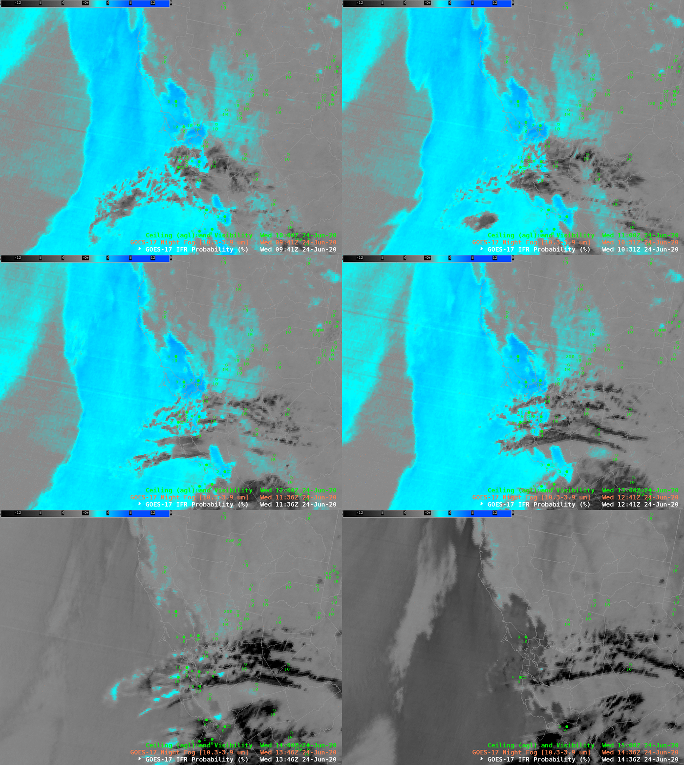
GOES-17 ‘Night Fog’ Brightness Temperature Difference imagery, above, shows a stratus deck (cyan and blue in this default AWIPS enhancement) off the central California coast. Higher clouds (grey and black in the enhancement) are drifting over San Francisco bay, obscuring the GOES-17 satellite’s view of low clouds. These high clouds can present a challenge to aviation forecasters for San Francisco’s airport, and important airline hub because the nature of low clouds cannot be determined. (Note the striping in the image is an artifact of GOES-17’s malfunctioning Loop Heat Pipe). This animation also shows the effect of increasing amounts of reflected solar radiation on the Night Fog Brightness Temperature Difference signal.
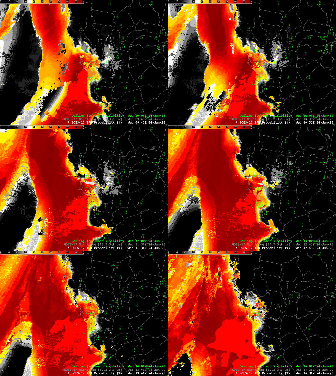
GOES-17 IFR Probability fields, below, augment information at low levels by using model (Rapid Refresh) estimates of low-level saturation (as might be found in low stratus) in the computation of IFR Probability. The animation below shows that SFO was in a region of high — but not very high — IFR Probabililty. Note also how the signal is constant through the sunrise at the end of the animation.
The airport (KSFO) did not report IFR conditions on this morning.
