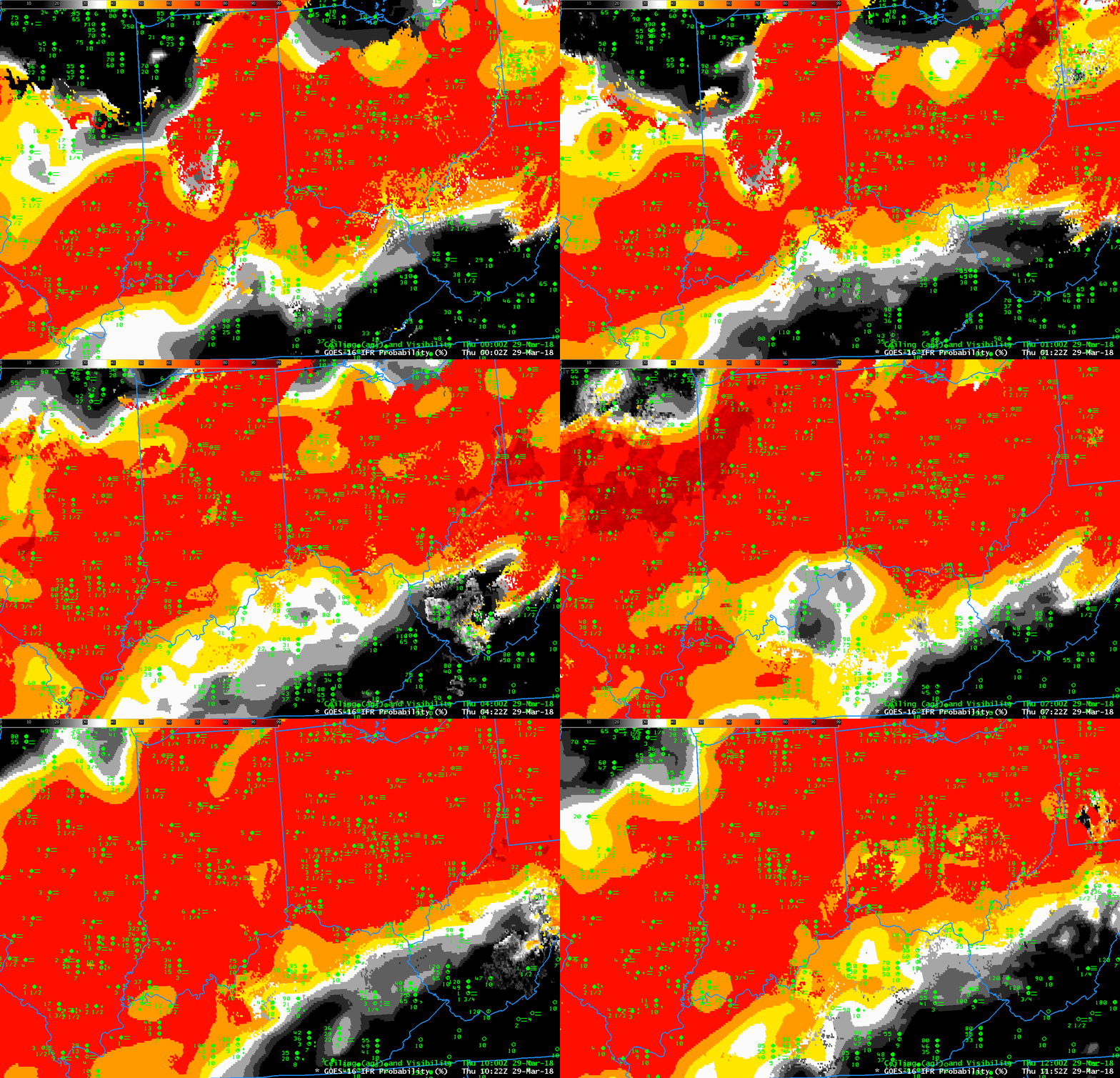
GOES-16 IFR Probability fields, 0002 UTC through 1152 UTC on 29 March 2018, every 20 minutes (Click to enlarge)
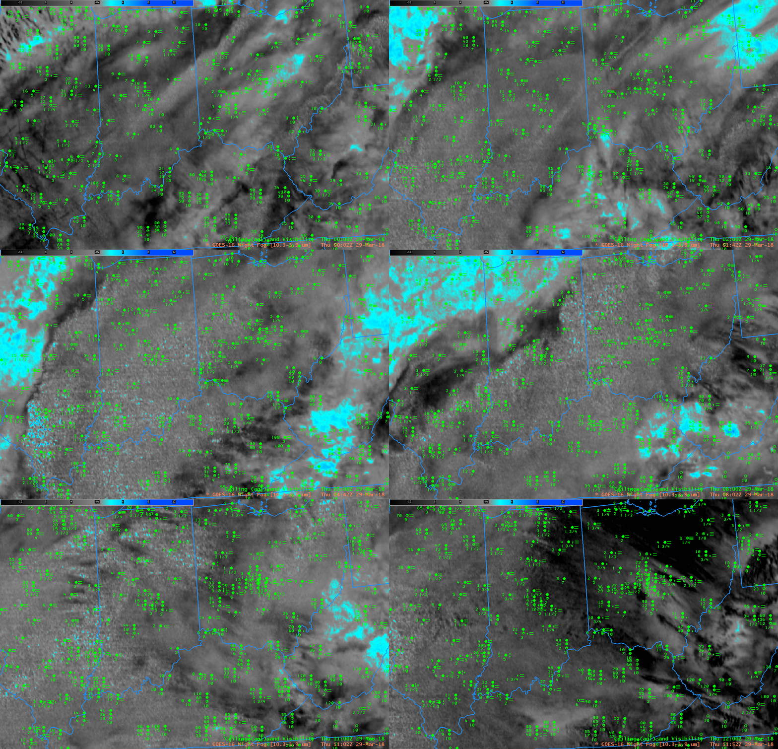
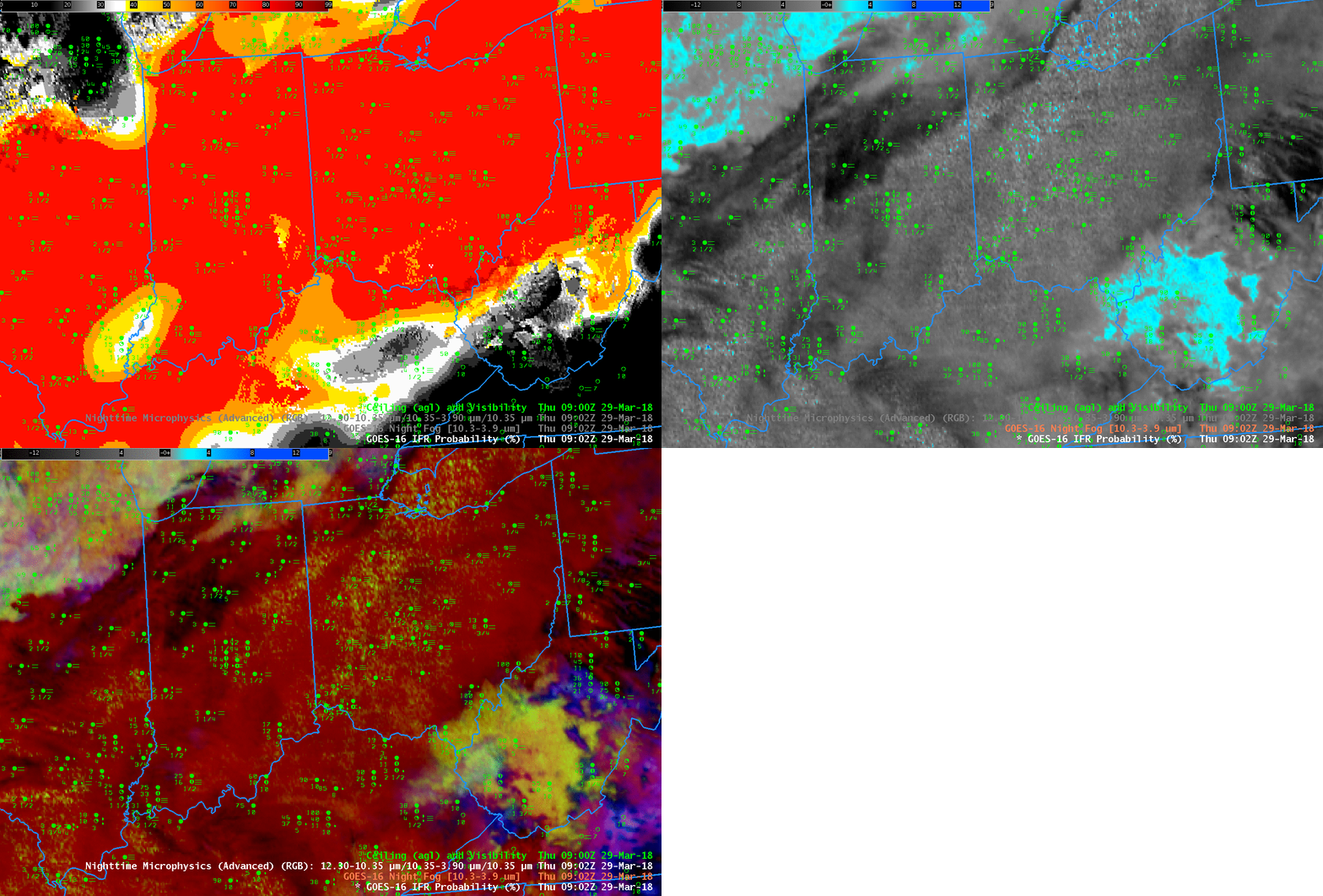
Advection fog in the Spring, when high dewpoints overrun very cold ground surfaces, usually in association with an extratropical cyclone, are very difficult to detect using satellite-only products, as shown in the Brightness Temperature Difference field animation below (Click here for the same animation but with a 5-minute time step as observed in the CONUS domain by GOES-16). GOES-16 IFR Probability, above (Click here for an animation with a 5-minute cadence), is able to highlight the region of low ceilings and visibilities because Rapid Refresh Data supplies information about near-surface saturation that is lacking in satellite-only products such as the Brightness Temperature Difference, below, or, say, the Nighttime Microphysics RGB that uses the Brightness Temperature Difference. A toggle including IFR Probability, Night Fog Brightness Temperature Difference, and Nighttime Microphysics is below (from 0902 UTC on 29 March). Only the IFR Probability has an obvious signal difference between regions with IFR Conditions and regions without.


