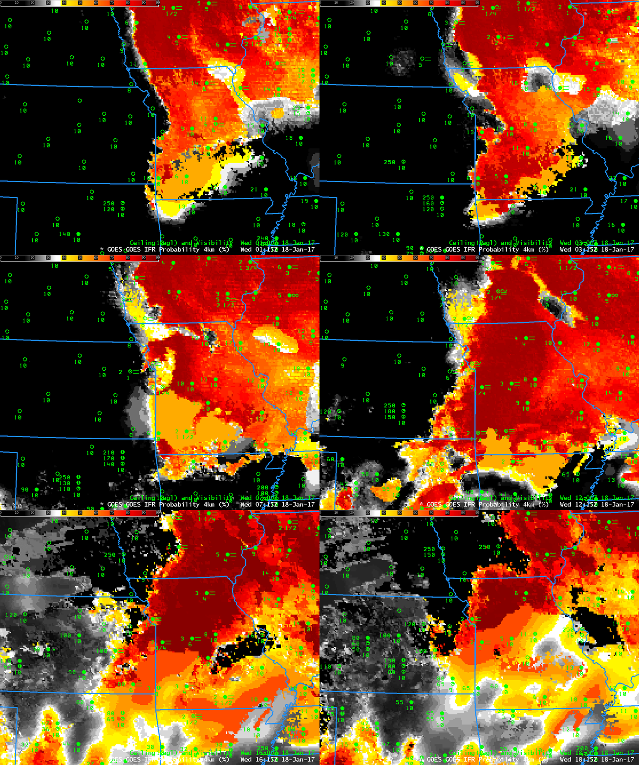
GOES-R IFR Probabilities, hourly from 0115 through 1815 UTC, and surface observations of ceilings and visibilities, on 18 January 2017 (Click to enlarge)
Ice Fog developed over Kansas City during the early morning hours of 18 January 2017, with accidents that snarled traffic (tweeted image courtesy @DrWxologist Chad Gravelle) starting before sunrise and continuing through the morning rush hour (Screenshot of News link from here). Dense Fog Advisories were issued. The animation above, of GOES-R IFR Probability fields, shows the slow westward progression of the Fog/Low Clouds into the Kansas City Metro area shortly after 4 AM CST. High IFR Probabilities persist through 1800 UTC and diminished shortly thereafter.
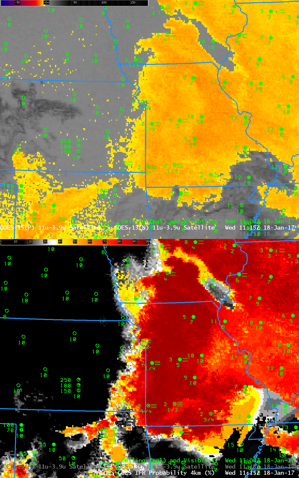
During this case, an absence of mid-level and high clouds allowed IFR Probabilities to reach very large values. The toggle below shows Brightness Temperature Difference fields (3.9 – 10.7) and GOES-R IFR Probabilities at 1115 UTC. Low clouds cover Missouri except for the region over the Missouri Bootheel. Note that the western edge of the satellite-detected low clouds is slightly to the east of the western edge of the IFR Probability in this case. Model data are suggesting that low-level saturation is occurring in those regions (over far southwest Iowa, for example) although satellite data were not yet showing a strong signal. Observations show IFR conditions (at Clarinda, Iowa, for example, where freezing fog is reported with 200-foot ceilings and 1/4-mile visibility).

