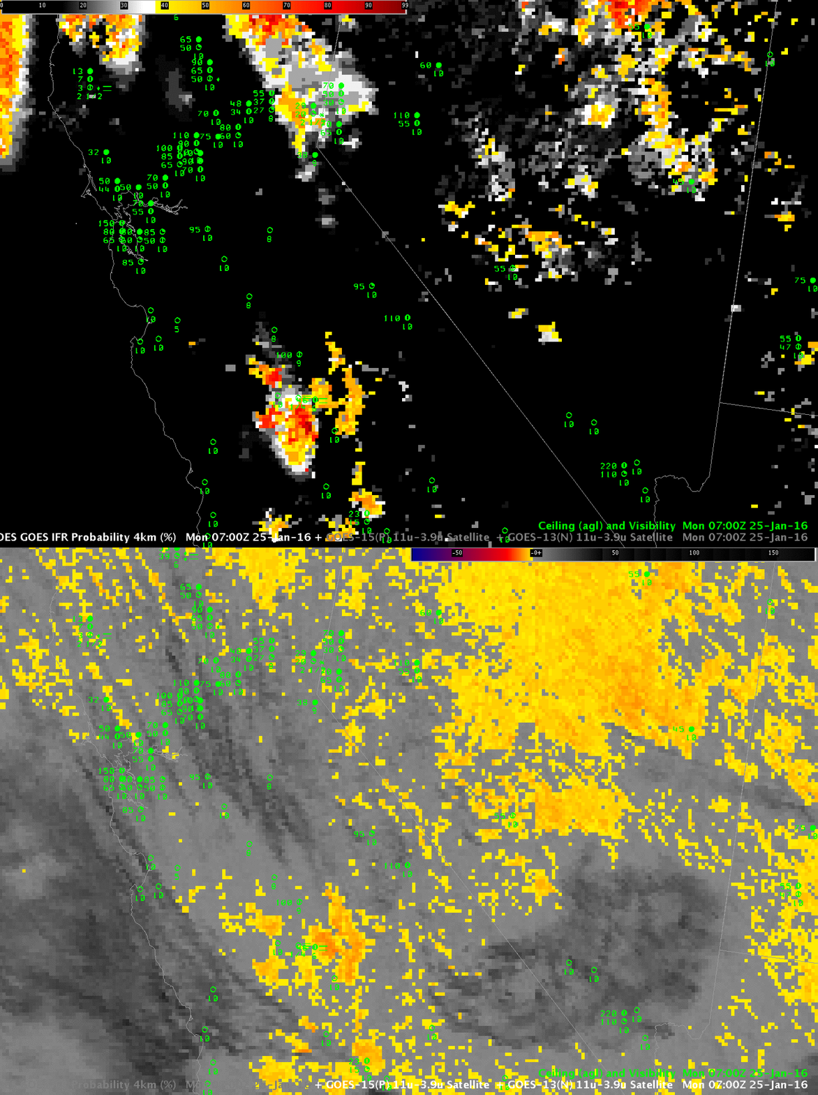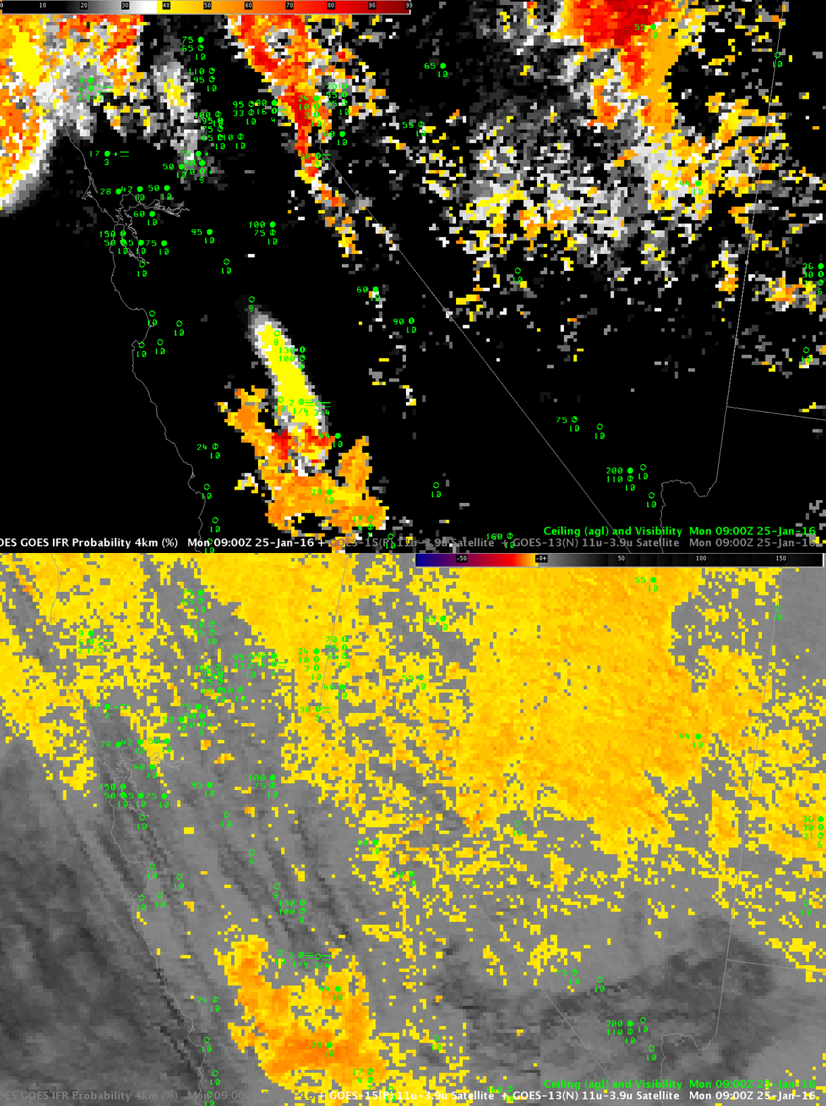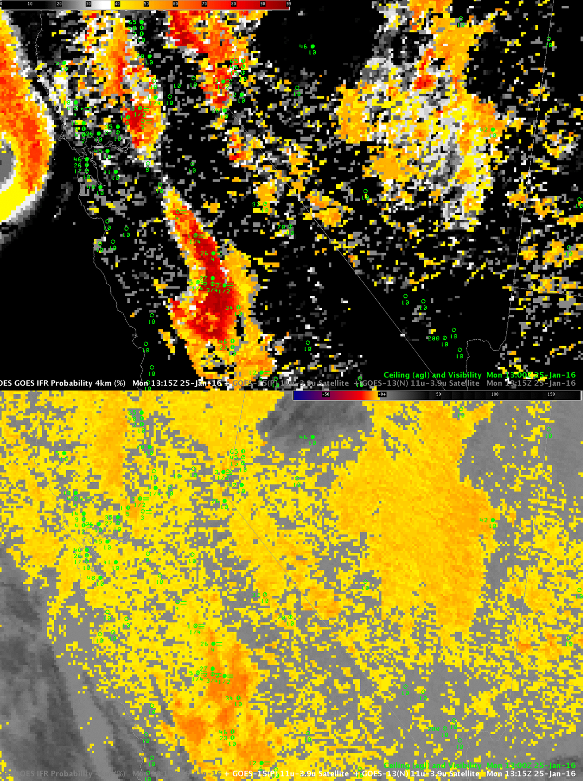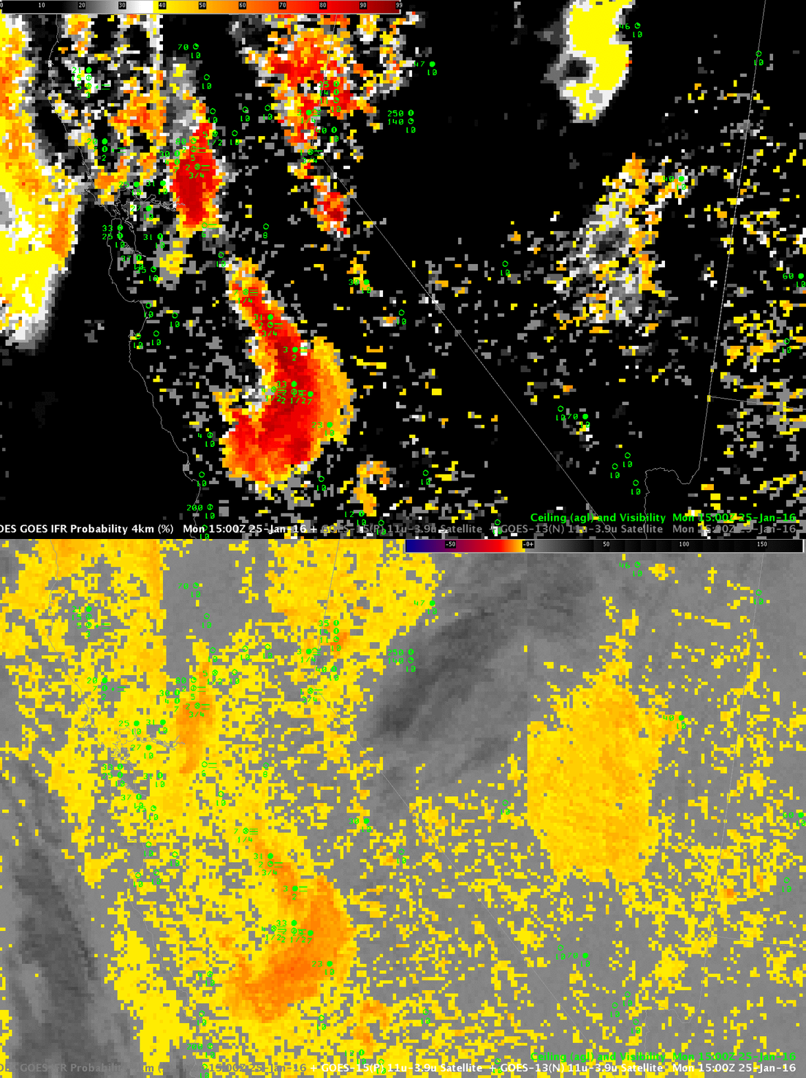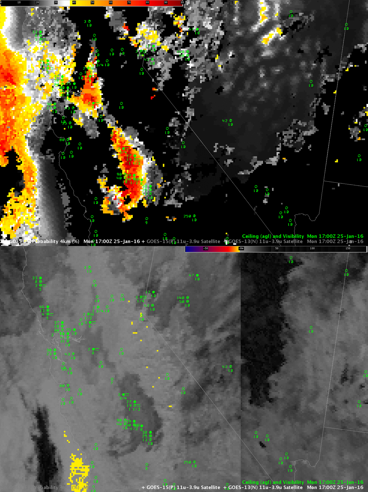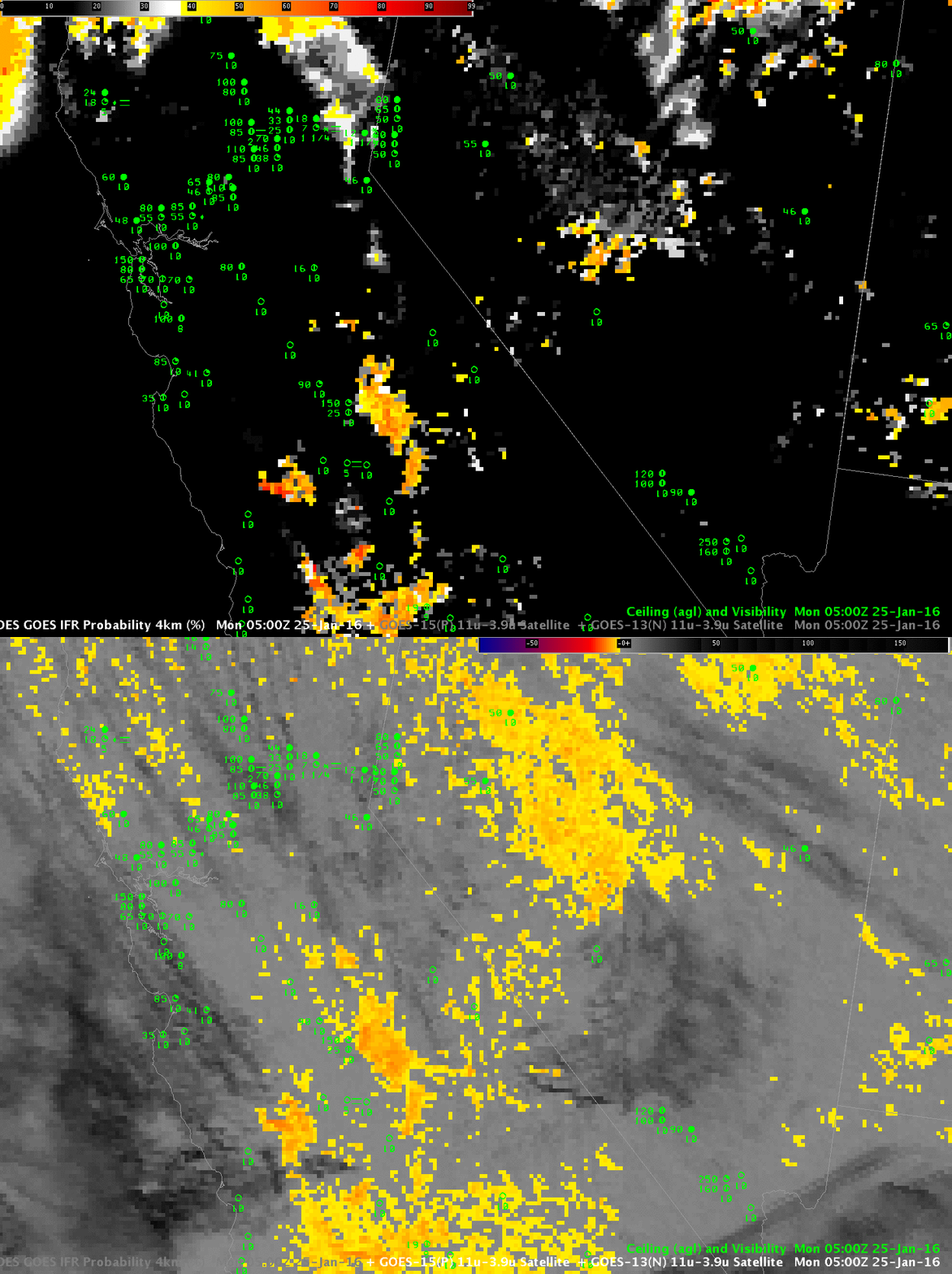
GOES-R IFR Probability Fields and GOES Brightness Temperature Difference (10.7 µm – 3.9 µm) at 0500 UTC, 25 January 2016 (Click to enlarge)
Fog developed over California’s central Valley during the early morning of 25 January 2016. The toggle above shows the GOES-R IFR Probability field and the GOES Brightness Temperature Difference field at 0500 UTC, before any IFR conditions were reported. Note that the brightness temperature difference field reports large regions of water-based clouds over Nevada — IFR Probability fields screen out this region because low-level saturation is not occurring in the Rapid Refresh Model. The inference should be that any cloud present there is mid-level stratus rather than fog. That screening of water-based clouds continues at 0700 UTC, below. Around Hanford, IFR Probability values have increased as ceilings and visibilities have lowered.
By 0900 UTC, above, high clouds have moved over Hanford (shown as dark streaks in the brightness temperature difference field enhancement) where IFR conditions are occurring. IFR Probability fields correctly continue to maintain a strong signal around Hanford even though brightness temperature difference fields cannot detect low clouds because of the presence of high clouds. Thus, GOES-R IFR Probability in that region is controlled by Rapid Refresh Model output that successfully predicted the presence of low-level saturation. By 1100 UTC, below, the high clouds have moved south, and GOES-R IFR Probability values rebound. When both Satellite data and Model data can be used as predictors, IFR Probability field values are larger than when only satellite data or only model data are used as predictors.
By 1300 UTC, the region of IFR Conditions near Hanford has expanded — and a second region has developed closer to Sacramento. IFR Probability fields continue to screen out regions that the brightness temperature difference field alone suggests are regions of low stratus. Surface-based observations do show regions of mid-level stratus over Nevada, around San Francisco, and over northern California, three regions where the brightness temperature difference signal is strong. The higher terrain of the Sierra Nevada to the east of the Central Valley also shows higher IFR Probability as might be expected where terrain rises up into mid-level stratus.
The 1500 UTC images, below, continue these trends. By 1700 UTC, at bottom, there is enough solar radiation reflecting off the clouds that the brightness temperature difference has flipped sign. The IFR Probability field, however, has a consistent signal over the persistent region of low clouds/fog around Hanford and around Sacramento.

