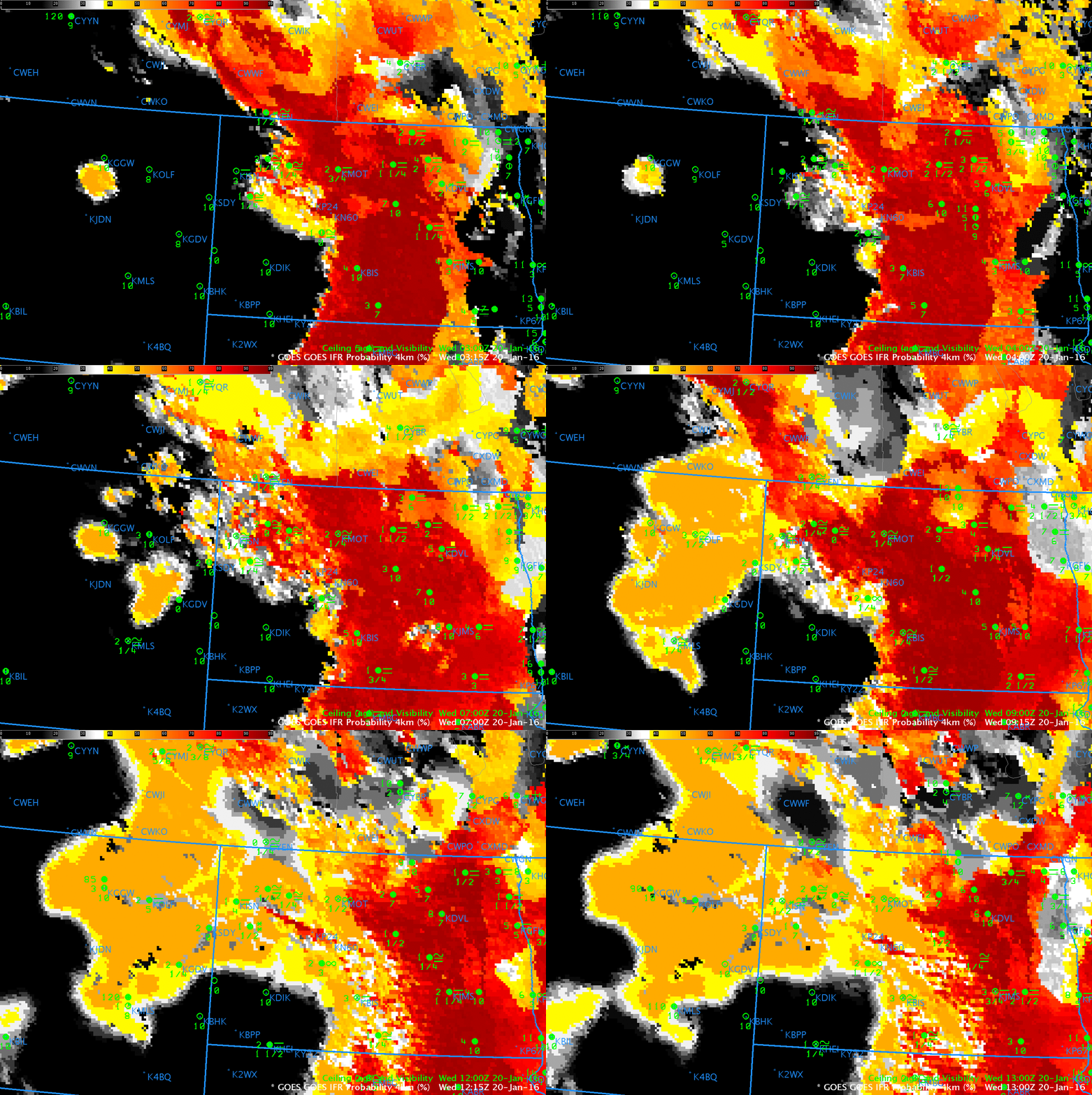
Dense Fog over North Dakota and Freezing Fog over eastern Montana prompted the issuance of Dense and Freezing Fog advisories early Wednesday Morning. GOES-R IFR Probabilities, above, computed from data from the GOES-13 Imager and from Rapid Refresh Model output, capture the growth/evolution of the fog field. In general, the IFR Probability field captures the area of reduced visibilities (with some exceptions, such as KHEI (Hettinger, ND, near the border with South Dakota is southwest North Dakota).
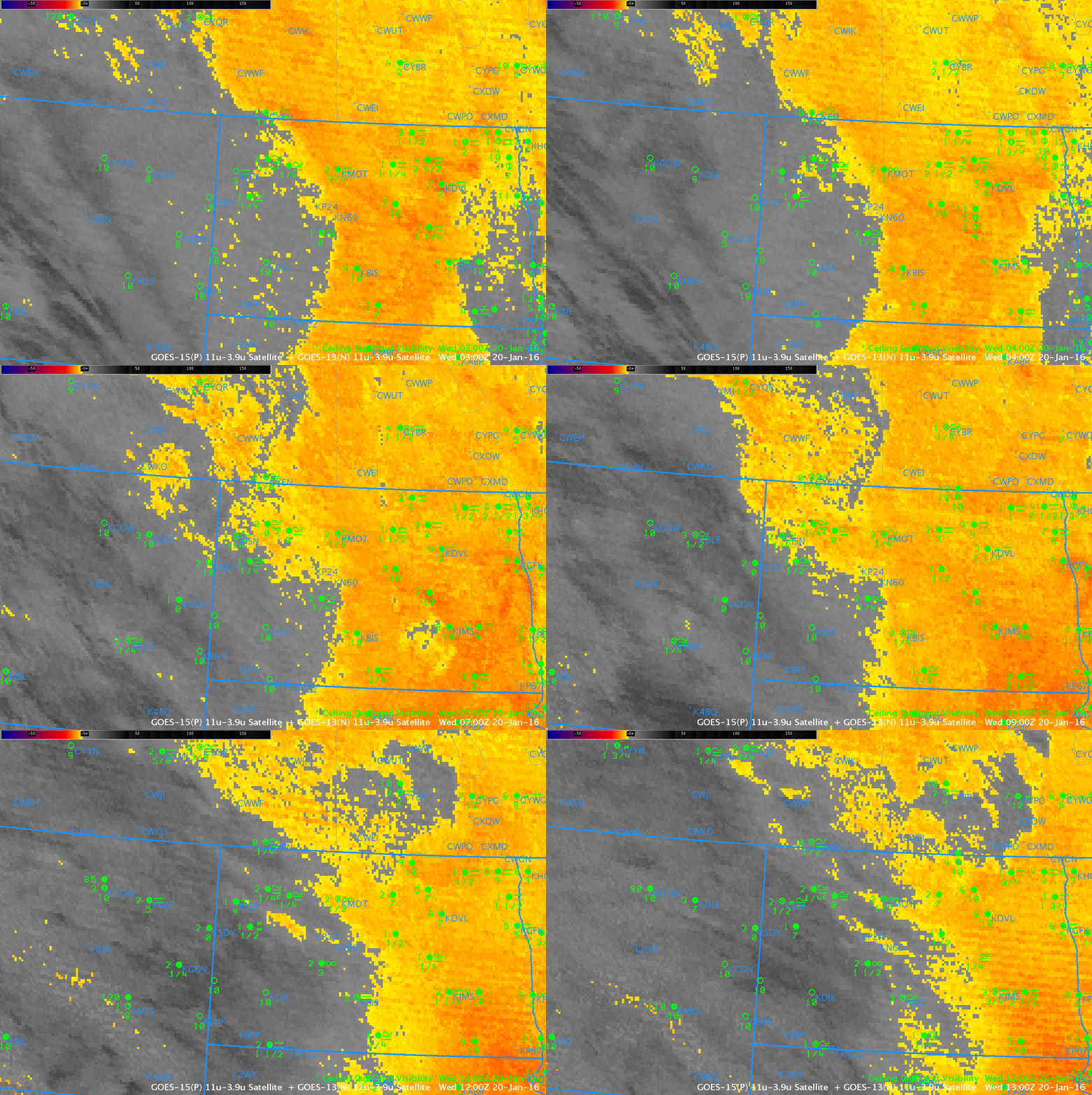
Compare the areal extent of the IFR Probability field with that from the Brightness Temperature Difference from GOES, below. The presence of multiple cloud layers prevents any satellite from viewing low clouds, and satellite-only products therefore give little information about near-surface events in much of western North Dakota and Montana. When Rapid Refresh Model output is controlling the GOES-R IFR Probability field, as happened in this case over Montana and western North Dakota, the IFR Probability will have lower values and a less pixelated look that reflects the coarser model resolution and model smoothing.


