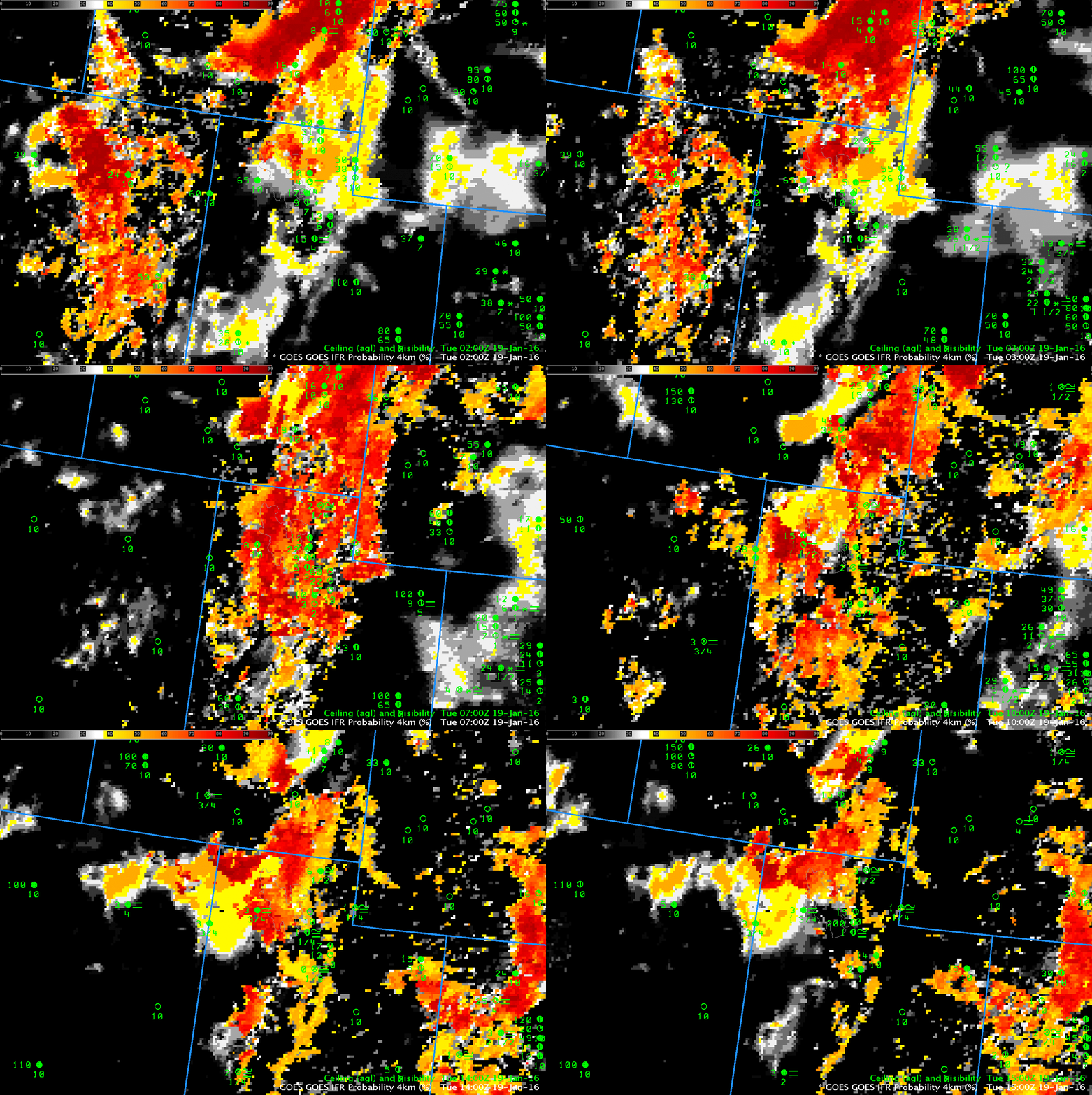
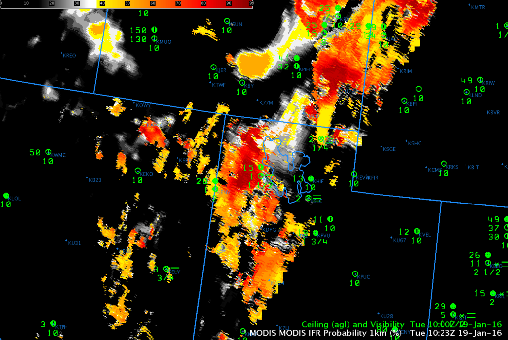
Dense Fog Advisories were issued over southern Idaho early on 19 January 2016. GOES-R IFR Probability fields, below, show high probabilities in this region. Surface observations are not common over northern Utah/southern Idaho, and the hourly animation does show IFR Conditions observed near the high IFR Probabilities over southern Idaho and northern Utah (Logan, UT — KLGU — at 41:47 N, 111:51 W, in far northern Utah from 0300 – 1300 UTC; Elko NV — KEKO — at 40:50 N, 115:47 W also shows IFR conditions). The Snake River Valley in Idaho also shows high IFR Probabilities during parts of the animation.
GOES-R IFR Probability fields fuse together information from GOES-15 (or, in the eastern part of the USA, GOES-13) and Rapid Refresh Data. Highest probabilities occur where the satellite detects low (water-based) clouds and where the Rapid Refresh Model predicts low-level saturation. High IFR Probabilities don’t necessarily guarantee the presence of IFR Conditions — but they are a flag that should prompt a forecaster to be alert to the possibility that IFR conditions are present nearby or are developing. When dense fog is valley-based as might happen in the Rocky Mountains, GOES Pixel footprints and Rapid Refresh model resolution are sometimes too coarse to resolve completely the fog. MODIS data (bottom) has 1-km horizontal resolution and IFR Probabilities computed from MODIS data are more likely to resolve small valleys.


