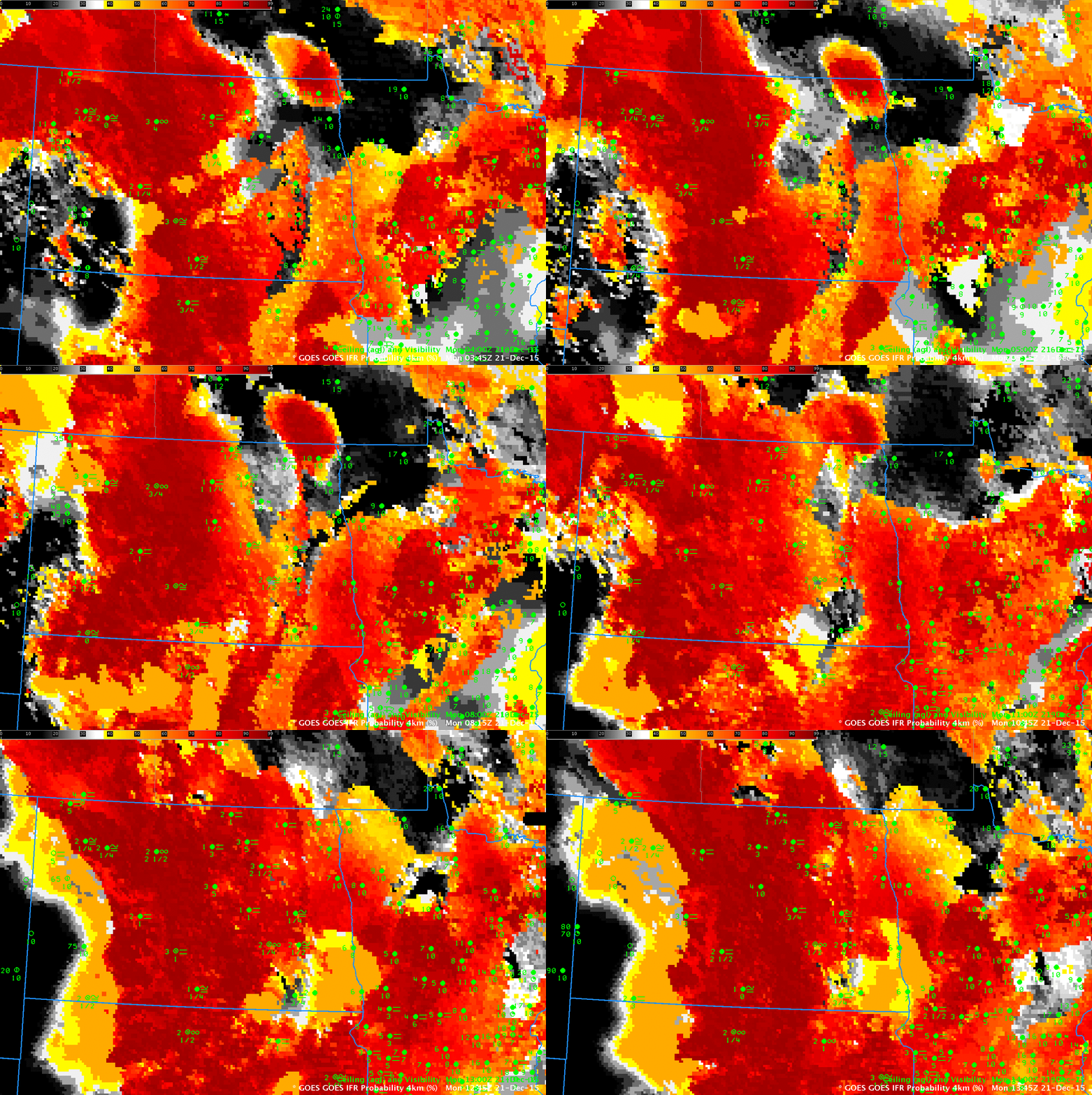
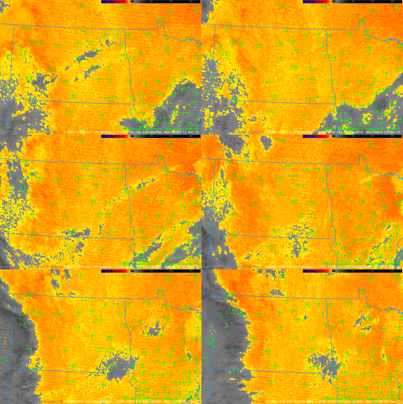
The National Weather Service in Bismarck issued Dense Fog Advisories for a fog and freezing fog early in the morning on December 21 (Happy Solstice!!) 2015. (Link). The half-hourly animation above shows the GOES-R IFR Probability during the overnight hours of 20-21 December 2015. (Here is a faster animation). Several aspects of this animation warrant comment. First, the western edge of the IFR Conditions matches well with the western edge of highest IFR Probabilities over North Dakota. This is true even as high clouds (obvious in the animation of Brightness Temperature Difference, below) move over North Dakota from the west: When this happens, IFR Probabilities decrease (and the field itself becomes more horizontally uniform) because Rapid Refresh Model Data output is the main predictor being used to diagnose the IFR Probability. The edge of the IFR Probability field moves through Dickinson ND (in the southwest part of the state) as the ceilings and visibilities there improve.
In addition, a persistent region of small IFR Probabilities exists over northern Minnesota in a region where IFR conditions are not reported. The Brightness Temperature Difference field there (below) shows a strong signal. (Click here for a faster animation of Brightness Temperature Difference) Thus, GOES-R IFR Probability is better able to differentiate between mid-level stratus and low stratus/fog. Over northern Minnesota, the Satellite data says water-based clouds are present, but the Rapid Refresh data notes little saturation in the lowest 1000 feet of the model. Thus, IFR Probabilities are small there.


