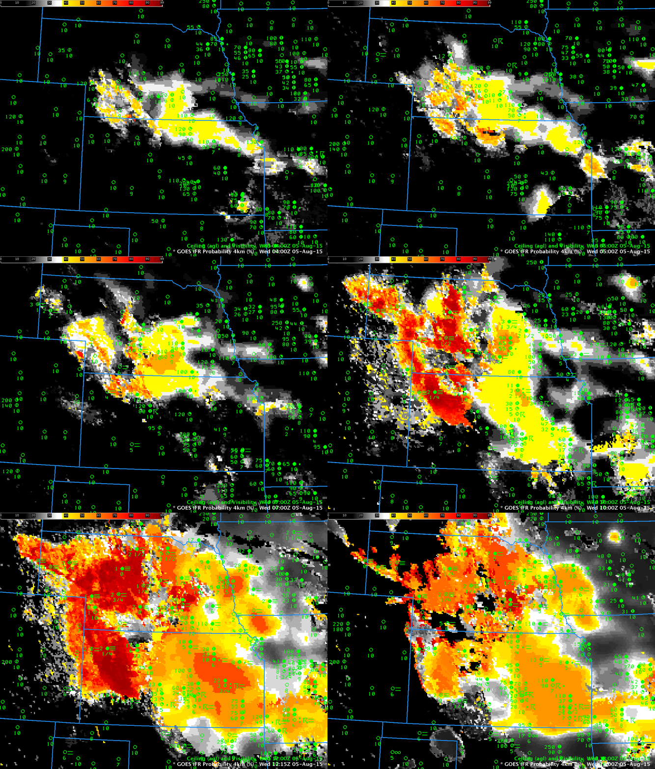
GOES-R IFR Probability fields computed from GOES-13 and Rapid Refresh data, hourly from 0400 through 1315 UTC, 5 August 2015 (Click to enlarge)
Dense fog developed over the High Plains of Kansas and Nebraska overnight on 4-5 August 2015, and Advisories were issued by the North Platte, NE, Goodland KS and Dodge City KS WFOs. The animation above, of GOES-R IFR Probability fields computed from GOES-13 data, shows a slow expansion in the area of highest probabilities. The IFR Probability field has less spatial variability over eastern Kansas and eastern Nebraska where strong convection prevented the satellite from detecting low clouds; there, only model data predictors (from model fields that vary smoothly) could be used in the computation of the GOES-R IFR Probability fields and the IFR Probability field therefore has a smoother look.

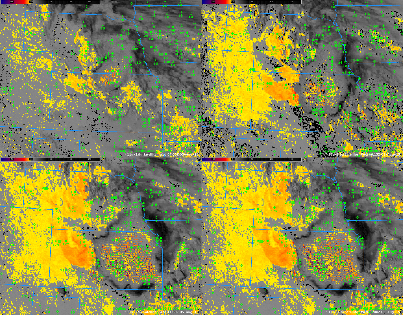
GOES-13 Brightness Temperature Difference Fields (10.7 µm – 3.9 µm) at 0700, 0915 and 1100 UTC on 5 August 2015 (click to enlarge)
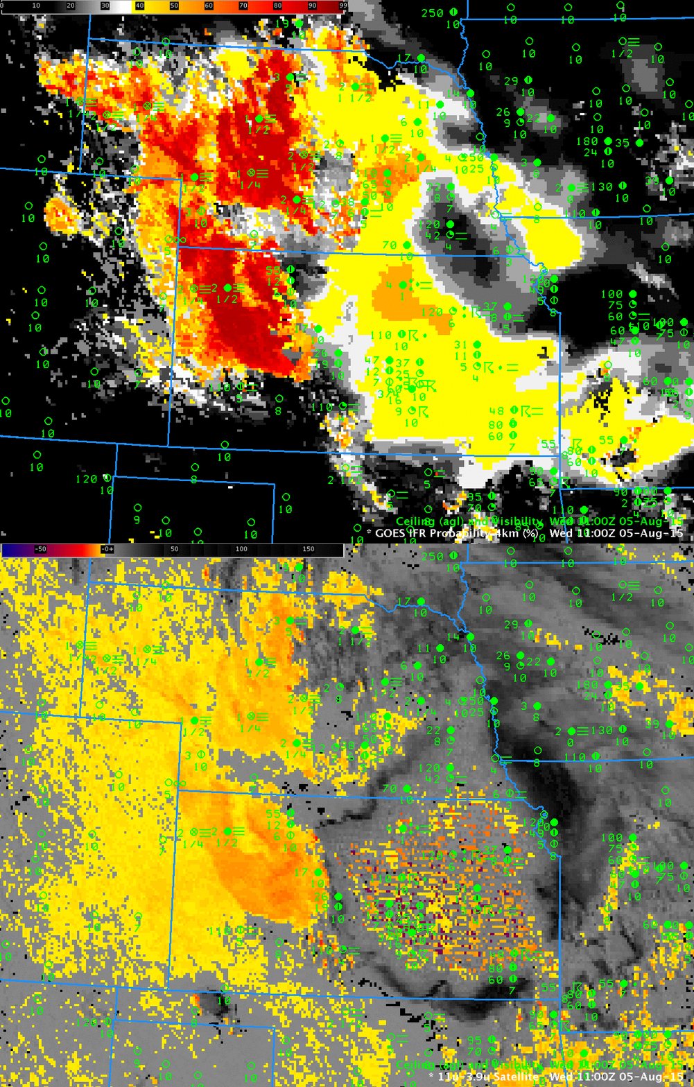
The GOES-13 Brightness Temperature Difference field (10.7 µm – 3.9 µm), above, at 0700, 0915 and 1100 UTC, similarly shows an expansion in the detection of water-based clouds over the High Plains. However, the field overpredicts the region of IFR conditions. The toggle between 1100 UTC IFR Probability and Brightness Temperature Difference, below, highlights how the IFR Probability can screen out regions (Southwestern Kansas, eastern Colorado) where low clouds are present, but IFR Conditions may not be. The toggle also shows how GOES-R IFR Probability can give information in regions where the Brightness Temperature Difference field has a signal for high clouds only (that is, under the convection in eastern Kansas)

Toggle between GOES-R IFR Probability and GOES-13 Brightness Temperature Difference (10.7 µm – 3.9 µm), 1100 UTC, 5 August 2015 (Click to enlarge)
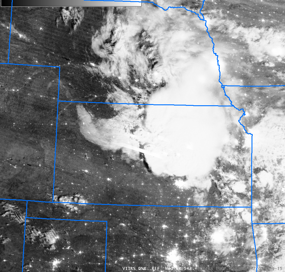
Suomi NPP overflew Kansas around 0800 UTC on 5 August, and the Day Night Band imagery, below, showed both the strong convection (complete with streaks associated with lightning) and the developing low clouds. Brightness Temperature Difference (11.45 µm – 3.74 µm) fields from Suomi NPP (Link) confirm the presence of water-based clouds (yellow and orange in the enhancement used). The strong convection over eastern Kansas has multiple overshooting tops still at 0854 UTC (Link).

