A small region of dense fog developed over northeast Colorado and western Nebraska during the early morning on June 1st 2015. How did the GOES-R and traditional products handle this event? The animation below shows IFR Probabilities from 0730-0800 UTC on 1 June. Probabilities jump from <10% to about 20% at 0800 UTC in a region centered on Holyoke, CO, just south of I-76 in northeast Colorado. The Brightness Temperature Difference Field for the same 3 times, below the IFR Probabilities, shows a signal moving over the region but not substantially changing. (From this, one could conclude that the Rapid Refresh model data might be driving increase in the IFR Probability field)
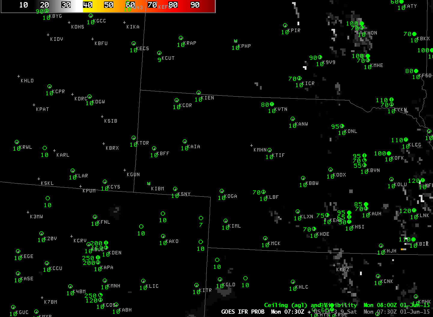
GOES-R IFR Probabilities, 0730-0800 UTC on 1 June (Click to enlarge)
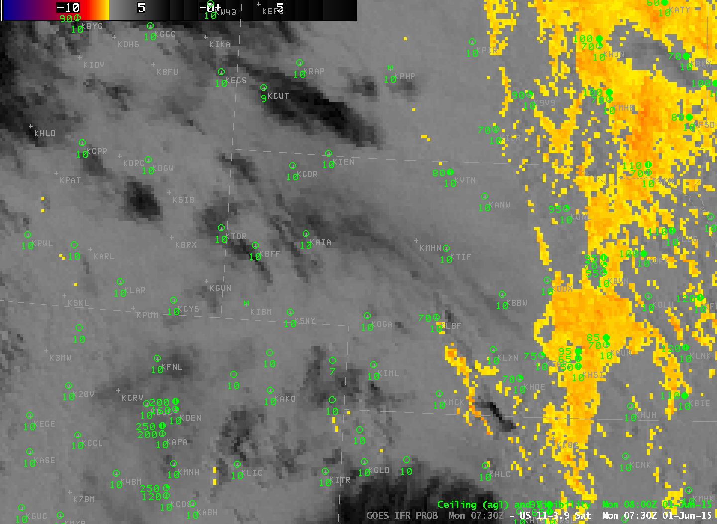
GOES-East Brightness Temperature Difference fields (10.7 µm – 3.9 µm) at 0730, 0745 and 0800 UTC, 1 June 2015 (Click to enlarge)
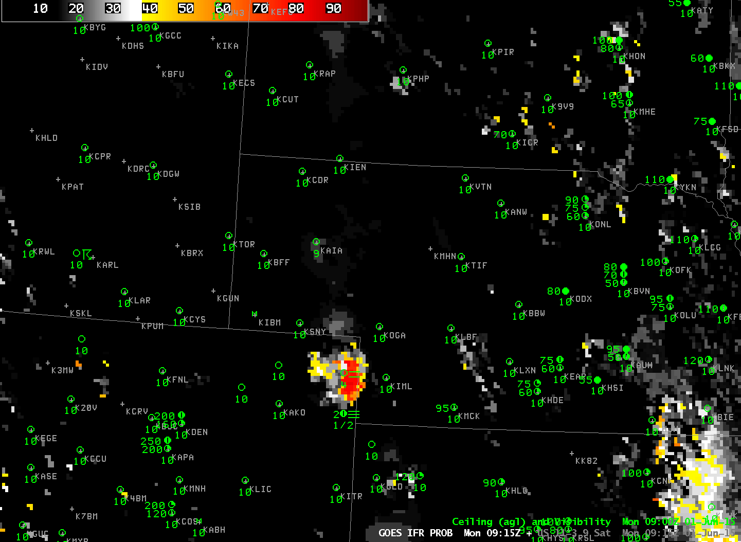
Toggle between GOES-R IFR Probabilities and GOES-East Brightness Temperature Difference Fields, 0915 UTC on 1 June (Click to enlarge)
By 0915 UTC (above), IFR Probabilities and GOES-13 Brightness Temperature Difference fields show a strong signal over NE Colorado where IFR Conditions occur/are developing. IFR Probability fields have provided more lead-time in the development of this region of low ceilings and visibilities. By 1100 UTC (below), a stronger, more widespread signal is apparent in both fields. At 1230 UTC (bottom), the rising sun has altered the brightness temperature field so it gives no useful information on low clouds; this highlights an advantage of GOES-R IFR Probability fields: A consistent signal through sunrise.
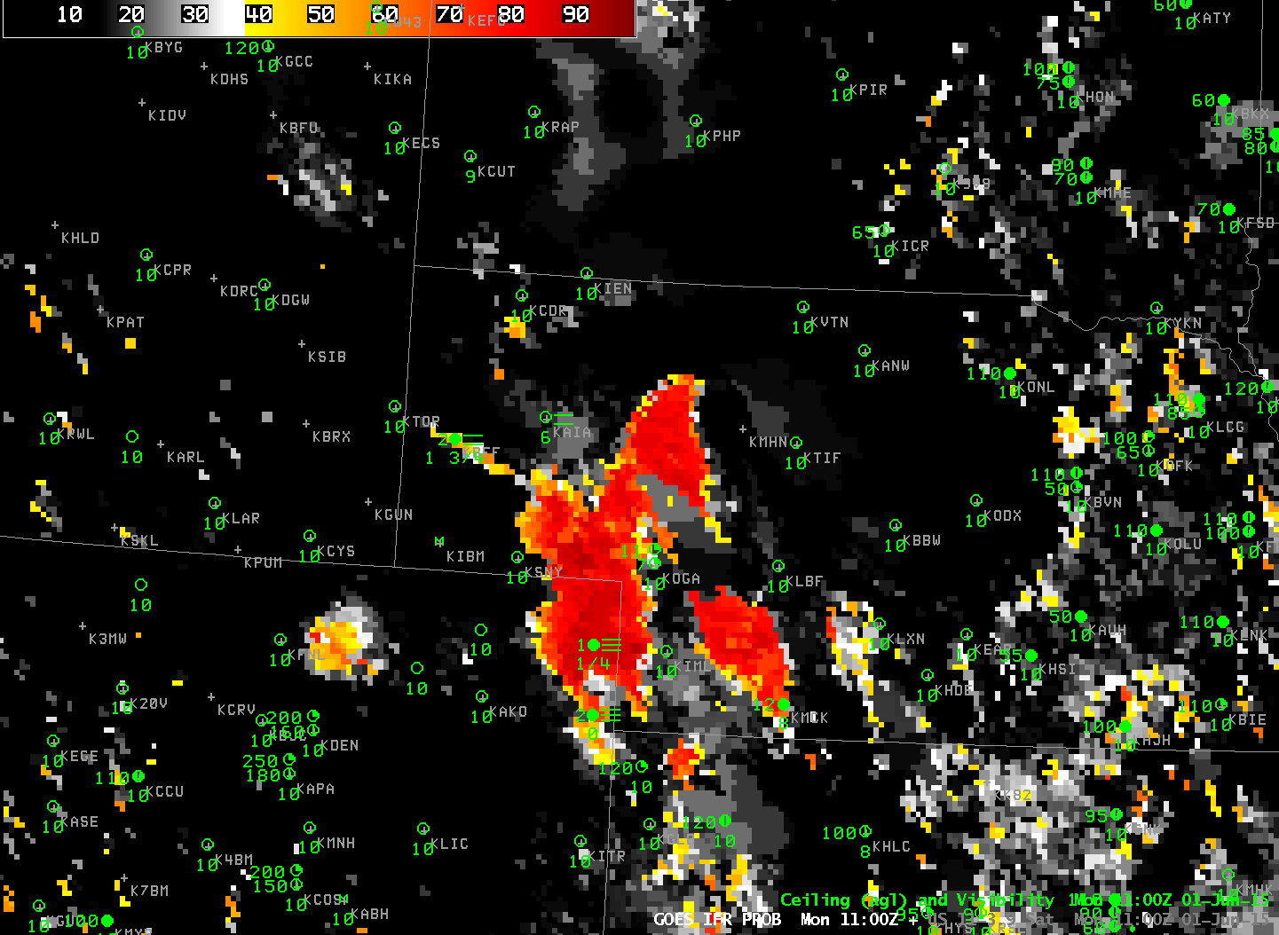
Toggle between GOES-R IFR Probabilities and GOES-East Brightness Temperature Difference Fields, 1100 UTC on 1 June (Click to enlarge)
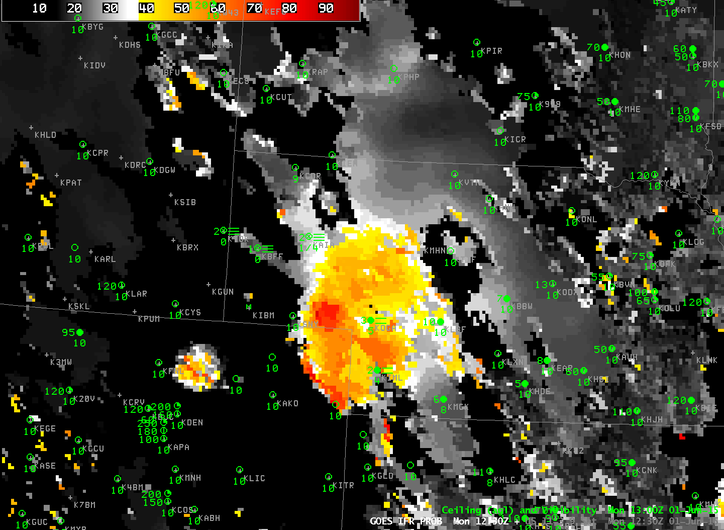
Toggle between GOES-R IFR Probabilities and GOES-East Brightness Temperature Difference Fields, 1230 UTC on 1 June (Click to enlarge)