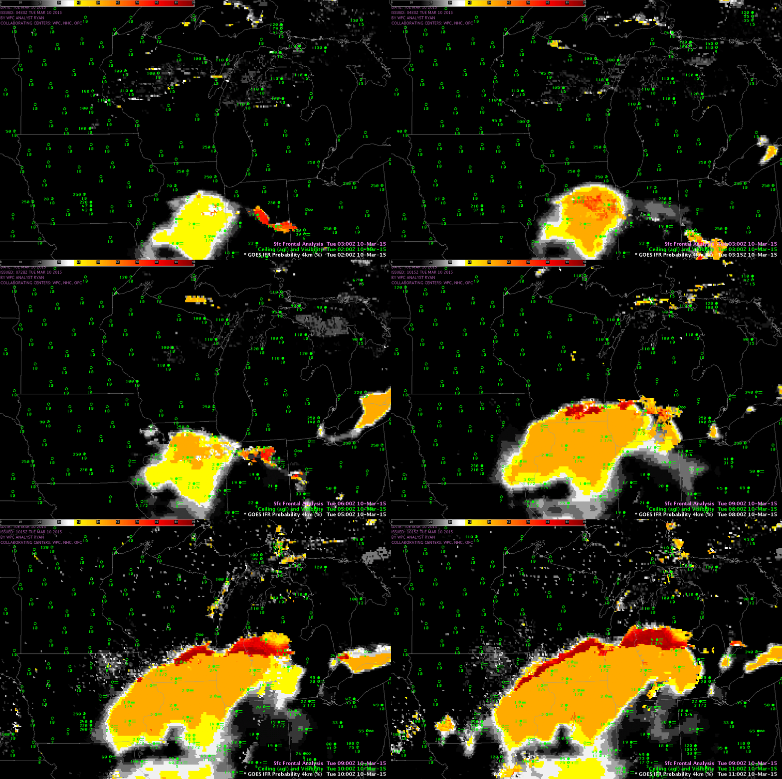
GOES-R IFR Probability Fields, 0200-1100 UTC on 10 March 2015, along with surface observations of ceilings and visibilities (Click to enlarge)
A region of dense fog/low clouds moved northward overnight through Illinois and into Wisconsin. Its movement northward was captured accurately by the GOES-R IFR Probability fields, above. IFR conditions develop as the region of high IFR Probability moves overhead. In addition, as the IFR Probability fields move northward, ceilings and visibilities along its southern flank improve. That is, the IFR Probability fields capture the northward motion of improving visibilities over Illinois. Detecting when visibilities improve is as important as detecting when visibilities deteriorate, and the GOES-R IFR Probability field in this case is doing both.
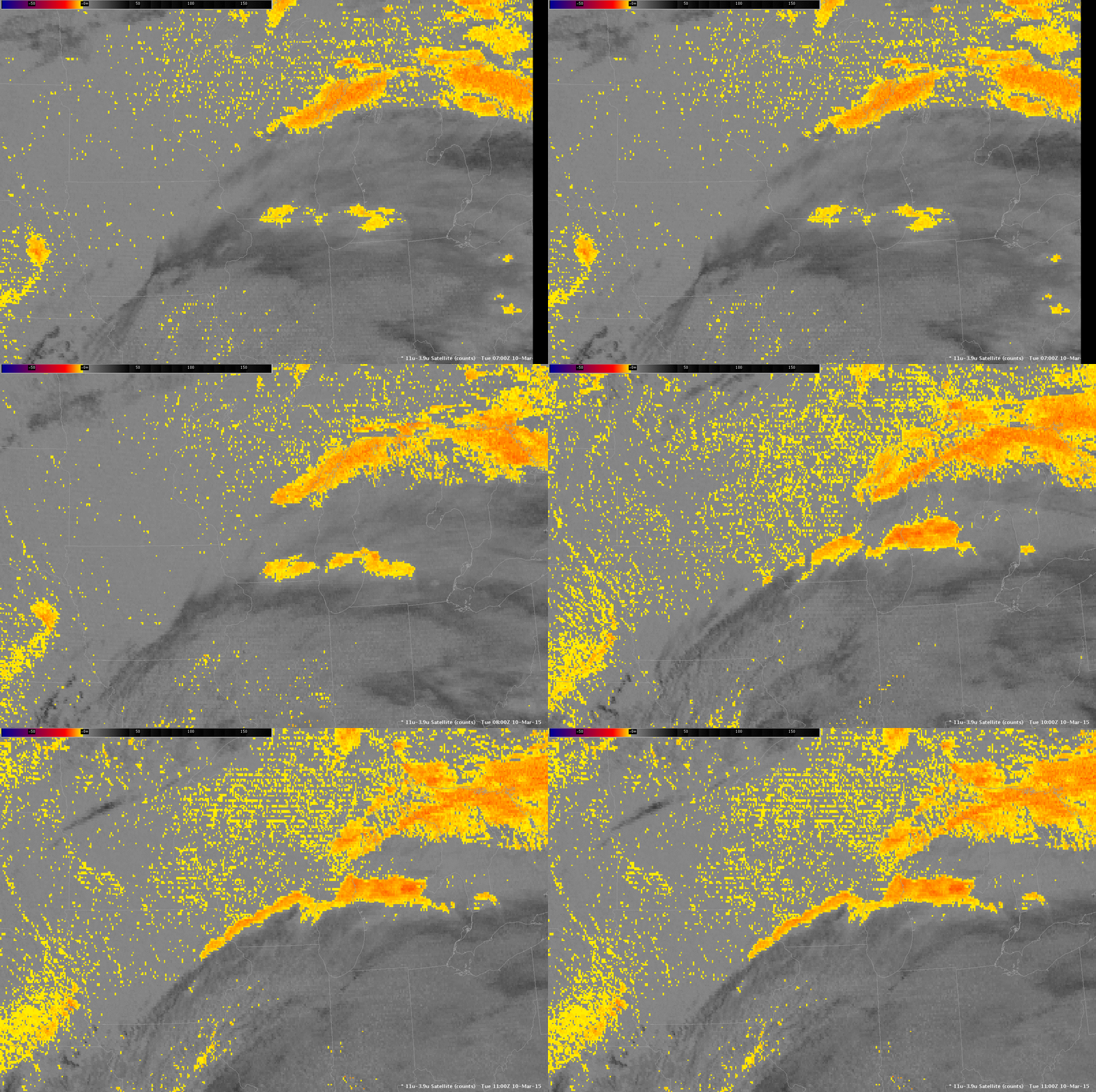
Compare that to the traditional method of detecting low clouds, the brightness temperature difference field, shown below. Low stratus and fog along the northern edge of the cirrus shield is detected, but the northward movement of the southern edge of the IFR conditions cannot be detected under the cirrus.

GOES-East Brightness Temperature Difference Fields (10.7µm – 3.9µm), 0700-1100 UTC, 10 March 2015 (Click to enlarge)
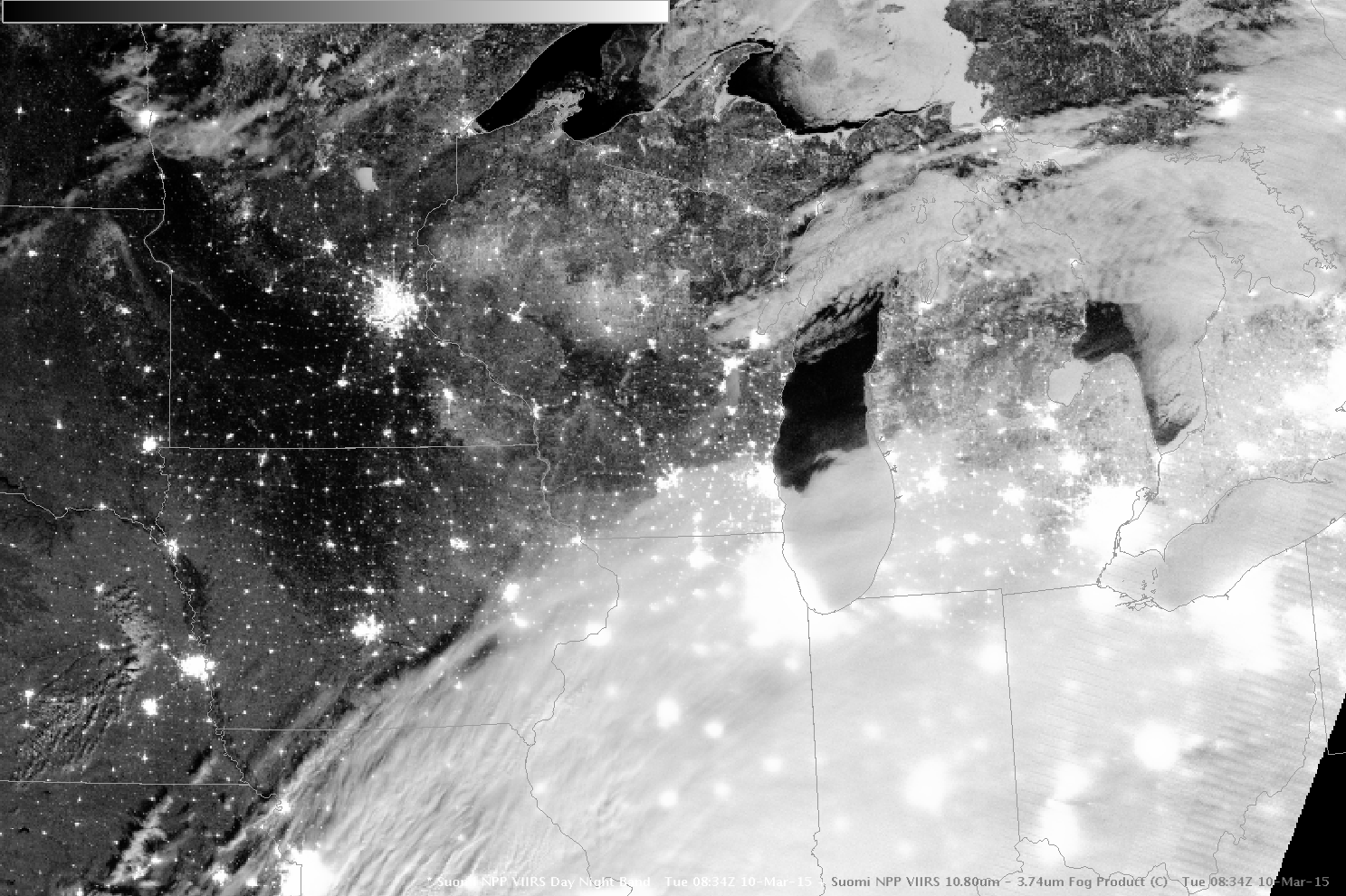
Suomi-NPP overflew the region at 0830 UTC, just as the fog was moving into southern Wisconsin. The image below shows the extensive cloud field. The brightness temperature difference field (11.32µm – 3.74µm) (here) for the same time suggests that much of the cloudiness detected over Illinois is higher cloud.

