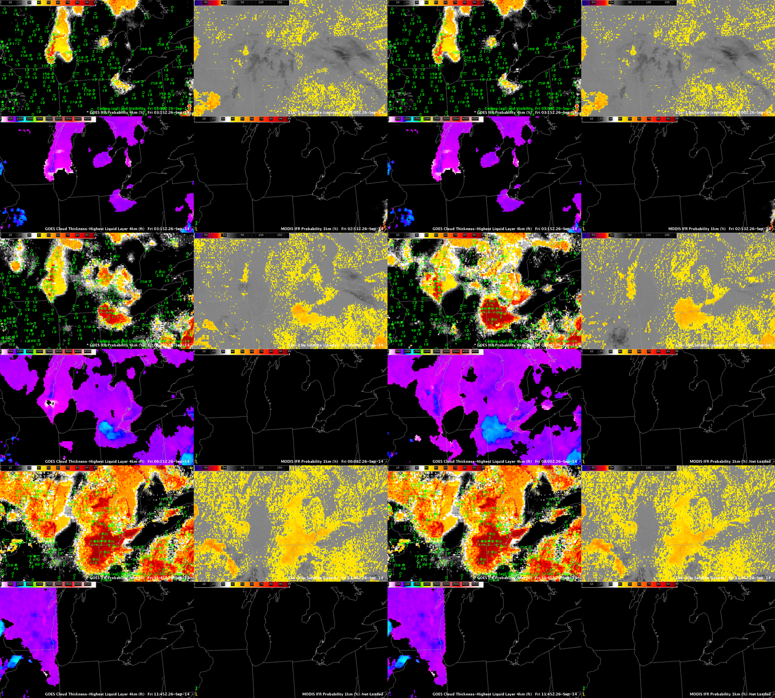
GOES-R IFR Probabilities computed from GOES-East (Upper Left), GOES-13 Brightness Temperature Difference (10.7 µm – 3.9 µm) (Upper Right), GOES-R Cloud Thickness computed from GOES-East (Lower Left), GOES-R IFR Probabilities computed from MODIS (Lower Right), hourly from 0300 through 1200 UTC 26 September (Click to enlarge)
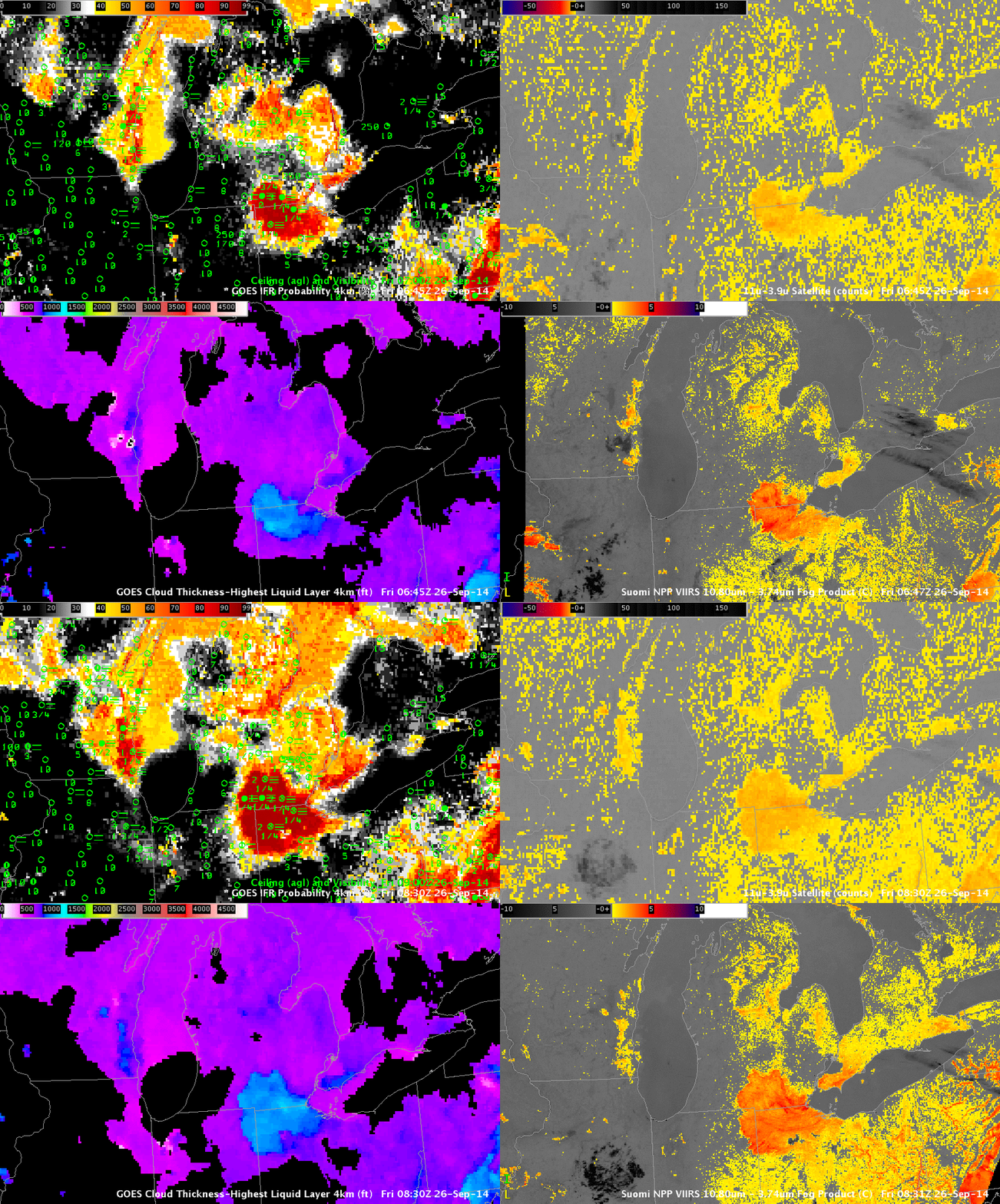
Fog developed over southeast Wisconsin during the morning of 26 September 2014. The GOES-R IFR Probability fields did a better job of detecting the hazard than did the traditional method of satellite-based fog detection (brightness temperature difference) in part because of the presence of higher clouds. (Fog/low stratus also generated IFR conditions over northeast Ohio). The animation above also includes a MODIS-based IFR Probability field. In fact, three separate MODIS-based fields were created, one at 0430 UTC, one at 0700 UTC, and one at 0845 UTC, shown below (Note that the MODIS-based IFR toggles with the MODIS Brightness Temperature Difference field). MODIS data confirms the small-scale nature of the fog event over southeast Wisconsin. (Note also how the MODIS-based data at 0700 UTC, below, are able to resolve the small river valleys in Pennsylvania in ways the GOES data cannot.)
Note how the IFR Probability fields ignore regions of mid-level stratus, such as over northeast Ohio along Lake Erie.
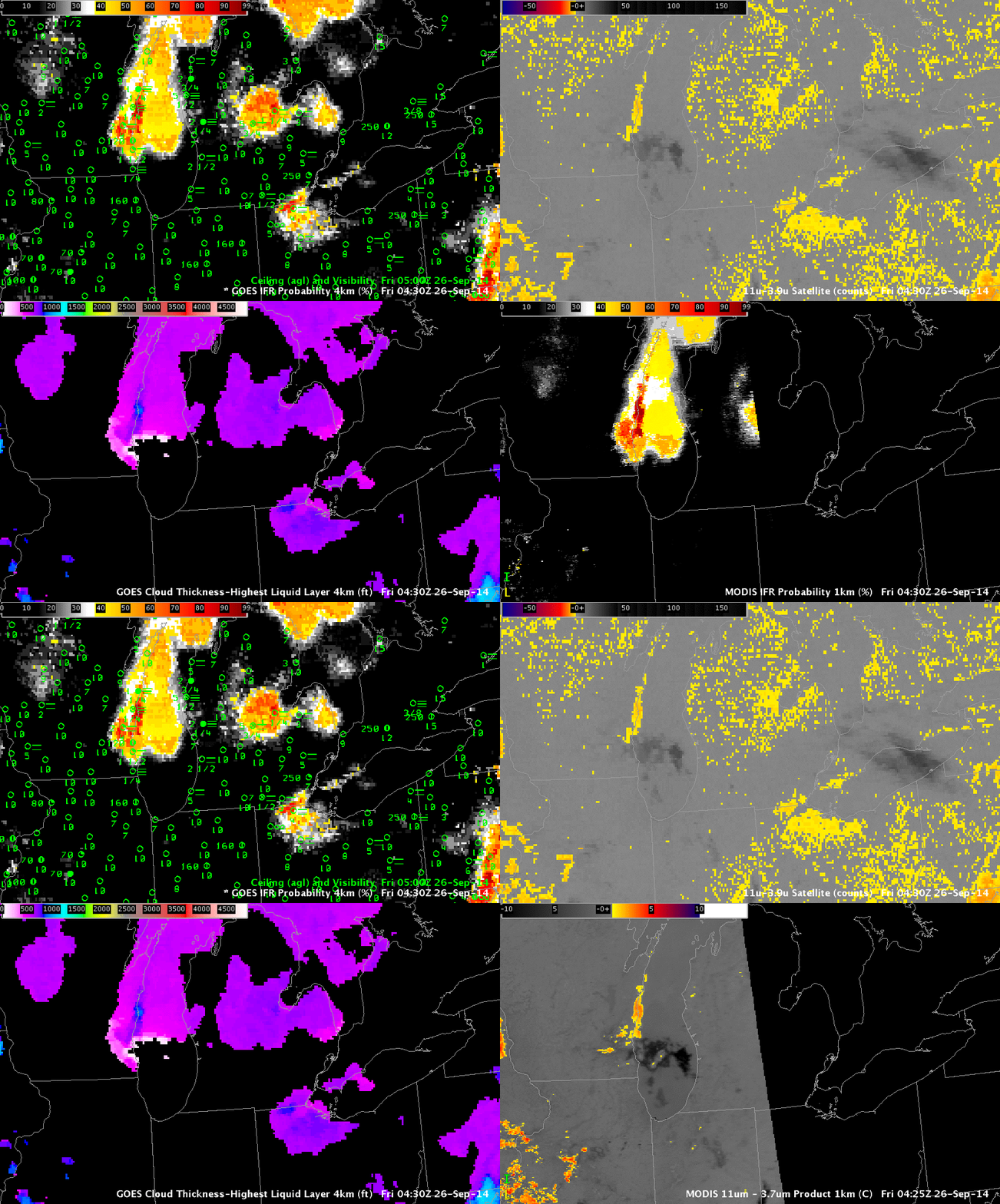
As above, but for 0430 UTC, and with the MODIS Brightness Temperature Difference in the lower right (Click to enlarge)
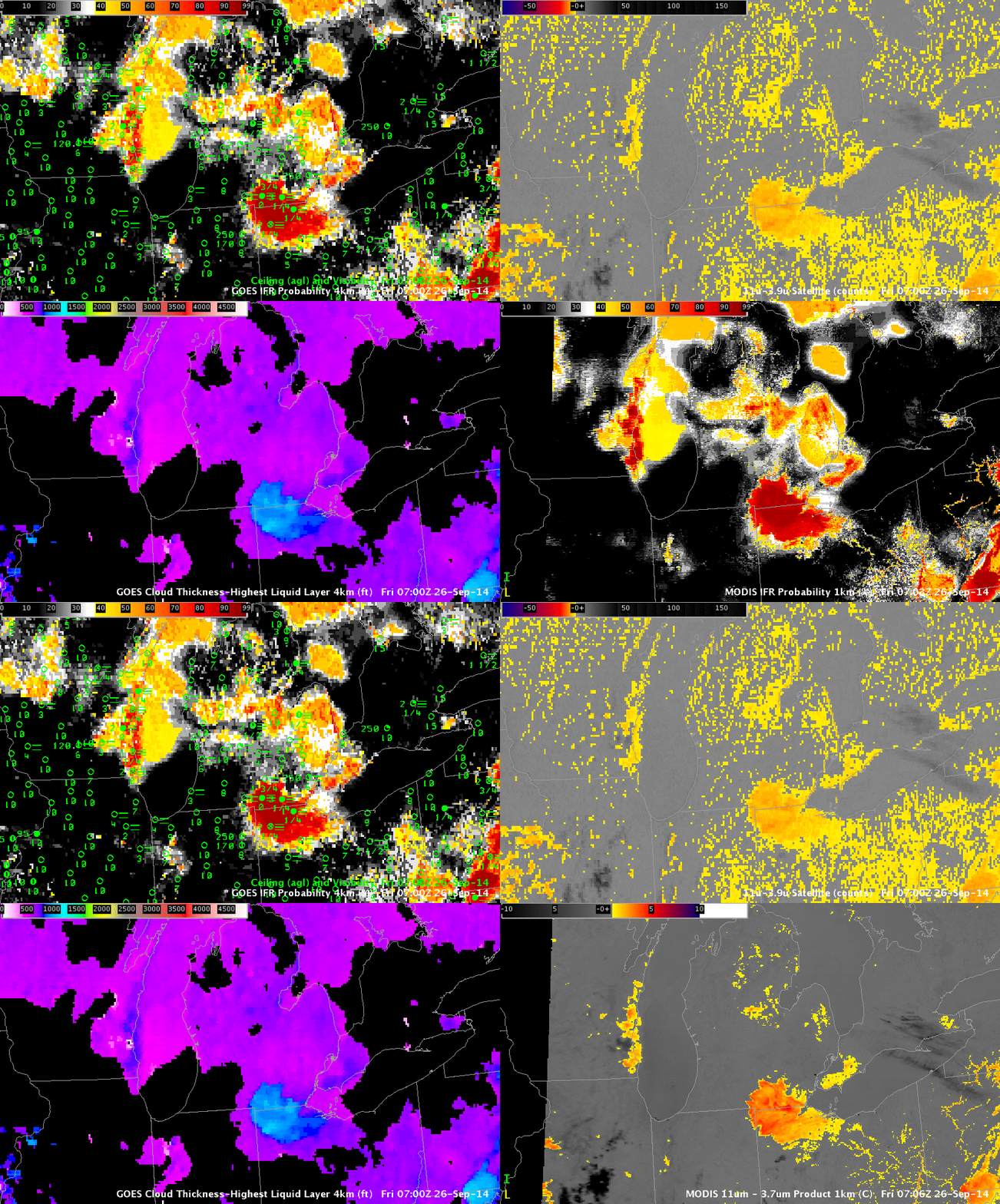
As above, but for 0700 UTC, and with the MODIS Brightness Temperature Difference in the lower right (Click to enlarge)
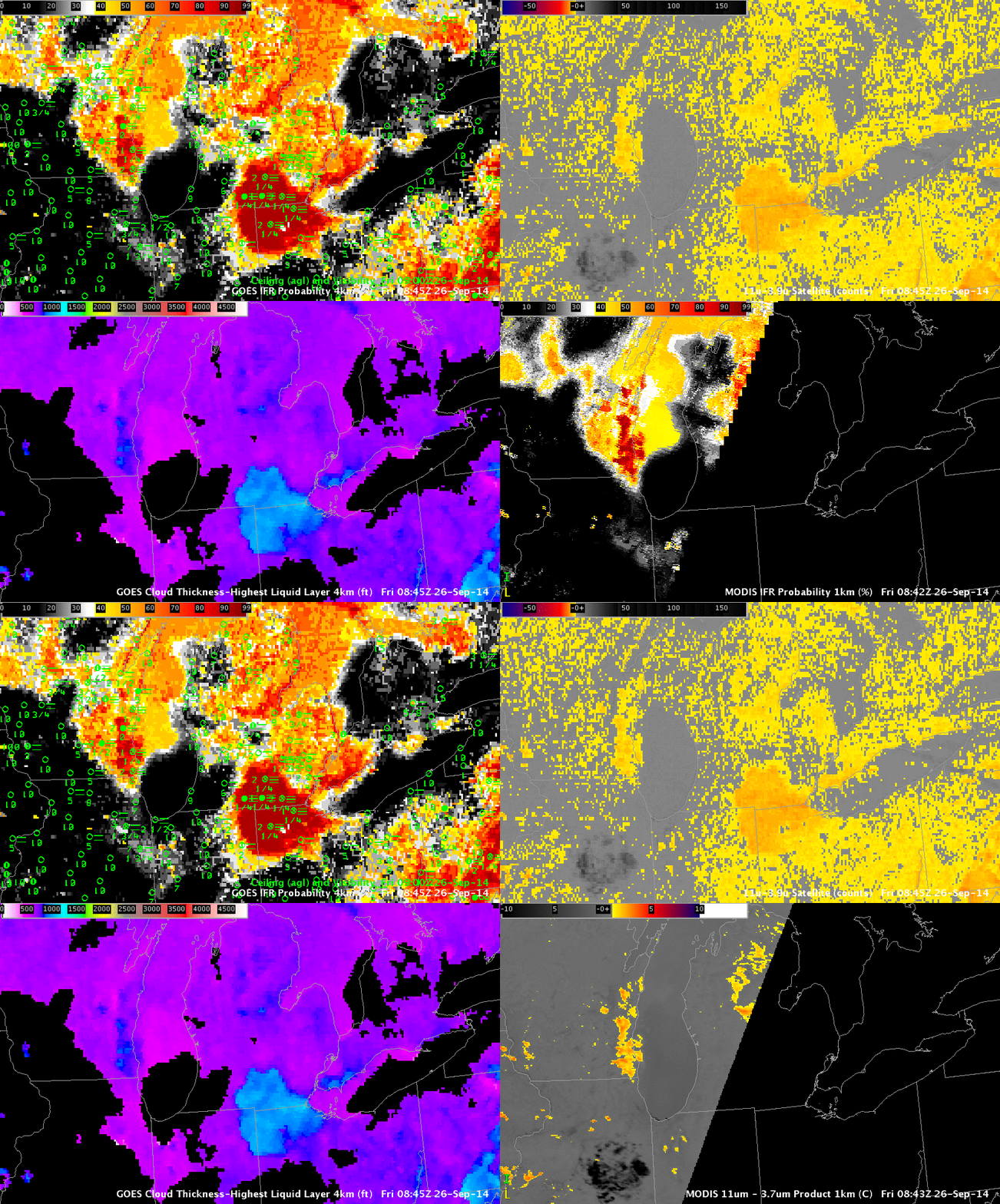
As above, but for 0845 UTC, and with the MODIS Brightness Temperature Difference in the lower right (Click to enlarge)
Suomi NPP Overflew the region as well. GOES-R IFR Probability algorithms do not yet incorporate Suomi NPP data; when that happens, an early morning snapshot that complements MODIS overpasses will be available.

