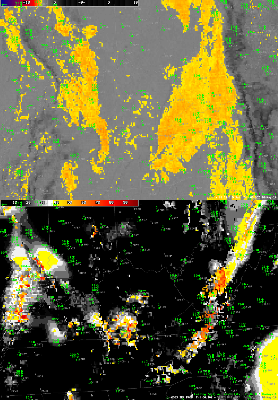
Toggle between GOES-13 Brightness Temperature Difference (10.7µm – 3.9µm) and GOES-R IFR Probability over Kentucky and surrounding states. Surface observations of ceiling heights and visibility are included, 0630 UTC 16 May 2014 (Click to enlarge)
The toggle above highlights a strength of the GOES-R IFR Probability fields compared to the GOES Brightness Temperature Difference when it comes to detecting low fog/stratus. The Brightness Temperature Difference field only sees the top of the cloud. In the toggle above, the region of elevated stratus, the stratus over western Virginia and western West Virginia is highlighted, but those clouds are unimportant for aviation/transportation, and IFR Probability fields ignore that region (save for the spine of the Appalachians where the mountains are rising up into the clouds, so ceilings are near the surface).
There are heightened IFR Probabilities in/around KEKQ (Monticello, Kentucky) at 0630 UTC: what is the character of that fog? It’s difficult to tell with the coarse GOES resolution (although someone familiar with the topography of eastern Kentucky might guess).
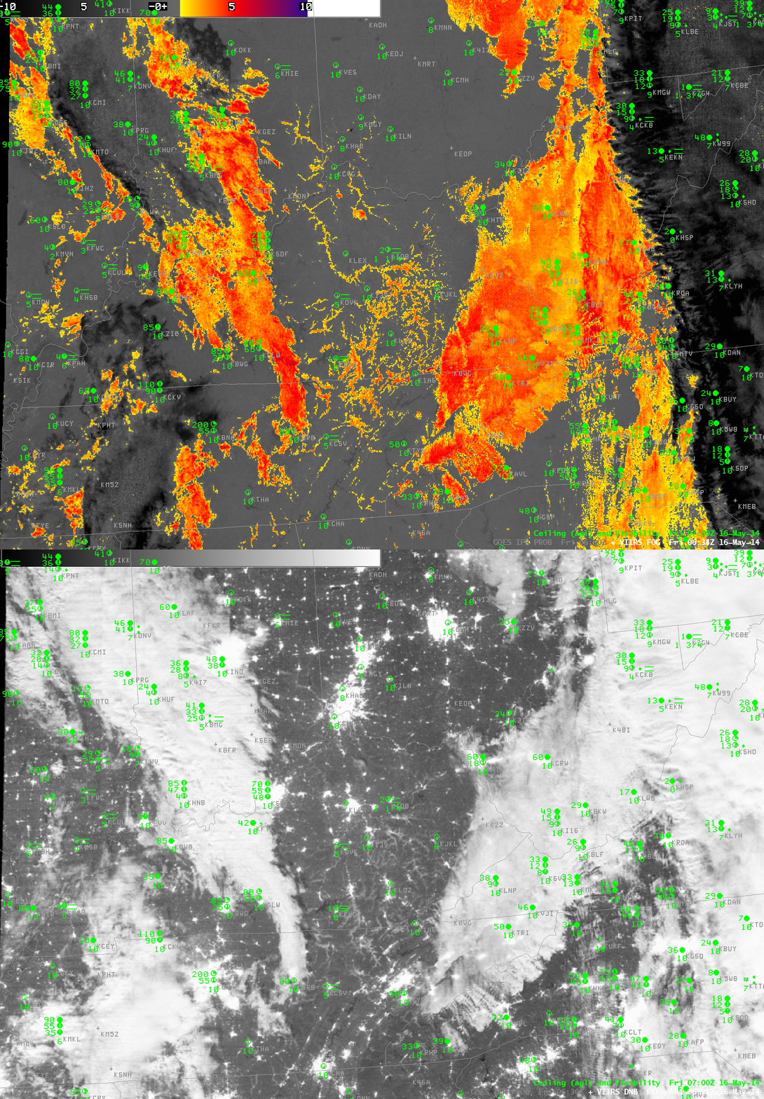
The imagery below toggle between the high-resolution (1-km) Suomi/NPP VIIRS Brightness Temperature Difference (11µm – 3.74µm) and the Day/Night Band at 0638 UTC. The higher resolution imagery allows the dendritic nature of the valley fog to appear in a way that is impossible with the coarser-resolution GOES data. Fog is initially developing in river valleys. Both the Brightness Temperature Difference and Day/Night imagery, however, are seeing only the top of the cloud and are not giving information about the likelihood of fog. But the cloud structure would alert a forecaster to the probability of developing fog (as does the time trend in the GOES-R IFR Probability fields).
Note how the cirrus shield east of the Appalachians shows up distinctly in both GOES and VIIRS brightness temperature difference fields. High clouds such as those prevent the satellite detection of fog/stratus at low levels. In those cases, only the IFR Probability field has a chance to detect fog if it is present.

Suomi/NPP Brightness Temperature Difference (11.0µm – 3.74µm) and Day/Night Band from VIIRS, 0638 UTC 16 MAy 2014 (Click to enlarge)
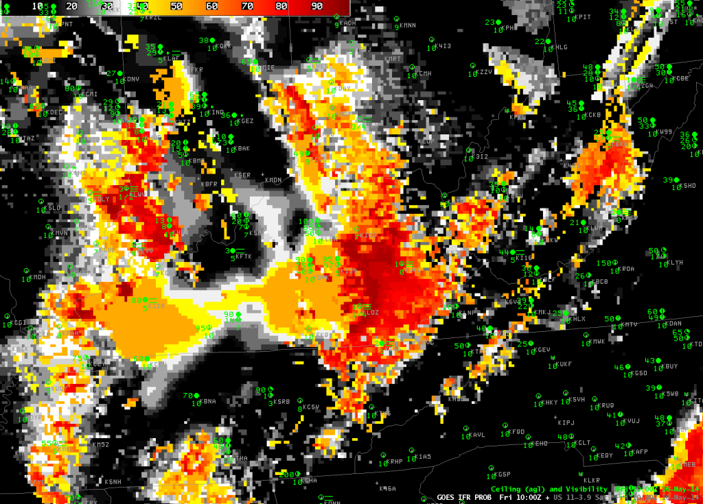
By 1000 UTC, the fog that was initially confined to river valleys over central Kentucky has expanded. In this case, Suomi/NPP data (or the trending of the GOES data) gives a forecaster a heads up on the development of overnight fog.

